 |
|
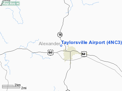
Location & QuickFacts
| FAA Information Effective: | 2008-09-25 |
| Airport Identifier: | 4NC3 |
| Airport Status: | Operational |
| Longitude/Latitude: | 081-11-48.0000W/35-55-51.0000N
-81.196667/35.930833 (Estimated) |
| Elevation: | 1090 ft / 332.23 m (Estimated) |
| Land: | 12 acres |
| From nearest city: | 1 nautical miles NW of Taylorsville, NC |
| Location: | Alexander County, NC |
| Magnetic Variation: | 05W (1985) |
Owner & Manager
| Ownership: | Privately owned |
| Owner: | Taylorsville Flying Club |
| Address: | 496 Airport Road
Taylorsville, NC 28681 |
| Phone number: | 828-632-2757 |
| Manager: | Earl J. Matheson |
| Address: | 2798 Hwy 90 East
Taylorsville, NC 28681 |
| Phone number: | 828-632-2757 |
Airport Operations and Facilities
| Airport Use: | Private |
| Wind indicator: | Yes |
| Segmented Circle: | No |
| Control Tower: | No |
| Landing fee charge: | No |
| Sectional chart: | Atlanta |
| Region: | ASO - Southern |
| Boundary ARTCC: | ZTL - Atlanta |
| Tie-in FSS: | RDU - Raleigh |
| FSS on Airport: | No |
| FSS Toll Free: | 1-800-WX-BRIEF |
Airport Services
| Airframe Repair: | NONE |
| Power Plant Repair: | NONE |
Runway Information
Runway 09/27
| Dimension: | 2400 x 75 ft / 731.5 x 22.9 m |
| Surface: | TURF, |
| |
Runway 09 |
Runway 27 |
| Traffic Pattern: | Left | Left |
| Obstruction: | 50 ft trees, 200.0 ft from runway | |
|
Radio Navigation Aids
| ID |
Type |
Name |
Ch |
Freq |
Var |
Dist |
| MRN | FAN MARKER | Lenoir | | | 03W | 22.4 nm |
| HK | NDB | Tawba | | 332.00 | 06W | 10.2 nm |
| VW | NDB | Temky | | 280.00 | 05W | 11.4 nm |
| UKF | NDB | Wilki | | 209.00 | 06W | 11.9 nm |
| IZN | NDB | Lincolnton | | 432.00 | 06W | 24.2 nm |
| FIQ | NDB | Fiddlers | | 391.00 | 07W | 26.7 nm |
| JU | NDB | Ashee | | 410.00 | 07W | 30.8 nm |
| ZEF | NDB | Zephyr | | 326.00 | 05W | 32.5 nm |
| BAR | NDB | Hemlock | | 320.00 | 02W | 35.8 nm |
| DVZ | NDB | Davie | | 354.00 | 06W | 36.1 nm |
| RU | NDB | Rovdy | | 275.00 | 06W | 36.4 nm |
| AZW | NDB | Mount Airy | | 223.00 | 07W | 41.8 nm |
| JJO | NDB | Mountain City | | 396.00 | 04W | 42.2 nm |
| GHJ | NDB | Stonia | | 260.00 | 06W | 44.5 nm |
| SEN | NDB | Swearing/dcmsnd | | 260.00 | 06W | 44.7 nm |
| SLP | NDB | First River | | 417.00 | 06W | 45.3 nm |
| BZM | VOR/DME | Barretts Mountain | 045X | 110.80 | 06W | 4.3 nm |
| CLT | VOR/DME | Charlotte | 097X | 115.00 | 05W | 46.1 nm |
| HKY | VOT | Hickory Regional | | 110.00 | | 14.9 nm |
| CLT | VOT | Charlotte | | 112.00 | | 44.9 nm |
Remarks
Images and information placed above are from
http://www.airport-data.com/airport/4NC3/
We thank them for the data!
| General Info
|
| Country |
United States
|
| State |
NORTH CAROLINA
|
| FAA ID |
4NC3
|
| Latitude |
35-58-47.494N
|
| Longitude |
079-25-17.071W
|
| Elevation |
688 feet
|
| Near City |
BURLINGTON
|
We don't guarantee the information is fresh and accurate. The data may
be wrong or outdated.
For more up-to-date information please refer to other sources.
|
|


