 |
|
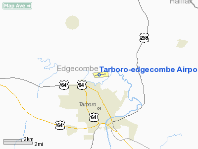
Tarboro-edgecombe Airport |
Location & QuickFacts
| FAA Information Effective: | 2008-09-25 |
| Airport Identifier: | ETC |
| Airport Status: | Operational |
| Longitude/Latitude: | 077-32-47.8980W/35-56-13.5630N
-77.546638/35.937101 (Estimated) |
| Elevation: | 53 ft / 16.15 m (Surveyed) |
| Land: | 16 acres |
| From nearest city: | 2 nautical miles N of Tarboro, NC |
| Location: | Edgecombe County, NC |
| Magnetic Variation: | 08W (1985) |
Owner & Manager
| Ownership: | Publicly owned |
| Owner: | Tarboro-edgecombe Arpt Auth
JACK BRINSON, CHAIRMAN. |
| Address: | Po Box 280
Tarboro, NC 27886 |
| Manager: | Tarboro-edgecombe Arpt Auth
SAMUEL NOBLE TOWN MGR |
| Address: | Po Box 220
Tarboro, NC 27886 |
| Phone number: | 252-641-4250
EMERGENCY PHONE DURING BUSINESS HOURS 252-641-4204 TOWN HALL; 252-641-4247 POLICE DISPATCH. |
Airport Operations and Facilities
| Airport Use: | Open to public |
| Wind indicator: | Yes |
| Segmented Circle: | Yes |
| Control Tower: | No |
| Lighting Schedule: | DUSK-DAWN
ACTVT MIRL RY 09/27, REIL RY 09 AND PAPI RYS 09 & 27 - CTAF. |
| Beacon Color: | Clear-Green (lighted land airport) |
| Landing fee charge: | No |
| Sectional chart: | Charlotte |
| Region: | ASO - Southern |
| Boundary ARTCC: | ZDC - Washington |
| Tie-in FSS: | RDU - Raleigh |
| FSS on Airport: | No |
| FSS Toll Free: | 1-800-WX-BRIEF |
| NOTAMs Facility: | RDU (NOTAM-d service avaliable) |
| Federal Agreements: | N |
Airport Communications
Airport Services
| Airframe Repair: | NONE |
| Power Plant Repair: | NONE |
| Bottled Oxygen: | NONE |
| Bulk Oxygen: | NONE |
Runway Information
Runway 09/27
| Dimension: | 4000 x 60 ft / 1219.2 x 18.3 m |
| Surface: | ASPH, Good Condition |
| Edge Lights: | Medium |
| |
Runway 09 |
Runway 27 |
| Longitude: | 077-33-11.5200W | 077-32-23.1500W |
| Latitude: | 35-56-12.0200N | 35-56-16.3000N |
| Elevation: | 54.00 ft | 46.00 ft |
| Alignment: | 84 | 127 |
| Traffic Pattern: | Left | Left |
| Markings: | Non-precision instrument, Good Condition | Non-precision instrument, Good Condition |
| Crossing Height: | 28.00 ft | 38.00 ft |
| Displaced threshold: | 200.00 ft | 0.00 ft |
| VASI: | 2-light PAPI on left side | 2-light PAPI on left side |
| Visual Glide Angle: | 4.00° | 3.00° |
| Runway End Identifier: | Yes | |
| Obstruction: | 38 ft trees, 305.0 ft from runway, 97 ft right of centerline, 2:1 slope to clear
RWY 09 APCH SLOPE 13:1 TO DSPLCD THLD.
ROAD 160 FT FM THLD ON CNTRLN AND +4 FT FENCE 125 FT FM PAVEMENT ON CNTRLN. | 40 ft trees, 853.0 ft from runway, 24 ft right of centerline, 16:1 slope to clear |
|
Radio Navigation Aids
| ID |
Type |
Name |
Ch |
Freq |
Var |
Dist |
| PGV | FAN MARKER | Belvoir | | | 06W | 19.6 nm |
| ETC | NDB | Tarboro | | 257.00 | 08W | 0.1 nm |
| AQE | NDB | Alwood | | 230.00 | 09W | 16.2 nm |
| MCZ | NDB | Williamston | | 336.00 | 09W | 18.6 nm |
| RW | NDB | Jambe | | 235.00 | 09W | 22.8 nm |
| ASJ | NDB | Ahoskie | | 415.00 | 10W | 28.3 nm |
| JYN | NDB | Wayne | | 208.00 | 08W | 30.1 nm |
| RZZ | NDB | Rapids | | 407.00 | 08W | 31.3 nm |
| RNW | NDB | Chocowinity | | 388.00 | 07W | 33.5 nm |
| PMZ | NDB | Plymouth | | 221.00 | 10W | 38.9 nm |
| ELQ | NDB | Emporia | | 261.00 | 10W | 41.3 nm |
| EUU | NDB | Jnall | | 251.00 | 07W | 44.1 nm |
| AEA | NDB | Jones | | 373.00 | 09W | 47.5 nm |
| EDE | NDB | Edenton | | 265.00 | 10W | 48.0 nm |
| GSB | TACAN | Seymour Johnson | 112X | | 08W | 41.7 nm |
| TYI | VORTAC | Tar River | 125X | 117.80 | 05W | 8.0 nm |
| ISO | VORTAC | Kinston | 033X | 109.60 | 05W | 34.0 nm |
| CVI | VORTAC | Cofield | 093X | 114.60 | 09W | 41.9 nm |
Remarks
- DEER ON AND INVOF ARPT.
- 500' LOW LEVEL ROUTE 3 MI NE OF ARPT - BE ALERT FOR MIL ACFT INVOF ARPT.
- HELO PAD/PARKING AREA PVT USE ONLY.
- RY 27 SAFETY AREA HAS SFC VARIATIONS & DEPRESSIONS AND A 20 FT DROP OFF 100 FT FM BOTH SIDES.
Images and information placed above are from
http://www.airport-data.com/airport/ETC/
We thank them for the data!
| General Info
|
| Country |
United States
|
| State |
NORTH CAROLINA
|
| FAA ID |
ETC
|
| Latitude |
35-56-13.563N
|
| Longitude |
077-32-47.898W
|
| Elevation |
53 feet
|
| Near City |
TARBORO
|
We don't guarantee the information is fresh and accurate. The data may
be wrong or outdated.
For more up-to-date information please refer to other sources.
|
|


