 |
|
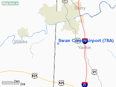
Location & QuickFacts
| FAA Information Effective: | 2008-09-25 |
| Airport Identifier: | 78A |
| Airport Status: | Operational |
| Longitude/Latitude: | 080-52-05.2580W/36-12-08.4830N
-80.868127/36.202356 (Estimated) |
| Elevation: | 1135 ft / 345.95 m (Surveyed) |
| Land: | 35 acres |
| From nearest city: | 3 nautical miles SW of Jonesville, NC |
| Location: | Yadkin County, NC |
| Magnetic Variation: | 05W (1985) |
Owner & Manager
| Ownership: | Privately owned |
| Owner: | Billy Cockrell |
| Address: | 3133 Swan Creek Rd
Jonesville, NC 28642 |
| Phone number: | 336-526-5867 |
| Manager: | Billy Cockrell |
| Address: | 3133 Swan Creek Rd
Jonesville, NC 28642 |
| Phone number: | 336-526-5867 |
Airport Operations and Facilities
| Airport Use: | Open to public |
| Wind indicator: | Yes |
| Segmented Circle: | No |
| Control Tower: | No |
| Landing fee charge: | No |
| Sectional chart: | Cincinnati |
| Region: | ASO - Southern |
| Boundary ARTCC: | ZTL - Atlanta |
| Tie-in FSS: | RDU - Raleigh |
| FSS on Airport: | No |
| FSS Toll Free: | 1-800-WX-BRIEF |
| NOTAMs Facility: | RDU (NOTAM-d service avaliable) |
Airport Communications
Airport Services
| Airframe Repair: | NONE |
| Power Plant Repair: | NONE |
| Bottled Oxygen: | NONE |
| Bulk Oxygen: | NONE |
Runway Information
Runway 02/20
| Dimension: | 1650 x 200 ft / 502.9 x 61.0 m |
| Surface: | TURF, Fair Condition |
| |
Runway 02 |
Runway 20 |
| Traffic Pattern: | Left | Left |
| Obstruction: | 20 ft road, 12.0 ft from runway | 51 ft trees, 36.0 ft from runway, 113 ft left of centerline |
|
Runway 10/28
| Dimension: | 2600 x 200 ft / 792.5 x 61.0 m |
| Surface: | TURF, Fair Condition |
| |
Runway 10 |
Runway 28 |
| Traffic Pattern: | Left | Left |
| Obstruction: | 40 ft trees, 20.0 ft from runway, 112 ft right of centerline | 4 ft hill, 0.0 ft from runway, 40 ft right of centerline |
|
Radio Navigation Aids
| ID |
Type |
Name |
Ch |
Freq |
Var |
Dist |
| MRN | FAN MARKER | Lenoir | | | 03W | 44.2 nm |
| ZEF | NDB | Zephyr | | 326.00 | 05W | 9.7 nm |
| UKF | NDB | Wilki | | 209.00 | 06W | 12.4 nm |
| AZW | NDB | Mount Airy | | 223.00 | 07W | 19.2 nm |
| JU | NDB | Ashee | | 410.00 | 07W | 26.0 nm |
| DVZ | NDB | Davie | | 354.00 | 06W | 26.5 nm |
| VW | NDB | Temky | | 280.00 | 05W | 27.4 nm |
| HK | NDB | Tawba | | 332.00 | 06W | 32.8 nm |
| RU | NDB | Rovdy | | 275.00 | 06W | 33.7 nm |
| HLX | NDB | Hillsville | | 269.00 | 06W | 33.7 nm |
| SEN | NDB | Swearing/dcmsnd | | 260.00 | 06W | 37.6 nm |
| IZN | NDB | Lincolnton | | 432.00 | 06W | 41.3 nm |
| MK | NDB | Suzze | | 335.00 | 06W | 46.8 nm |
| JJO | NDB | Mountain City | | 396.00 | 04W | 48.1 nm |
| FIQ | NDB | Fiddlers | | 391.00 | 07W | 49.0 nm |
| BAR | NDB | Hemlock | | 320.00 | 02W | 49.2 nm |
| BZM | VOR/DME | Barretts Mountain | 045X | 110.80 | 06W | 27.0 nm |
| GSO | VORTAC | Greensboro | 109X | 116.20 | 03W | 44.3 nm |
| HKY | VOT | Hickory Regional | | 110.00 | | 37.7 nm |
Remarks
- NO LINE-OF-SIGHT BTWN RY ENDS.
- RY 10 SLOPES UPHILL; RY 02 FIRST HALF SLOPES UPHILL.
- ARPT CLSD TO TSNT ACFT.
- EXISTED PRIOR TO MAY 1959.
Images and information placed above are from
http://www.airport-data.com/airport/78A/
We thank them for the data!
| General Info
|
| Country |
United States
|
| State |
NORTH CAROLINA
|
| FAA ID |
78A
|
| Latitude |
36-12-08.483N
|
| Longitude |
080-52-05.258W
|
| Elevation |
1135 feet
|
| Near City |
JONESVILLE
|
We don't guarantee the information is fresh and accurate. The data may
be wrong or outdated.
For more up-to-date information please refer to other sources.
|
|


