 |
|
Location & QuickFacts
| FAA Information Effective: | 2008-09-25 |
| Airport Identifier: | 99NC |
| Airport Status: | Operational |
| Longitude/Latitude: | 077-07-05.0000W/35-12-52.0000N
-77.118056/35.214444 (Estimated) |
| Elevation: | 7 ft / 2.13 m (Estimated) |
| Land: | 0 acres |
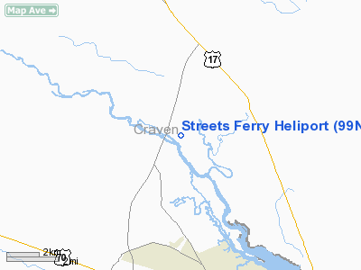
| From nearest city: | 9 nautical miles NE of New Bern, NC |
| Location: | Craven County, NC |
| Magnetic Variation: | () |
Owner & Manager
| Ownership: | Privately owned |
| Owner: | Weyerhaeuser Co. |
| Address: | 1785 Weyerhaeuser Road
New Bern, NC 28586 |
| Phone number: | 252-633-7244 |
| Manager: | Robert Green - Mill Manager |
| Address: | 1785 Weyerhaeuser Road
New Bern, NC 28586 |
| Phone number: | 252-633-7244 |
Airport Operations and Facilities
| Airport Use: | Private |
| Control Tower: | No |
| Sectional chart: | Charlotte |
| Region: | ASO - Southern |
| Boundary ARTCC: | ZDC - Washington |
| Tie-in FSS: | RDU - Raleigh |
| FSS Toll Free: | 1-800-WX-BRIEF |
Runway Information
Helipad H1
| Dimension: | 50 x 50 ft / 15.2 x 15.2 m |
| Surface: | CONC, |
| |
Runway H1 |
Runway |
| Traffic Pattern: | Left | Left |
|
Radio Navigation Aids
| ID |
Type |
Name |
Ch |
Freq |
Var |
Dist |
| PGV | FAN MARKER | Belvoir | | | 06W | 28.7 nm |
| RNW | NDB | Chocowinity | | 388.00 | 07W | 17.7 nm |
| AQE | NDB | Alwood | | 230.00 | 09W | 32.1 nm |
| NCA | NDB | New River | | 356.00 | 08W | 33.4 nm |
| MRH | NDB | Morehead | | 269.00 | 08W | 36.7 nm |
| MCZ | NDB | Williamston | | 336.00 | 09W | 38.9 nm |
| PMZ | NDB | Plymouth | | 221.00 | 10W | 39.8 nm |
| DKA | NDB | Kenan | | 332.00 | 07W | 40.3 nm |
| JYN | NDB | Wayne | | 208.00 | 08W | 42.7 nm |
| ETC | NDB | Tarboro | | 257.00 | 08W | 48.1 nm |
| DIW | NDB/DME | Dixon | 107X | 198.00 | 08W | 42.2 nm |
| NKT | TACAN | Cherry Point | 075X | | 09W | 22.3 nm |
| NJM | TACAN | Bogue Mcalf | 067X | | 08W | 31.9 nm |
| NCA | TACAN | New River | 101X | | 08W | 34.4 nm |
| GSB | TACAN | Seymour Johnson | 112X | | 08W | 42.5 nm |
| EWN | VOR/DME | New Bern | 083X | 113.60 | 08W | 9.2 nm |
| ISO | VORTAC | Kinston | 033X | 109.60 | 05W | 23.6 nm |
Remarks
- 76 FT TWR 1200 FT NW, 252 FT STACKS 1200 FT SE AND 50 FT TREES 150 FT W OF PAD.
- PRVDD VFR OPNS, PVT USE, AREA IS MARKED AND WIND INDICATOR IS MAINTAINED.
Images and information placed above are from
http://www.airport-data.com/airport/99NC/
We thank them for the data!
|
|


