 |
|
Location & QuickFacts
| FAA Information Effective: | 2008-09-25 |
| Airport Identifier: | SVH |
| Airport Status: | Operational |
| Longitude/Latitude: | 080-57-14.0250W/35-45-53.9850N
-80.953896/35.764996 (Estimated) |
| Elevation: | 968 ft / 295.05 m (Surveyed) |
| Land: | 0 acres |
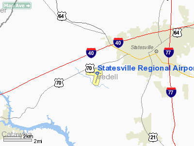
| From nearest city: | 3 nautical miles SW of Statesville, NC |
| Location: | Iredell County, NC |
| Magnetic Variation: | 05W (1985) |
Owner & Manager
| Ownership: | Publicly owned |
| Owner: | City Of Statesville |
| Address: | Po Box 1111
Statesville, NC 28687 |
| Phone number: | 704-878-3578 |
| Manager: | Bob Johnson |
| Address: | Po Box 1111
Statesville, NC 28687 |
| Phone number: | 704-878-3578 |
Airport Operations and Facilities
| Airport Use: | Open to public |
| Wind indicator: | Yes |
| Segmented Circle: | Yes |
| Control Tower: | No |
| Lighting Schedule: | DUSK-DAWN
ACTVT REIL RY 10, MALSR RY 28 & PAPI RYS 10 & 28 - CTAF. HIRL RY 10/28 PRESET MED INTST DUSK-2300; TO INCR INTST ACTVT - CTAF. AFTER 2300 ACTVT HIRL RY 10/28 - CTAF. |
| Beacon Color: | Clear-Green (lighted land airport) |
| Landing fee charge: | No |
| Sectional chart: | Charlotte |
| Region: | ASO - Southern |
| Boundary ARTCC: | ZTL - Atlanta |
| Tie-in FSS: | RDU - Raleigh |
| FSS Toll Free: | 1-800-WX-BRIEF |
| NOTAMs Facility: | SVH (NOTAM-d service avaliable) |
| Federal Agreements: | NGY |
Airport Communications
| CTAF: | 123.075 |
| Unicom: | 123.075 |
Airport Services
| Fuel available: | 100LLA |
| Airframe Repair: | MAJOR |
| Power Plant Repair: | MAJOR |
| Bottled Oxygen: | HIGH |
Runway Information
Runway 10/28
| Dimension: | 7006 x 100 ft / 2135.4 x 30.5 m |
| Surface: | ASPH, Good Condition |
| Weight Limit: | Single wheel: 30000 lbs.
Dual wheel: 100000 lbs. |
| Edge Lights: | High |
| |
Runway 10 |
Runway 28 |
| Longitude: | 080-57-56.2300W | 080-56-31.8200W |
| Latitude: | 35-45-58.1100N | 35-45-49.8600N |
| Elevation: | 958.00 ft | 957.00 ft |
| Alignment: | 97 | 127 |
| ILS Type: | LOCALIZER
| ILS/DME
|
| Traffic Pattern: | Left | Left |
| Markings: | Non-precision instrument, Good Condition | Precision instrument, Good Condition |
| Crossing Height: | 61.00 ft | 57.00 ft |
| Displaced threshold: | 1000.00 ft | 550.00 ft |
| VASI: | 2-light PAPI on left side | 2-light PAPI on left side |
| Visual Glide Angle: | 3.00° | 3.00° |
| Approach lights: | | MALSR |
| Runway End Identifier: | Yes | |
| Obstruction: | , 50:1 slope to clear
APCH SLOPE 50:1 TO DSPLCD THLD. | 30 ft tree, 576.0 ft from runway, 347 ft right of centerline, 12:1 slope to clear
APCH SLOPE 50:1 TO DSPLCD THLD. |
| Decleard distances: | Take off run available 7006.00 ft
Take off distance available 7006.00 ft
Actual stop distance available 6456.00 ft
Landing distance available 5456.00 ft
| Take off run available 7006.00 ft
Take off distance available 7006.00 ft
Actual stop distance available 6006.00 ft
Landing distance available 5456.00 ft
|
|
Radio Navigation Aids
| ID |
Type |
Name |
Ch |
Freq |
Var |
Dist |
| MRN | FAN MARKER | Lenoir | | | 03W | 32.8 nm |
| VW | NDB | Temky | | 280.00 | 05W | 5.4 nm |
| IZN | NDB | Lincolnton | | 432.00 | 06W | 15.1 nm |
| HK | NDB | Tawba | | 332.00 | 06W | 17.2 nm |
| UKF | NDB | Wilki | | 209.00 | 06W | 22.1 nm |
| RU | NDB | Rovdy | | 275.00 | 06W | 22.7 nm |
| DVZ | NDB | Davie | | 354.00 | 06W | 25.8 nm |
| SEN | NDB | Swearing/dcmsnd | | 260.00 | 06W | 32.0 nm |
| ZEF | NDB | Zephyr | | 326.00 | 05W | 34.8 nm |
| FIQ | NDB | Fiddlers | | 391.00 | 07W | 35.2 nm |
| GHJ | NDB | Stonia | | 260.00 | 06W | 35.9 nm |
| AZW | NDB | Mount Airy | | 223.00 | 07W | 42.1 nm |
| JU | NDB | Ashee | | 410.00 | 07W | 44.0 nm |
| SLP | NDB | First River | | 417.00 | 06W | 44.1 nm |
| VU | NDB | Aller | | 346.00 | 06W | 45.8 nm |
| BZM | VOR/DME | Barretts Mountain | 045X | 110.80 | 06W | 15.3 nm |
| CLT | VOR/DME | Charlotte | 097X | 115.00 | 05W | 34.5 nm |
| FML | VORTAC | Fort Mill | 071X | 112.40 | 02W | 46.6 nm |
| HKY | VOT | Hickory Regional | | 110.00 | | 21.4 nm |
| CLT | VOT | Charlotte | | 112.00 | | 33.1 nm |
Remarks
Images and information placed above are from
http://www.airport-data.com/airport/SVH/
We thank them for the data!
| General Info
|
| Country |
United States
|
| State |
NORTH CAROLINA
|
| FAA ID |
SVH
|
| Latitude |
35-45-54.950N
|
| Longitude |
080-57-24.250W
|
| Elevation |
965 feet
|
| Near City |
STATESVILLE
|
We don't guarantee the information is fresh and accurate. The data may
be wrong or outdated.
For more up-to-date information please refer to other sources.
|
|


