|
|
Star Hill Golf Club Airport |
 |
(Click on the photo to enlarge) |
Location & QuickFacts
| FAA Information Effective: | 2008-09-25 |
| Airport Identifier: | 60NC |
| Airport Status: | Operational |
| Longitude/Latitude: | 077-03-03.8100W/34-42-18.5820N
-77.051058/34.705162 (Estimated) |
| Elevation: | 40 ft / 12.19 m (Estimated) |
| Land: | 0 acres |
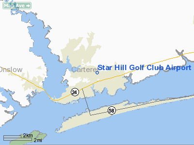
| From nearest city: | 0 nautical miles N of Cape Carteret, NC |
| Location: | Carteret County, NC |
| Magnetic Variation: | 08W (1985) |
Owner & Manager
| Ownership: | Privately owned |
| Owner: | Star Hill Golf & Country Club |
| Address: | 202 Clubhouse Drive
Cape Carteret, NC 28584-9240 |
| Phone number: | 252-393-8111 |
| Manager: | R. Steven Sewell |
| Address: | 202 Clubhouse Drive
Cape Carteret, NC 28584-9240 |
| Phone number: | 336-961-2851 |
Airport Operations and Facilities
| Airport Use: | Private |
| Wind indicator: | Yes |
| Segmented Circle: | No |
| Control Tower: | No |
| Lighting Schedule: | RDO-CTL
ACTVT LIRL RY 06/24 - 122.9. |
| Landing fee charge: | No |
| Sectional chart: | Charlotte |
| Region: | ASO - Southern |
| Boundary ARTCC: | ZDC - Washington |
| Tie-in FSS: | RDU - Raleigh |
| FSS on Airport: | No |
| FSS Toll Free: | 1-800-WX-BRIEF |
Airport Services
| Airframe Repair: | NONE |
| Power Plant Repair: | NONE |
Runway Information
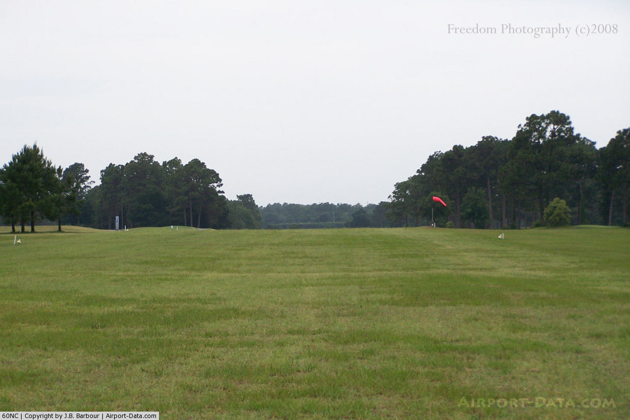
Runway 06/24
| Dimension: | 2800 x 75 ft / 853.4 x 22.9 m |
| Surface: | TURF, Fair Condition |
| Edge Lights: | Low |
| |
Runway 06 |
Runway 24 |
| Traffic Pattern: | Left | Left |
| Obstruction: | 50 ft trees, 50 ft right of centerline | 50 ft trees, 0.0 ft from runway, 50 ft left of centerline |
|
Radio Navigation Aids
| ID |
Type |
Name |
Ch |
Freq |
Var |
Dist |
| NCA | NDB | New River | | 356.00 | 08W | 18.7 nm |
| MRH | NDB | Morehead | | 269.00 | 08W | 19.3 nm |
| ACZ | NDB | Pendy | | 379.00 | 09W | 47.1 nm |
| DKA | NDB | Kenan | | 332.00 | 07W | 48.1 nm |
| RNW | NDB | Chocowinity | | 388.00 | 07W | 48.4 nm |
| DIW | NDB/DME | Dixon | 107X | 198.00 | 08W | 21.5 nm |
| NJM | TACAN | Bogue Mcalf | 067X | | 08W | 1.5 nm |
| NKT | TACAN | Cherry Point | 075X | | 09W | 14.7 nm |
| NCA | TACAN | New River | 101X | | 08W | 19.2 nm |
| EWN | VOR/DME | New Bern | 083X | 113.60 | 08W | 22.1 nm |
| ILM | VORTAC | Wilmington | 117X | 117.00 | 07W | 46.0 nm |
| ISO | VORTAC | Kinston | 033X | 109.60 | 05W | 47.2 nm |
Remarks
- 3' FENCE 50' FROM AER RWY 6 ACROSS CLEAR ZONE.
- GOLF COURSE SURROUNDS RWY; GOLF BALLS, PEDESTRIANS, AND VEHICLES MAY BE ON RWY AND APPROACH TO RWY 6.
- TREES 10' TO 60' TALL BOTH SIDES OF RWY; HIGH POINT OF RWY 1400'; ACRFT ON ONE END NOT VISIBLE FROM OTHER END.
- RWY 24 BARRICADES AT RWY END & TREES AT 250'.
- VFR ONLY. ESTAB & MAINTAIN TWO-WAY RADIO CTC W/CHERRY POINT ATCT PRIOR TO ENTERING R-5306 & W/BOGUE ATCT FOR TRAFFIC.
Images and information placed above are from
http://www.airport-data.com/airport/60NC/
We thank them for the data!
| General Info
|
| Country |
United States
|
| State |
NORTH CAROLINA
|
| FAA ID |
60NC
|
| Latitude |
34-42-18.582N
|
| Longitude |
077-03-03.810W
|
| Elevation |
40 feet
|
| Near City |
CAPE CARTERET
|
We don't guarantee the information is fresh and accurate. The data may
be wrong or outdated.
For more up-to-date information please refer to other sources.
|
|