|
|
| Stanly County Airport |
 |
| Stanly County Airport |
| IATA: none – ICAO: KVUJ – FAA LID: VUJ |
| Summary |
| Airport type |
Public |
| Operator |
Stanly County |
| Location |
Albemarle, North Carolina |
| Elevation AMSL |
609 ft / 185.6 m |
| Coordinates |
35°25′00″N 080°09′03″W / 35.4166667°N 80.15083°W / 35.4166667; -80.15083Coordinates: 35°25′00″N 080°09′03″W / 35.4166667°N 80.15083°W / 35.4166667; -80.15083 |
| Runways |
| Direction |
Length |
Surface |
| ft |
m |
| 4R/22L |
5,500 |
1,676 |
Asphalt |
| 4L/22R |
3,500 |
1,067 |
Asphalt |
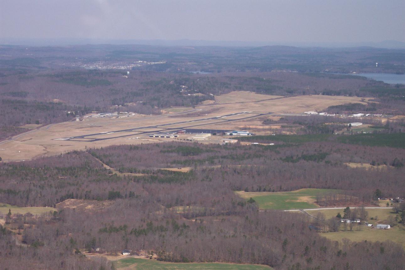
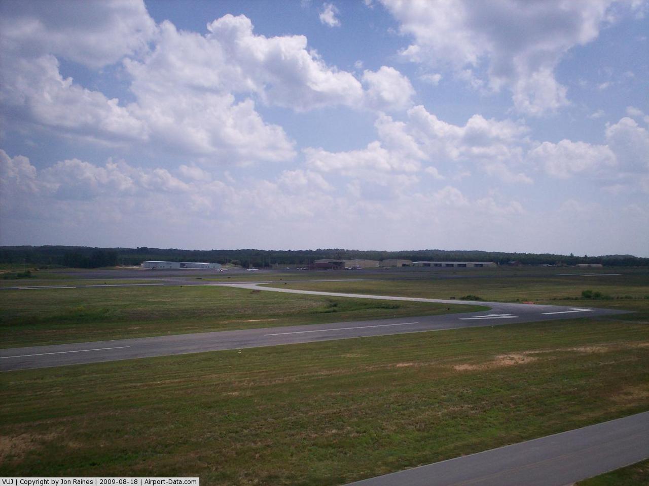
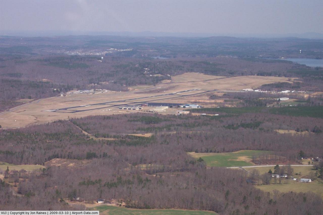
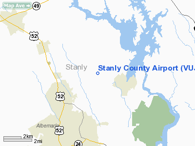
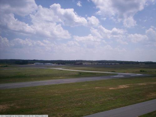
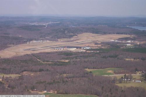
Stanly County Airport (ICAO: KVUJ, FAA LID: VUJ) is a public airport located four miles (6 km) northeast of the central business district (CBD) of Albemarle, a city in Stanly County, North Carolina, USA. This general aviation airport covers 300 acres (121 ha) and has two runways.
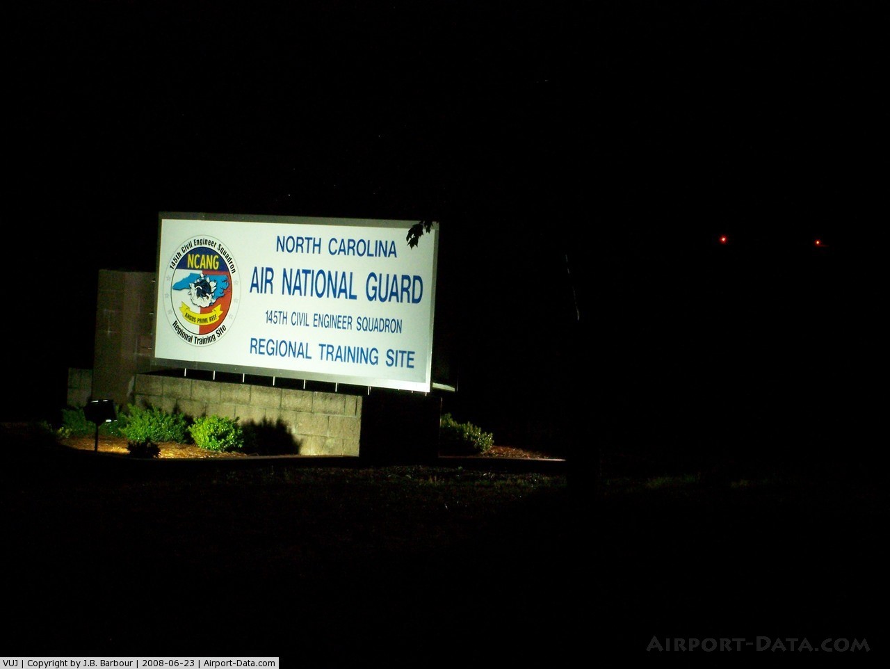
Air National Guard Station
Stanly County Airport serves as a regional training site for the North Carolina Air National Guard. The 235th Air Traffic Control Squadron operates the control tower at the airport. Also located at the airport's Air National Guard Station are the 118th Air Support Operations Squadron, 156th Weather Flight and the 263d Combat Communications Squadron. Runway 4R/22L is frequently used as an assault strip by the C-130s of the 145th Airlift Wing.
The above content comes from Wikipedia and is published under free licenses – click here to read more.
 |
(Click on the photo to enlarge) |
 |
(Click on the photo to enlarge) |
 |
(Click on the photo to enlarge) |
 |
(Click on the photo to enlarge) |
Location & QuickFacts
| FAA Information Effective: | 2008-09-25 |
| Airport Identifier: | VUJ |
| Airport Status: | Operational |
| Longitude/Latitude: | 080-09-02.8640W/35-25-00.1010N
-80.150796/35.416695 (Estimated) |
| Elevation: | 609 ft / 185.62 m (Surveyed) |
| Land: | 800 acres |
| From nearest city: | 4 nautical miles NE of Albemarle, NC |
| Location: | Stanly County, NC |
| Magnetic Variation: | 06W (1985) |
Owner & Manager
| Ownership: | Publicly owned |
| Owner: | Stanly County |
| Address: | 38512 Aviation Drive
New London, NC 28127 |
| Phone number: | 704-982-9013 |
| Manager: | David Griffin |
| Address: | 38512 Aviation Drive
New London, NC 28127 |
| Phone number: | 704-982-9013 |
Airport Operations and Facilities
| Airport Use: | Open to public |
| Wind indicator: | Yes |
| Segmented Circle: | Yes |
| Control Tower: | Yes |
| Lighting Schedule: | DUSK-DAWN
ACTVT MIRL RY 04L/22R & RY 04R/22L & REILS RY 04R/22L - CTAF. RY 4R/22L PAPIS ON DURING TOWER OPERATION, OTHER TIMES CTAF. |
| Beacon Color: | Clear-Green (lighted land airport) |
| Landing fee charge: | No |
| Sectional chart: | Charlotte |
| Region: | ASO - Southern |
| Traffic Pattern Alt: | 1100 ft |
| Boundary ARTCC: | ZTL - Atlanta |
| Tie-in FSS: | RDU - Raleigh |
| FSS on Airport: | No |
| FSS Toll Free: | 1-800-WX-BRIEF |
| NOTAMs Facility: | VUJ (NOTAM-d service avaliable) |
| Federal Agreements: | NGY |
Airport Communications
| CTAF: | 126.275 |
| Unicom: | 123.000 |
Airport Services
| Fuel available: | 100LLA1+
SELF SVC FUEL AVBL 24 HRS. |
| Airframe Repair: | MAJOR |
| Power Plant Repair: | MAJOR |
| Bottled Oxygen: | NONE |
| Bulk Oxygen: | LOW |
Runway Information
Runway 04L/22R
| Dimension: | 3500 x 75 ft / 1066.8 x 22.9 m |
| Surface: | ASPH, Good Condition |
| Weight Limit: | Dual wheel: 130000 lbs. |
| Edge Lights: | Medium |
| |
Runway 04L |
Runway 22R |
| Longitude: | 080-09-14.9600W | 080-08-49.4000W |
| Latitude: | 35-24-54.0500N | 35-25-21.6300N |
| Elevation: | 593.00 ft | 582.00 ft |
| Alignment: | 37 | 127 |
| Traffic Pattern: | Left | Left |
| Markings: | Basic, Fair Condition | Basic, Fair Condition |
| Obstruction: | 20 ft fence, 330.0 ft from runway, 220 ft left of centerline, 6:1 slope to clear
10 FT GROUND 0-200 FT FROM THLD 200 FT LEFT OF CNTRLN. | 9 ft trees, 204.0 ft from runway, 80 ft left of centerline
HAS 9 FT TREES 0-200 FT FROM THLD 100 FT L OF CNTRLN. |
|
Runway 04R/22L
| Dimension: | 5500 x 100 ft / 1676.4 x 30.5 m |
| Surface: | ASPH, Good Condition |
| Weight Limit: | Dual wheel: 130000 lbs. |
| Edge Lights: | Medium |
| |
Runway 04R |
Runway 22L |
| Longitude: | 080-09-23.3760W | 080-08-43.2180W |
| Latitude: | 35-24-33.5060N | 35-25-16.8430N |
| Elevation: | 609.00 ft | 578.00 ft |
| Alignment: | 37 | 127 |
| ILS Type: | | ILS
|
| Traffic Pattern: | Left | Left |
| Markings: | Precision instrument, Good Condition | Precision instrument, Good Condition |
| Crossing Height: | 39.00 ft | 40.00 ft |
| VASI: | 2-light PAPI on left side | 2-light PAPI on left side |
| Visual Glide Angle: | 3.00° | 3.00° |
| Runway End Identifier: | Yes | Yes |
| Obstruction: | 24 ft trees, 546.0 ft from runway, 427 ft left of centerline, 14:1 slope to clear | 13 ft tree, 631.0 ft from runway, 285 ft right of centerline, 33:1 slope to clear |
|
Radio Navigation Aids
| ID |
Type |
Name |
Ch |
Freq |
Var |
Dist |
| VU | NDB | Aller | | 346.00 | 06W | 5.5 nm |
| CQJ | NDB | City Lake | | 266.00 | 08W | 22.8 nm |
| SEN | NDB | Swearing/dcmsnd | | 260.00 | 06W | 23.0 nm |
| AFP | NDB | Anson County | | 283.00 | 07W | 23.8 nm |
| RU | NDB | Rovdy | | 275.00 | 06W | 25.2 nm |
| DVZ | NDB | Davie | | 354.00 | 06W | 33.4 nm |
| TWL | NDB | Wesley | | 204.00 | 06W | 39.0 nm |
| TOX | NDB | Siler City | | 371.00 | 07W | 39.5 nm |
| HFF | NDB | Mackall | | 278.00 | 06W | 40.2 nm |
| RCZ | NDB | Roscoe | | 375.00 | 07W | 40.7 nm |
| PYG | NDB | Pageland | | 270.00 | 06W | 41.4 nm |
| CQW | NDB | Cheraw | | 409.00 | 05W | 42.9 nm |
| HB | NDB | Himun | | 361.00 | 08W | 43.6 nm |
| EEJ | NDB | Lee County/dcmsnd | | 428.00 | 07W | 45.5 nm |
| IZN | NDB | Lincolnton | | 432.00 | 06W | 46.4 nm |
| VW | NDB | Temky | | 280.00 | 05W | 49.6 nm |
| TT | NDB | Leeco | | 406.00 | 08W | 49.7 nm |
| CLT | VOR/DME | Charlotte | 097X | 115.00 | 05W | 41.6 nm |
| CTF | VOR/DME | Chesterfield | 019X | 108.20 | 03W | 46.5 nm |
| SDZ | VORTAC | Sandhills | 055X | 111.80 | 03W | 30.1 nm |
| LIB | VORTAC | Liberty | 077X | 113.00 | 03W | 35.4 nm |
| GSO | VORTAC | Greensboro | 109X | 116.20 | 03W | 38.8 nm |
| FML | VORTAC | Fort Mill | 071X | 112.40 | 02W | 47.1 nm |
| CLT | VOT | Charlotte | | 112.00 | | 40.5 nm |
Remarks
- 959'MSL LGTD TWR 1.5NW.
- TFC PAT: RECTANGULAR - 1700 FT, OVERHEAD - 2200 FT.
- MISC: CLASS D AIRSPACE EFF 1300-0300Z++ MON -FRI, EXC HOL, OT CLASS E. NO MAINT PERS OR EQPT. NO CARGO HANDLING EQPT, HGR SPACE AND SECURITY AVBL. FIRE PROTECTION LTD. FUEL AVBL FR FBO 1300-0100++ OT PPR, C704-982-9013. GOVT CREDIT CARD ACCEPTED.
- MISC: REGIONAL TRAINING SITE (RTS) SUPPORT COORD THRU 145 AW/CE DSN 231-4229.
- ANG: PPR ONLY IF RON ON ANG RAMP AND FBO RAMP, 145 AW BASOPS DSN 231-4144/4177.
- MISC: WINDS ARE EST DUE TO FMQ-13 WIND SENSORS BEING ACCURATE TO WITHIN ONLY +/- 4 KT. ATC/WX WILL NOT INCL/RELAY WIND CORR INTO FCST/PHRASEOLOGY. THEREFORE, AIRCREWS WILL INCORPORATE A +/- 4 KT ACCURACY INTO THEIR DECISION MAKING PROCESS FOR FLYING OPN.
- RSTD: ANG RAMP RSTD TO MIL USE ONLY WITH A MAX OF THREE C-130 ACFT.
- CAUTION: BE ALERT FOR HIGH SPEED LOW LEVEL MIL ACFT IN VCNTY. FRQ NGT MIL OPR. FREQ ASSAULT OPS TO RY 22R. DEER AND BIRD HAZARD.
Images and information placed above are from
http://www.airport-data.com/airport/VUJ/
We thank them for the data!
| General Info
|
| Country |
United States
|
| State |
NORTH CAROLINA
|
| FAA ID |
VUJ
|
| Latitude |
35-25-00.101N
|
| Longitude |
080-09-02.864W
|
| Elevation |
609 feet
|
| Near City |
ALBEMARLE
|
We don't guarantee the information is fresh and accurate. The data may
be wrong or outdated.
For more up-to-date information please refer to other sources.
|
|