 |
|
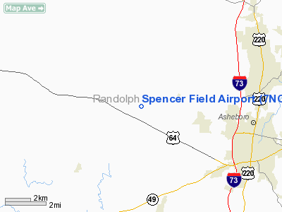
Location & QuickFacts
| FAA Information Effective: | 2008-09-25 |
| Airport Identifier: | 7NC9 |
| Airport Status: | Operational |
| Longitude/Latitude: | 079-54-40.1350W/35-43-38.4910N
-79.911149/35.727359 (Estimated) |
| Elevation: | 460 ft / 140.21 m (Estimated) |
| Land: | 0 acres |
| From nearest city: | 7 nautical miles W of Asheboro, NC |
| Location: | Randolph County, NC |
| Magnetic Variation: | 06W (1985) |
Owner & Manager
| Ownership: | Privately owned |
| Owner: | J C Spencer |
| Address: | 621 Spencer Meadow Rd
Asheboro, NC 27295 |
| Phone number: | 336-629-0097 |
| Manager: | J C Spencer |
| Address: | 621 Spencer Meadow Rd
Asheboro, NC 27205 |
| Phone number: | 336-629-0097 |
Airport Operations and Facilities
| Airport Use: | Private |
| Wind indicator: | Yes |
| Segmented Circle: | No |
| Control Tower: | No |
| Sectional chart: | Charlotte |
| Region: | ASO - Southern |
| Boundary ARTCC: | ZTL - Atlanta |
| Tie-in FSS: | RDU - Raleigh |
| FSS Toll Free: | 1-800-WX-BRIEF |
Runway Information
Runway 17/35
| Dimension: | 1400 x 75 ft / 426.7 x 22.9 m |
| Surface: | TURF, |
| |
Runway 17 |
Runway 35 |
| Traffic Pattern: | Left | Left |
| Obstruction: | 30 ft trees, 15.0 ft from runway | |
|
Radio Navigation Aids
| ID |
Type |
Name |
Ch |
Freq |
Var |
Dist |
| OQA | FAN MARKER | Rockingham County | | | | 42.2 nm |
| CQJ | NDB | City Lake | | 266.00 | 08W | 2.3 nm |
| VU | NDB | Aller | | 346.00 | 06W | 16.6 nm |
| SEN | NDB | Swearing/dcmsnd | | 260.00 | 06W | 19.2 nm |
| HB | NDB | Himun | | 361.00 | 08W | 21.9 nm |
| TOX | NDB | Siler City | | 371.00 | 07W | 22.0 nm |
| RU | NDB | Rovdy | | 275.00 | 06W | 28.2 nm |
| DVZ | NDB | Davie | | 354.00 | 06W | 28.8 nm |
| EEJ | NDB | Lee County/dcmsnd | | 428.00 | 07W | 39.8 nm |
| SIF | NDB | Slammer | | 423.00 | 07W | 40.0 nm |
| TT | NDB | Leeco | | 406.00 | 08W | 40.1 nm |
| AFP | NDB | Anson County | | 283.00 | 07W | 43.1 nm |
| HFF | NDB | Mackall | | 278.00 | 06W | 46.9 nm |
| AZW | NDB | Mount Airy | | 223.00 | 07W | 49.8 nm |
| LIB | VORTAC | Liberty | 077X | 113.00 | 03W | 15.4 nm |
| GSO | VORTAC | Greensboro | 109X | 116.20 | 03W | 19.4 nm |
| SDZ | VORTAC | Sandhills | 055X | 111.80 | 03W | 34.6 nm |
Remarks
- PRVDD VFR/PR USE; ARPTTFC PAT ALT ESTABLISHED AT 800' AGL/1260 AMSL; VFR TFC PAT ESTABLISHED EAST OF ARPT; EXECUTE/MAINTAIN OPERATIONAL AGREEMENT WITH OWNER OF DELK'S ARPT; & ARPT UNDERLIES THE FINAL APCH COURSE FOR VOR-A APCH TO ASHEBORO MUNI ARPT.
Images and information placed above are from
http://www.airport-data.com/airport/7NC9/
We thank them for the data!
| General Info
|
| Country |
United States
|
| State |
NORTH CAROLINA
|
| FAA ID |
7NC9
|
| Latitude |
35-43-38.491N
|
| Longitude |
079-54-40.135W
|
| Elevation |
460 feet
|
| Near City |
ASHEBORO
|
We don't guarantee the information is fresh and accurate. The data may
be wrong or outdated.
For more up-to-date information please refer to other sources.
|
|


