|
|
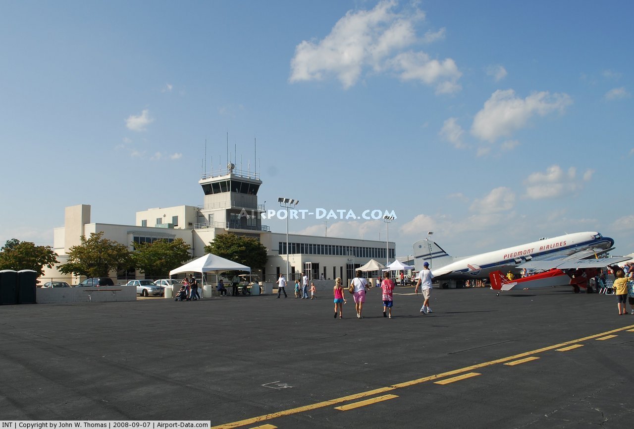
| Smith Reynolds Airport |
| IATA: INT – ICAO: KINT – FAA LID: INT |
| Summary |
| Airport type |
Public |
| Operator |
Airport Commission of Forsyth County |
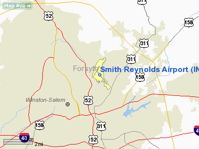
| Location |
Winston-Salem, North Carolina |
| Elevation AMSL |
969 ft / 295.4 m |
| Coordinates |
36°08′01″N 80°13′19″W / 36.13361°N 80.22194°W / 36.13361; -80.22194Coordinates: 36°08′01″N 80°13′19″W / 36.13361°N 80.22194°W / 36.13361; -80.22194 |
| Runways |
| Direction |
Length |
Surface |
| ft |
m |
| 15/33 |
6,655 |
2,028 |
Asphalt |
| 4/22 |
3,938 |
1,200 |
Asphalt |
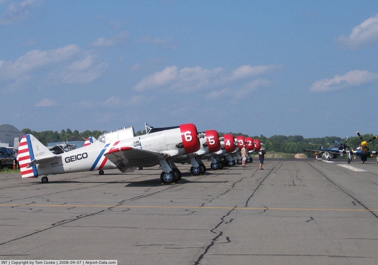
Smith Reynolds Airport (IATA: INT, ICAO: KINT, FAA LID: INT) is a public airport located 3 miles (5 km) northeast of the city of Winston-Salem in Forsyth County, North Carolina, USA. The airport has two runways, and is used primarily for general aviation and flight training, although some passenger operations take place there. In addition, it is home to the Winston-Salem air show, which is usually held in September, and draws about 20,000 spectators. History
The question of an airmail route and an airport for Winston-Salem was decided in the 1920s when land west of Greensboro was selected over a Winston-Salem tract, and Winston-Salem withdrew from the Tri-city Airport Commission.
A portion of land positioned off Walkertown Avenue (present-day Liberty Street) was located and determined to be the perfect site for a new airport. Clint Miller pledged $17,000 for the development of facilities at the new airfield, so when the new Airport Corporation met for the first time, they decided the new airfield would be named Miller Municipal Airport. Reynolds Aviation would be the main activity at Miller Field for its first five years. There were commuter flights to New York, Detroit, Philadelphia and Baltimore, and weekend taxi service to Wrightsville and Myrtle Beach. In 1932, when Dick Reynolds disbanded Reynolds Aviation, a group of local businessmen formed Camel City Flying Service. Camel City renovated the existing structures, strengthened field lights and installed a grandstand for aerial shows.
In 1933, the Civil Works Administration, a program developed by The New Deal, began extending each runway by 500 feet (150 m), lining the main hangar floors with concrete and relocating the field lighting system. Throughout the 1930s, Miller Airport was the recipient of many projects supported by the New Deal including a new administration building, a third runway, and a new field lighting system. The airport land was expanded to 170 acres (0.69 km) and a fourth runway was added by 1938.
In 1940, Charles Norfleet, the president of the Airport Commission, contacted Eastern Airlines, requesting them to begin servicing Miller Airport. When Eastern Airlines agreed to add Miller Airport to its North-South route, Dick Reynolds and his sisters, trustees of the Z. Smith Reynolds Foundation, donated funds from the Foundation to further modernize and expand the airport. In 1942, Miller Municipal Airport was renamed and dedicated to Smith Reynolds, a pioneer in aviation before his untimely death at the age of 20.
From 1942 until 1945, Smith Reynolds Airport served as a training base for military pilots in addition to its commercial and private airline services. Camel City Flying Services had become Piedmont Aviation, Inc. in 1940 and spent the 1940s building a base in flight training and airline sales. The company grew to over 80 employees by 1947 when the Civil Aeronautics Board awarded Piedmont Airlines a temporary certificate for regional air service. The company split into two divisions in order to continue the fixed base services, and service four feeder line routes extending from Wilmington, NC to Cincinnati, Ohio, servicing twenty-two airports with one of three of the original DC-3's affectionately known as the Pacemakers.
By 1953 Piedmont Airlines employed over 680 people and grossed over $5.3 million in gross revenue by covering almost 3,000 miles (4,800 km) on its route system. It grew into one of the nation's major airlines when it was merged into USAir in 1989. Although Piedmont's largest operation was at Charlotte/Douglas International Airport, they had maintained a significant presence at INT. USAir (later US Airways) closed its INT crew base in 1991. Their heavy maintenance base was closed in September 1998, leaving only specialty maintenance shops, the last of which was closed in 2005. US Airways still maintains its largest reservations center in Winston-Salem.
Prior Service
Winston-Salem has not had commercial service since US Airways Express carrier CCAir ended service in January 2000. The airport maintains high volume and income with its private aircraft through Landmark Aviation
The above content comes from Wikipedia and is published under free licenses – click here to read more.
 |
(Click on the photo to enlarge) |
 |
(Click on the photo to enlarge) |
Location & QuickFacts
| FAA Information Effective: | 2008-09-25 |
| Airport Identifier: | INT |
| Airport Status: | Operational |
| Longitude/Latitude: | 080-13-19.2000W/36-08-01.4000N
-80.222000/36.133722 (Estimated) |
| Elevation: | 969 ft / 295.35 m (Surveyed) |
| Land: | 702 acres |
| From nearest city: | 3 nautical miles NE of Winston Salem, NC |
| Location: | Forsyth County, NC |
| Magnetic Variation: | 07W (2000) |
Owner & Manager
| Ownership: | Publicly owned |
| Owner: | Forsyth County |
| Address: | Po Box 4457
Winston Salem, NC 27115 |
| Phone number: | 336-767-6361 |
| Manager: | Larry Scantlin
AIRPORT COMMISSION OF FORSYTH COUNTY. |
| Address: | Po Box 4457
Winston Salem, NC 27115 |
| Phone number: | 336-767-6361 |
Airport Operations and Facilities
| Airport Use: | Open to public |
| Wind indicator: | Yes |
| Segmented Circle: | Yes |
| Control Tower: | Yes |
| Lighting Schedule: | DUSK-DAWN
HIRL RY 15/33 PRESET ON MED INTST WHEN TWR CLSD, MIRL RY 04/22 UNAVBL WHEN TWR CLSD. WHEN TWR CLSD ACTVT REIL RY 15 AND MALSR RY 33 - CTAF. |
| Beacon Color: | Clear-Green (lighted land airport) |
| Landing fee charge: | No |
| Sectional chart: | Cincinnati |
| Region: | ASO - Southern |
| Boundary ARTCC: | ZTL - Atlanta |
| Tie-in FSS: | RDU - Raleigh |
| FSS on Airport: | No |
| FSS Toll Free: | 1-800-WX-BRIEF |
| NOTAMs Facility: | INT (NOTAM-d service avaliable) |
| Certification type/date: | I A S 05/1973
CLSD TO ACR OPNS WITH MORE THAN 30 PSGR SEATS 2300-0700 EXCP 24 HR PPR. ARFF INDEX B COVERAGE ALS AVAILABLE, CALL AMGR 336-767-6361. |
| Federal Agreements: | NGPY3 |
Airport Communications
| CTAF: | 123.750 |
| Unicom: | 122.950 |
Airport Services
| Fuel available: | 100LLA |
| Airframe Repair: | MAJOR |
| Power Plant Repair: | MAJOR |
| Bottled Oxygen: | HIGH/LOW |
| Bulk Oxygen: | HIGH/LOW |
Runway Information
Runway 04/22
| Dimension: | 3938 x 150 ft / 1200.3 x 45.7 m |
| Surface: | ASPH, Fair Condition |
| Weight Limit: | Single wheel: 40000 lbs.
Dual wheel: 55000 lbs.
Dual tandem wheel: 90000 lbs. |
| Edge Lights: | Medium |
| |
Runway 04 |
Runway 22 |
| Longitude: | 080-13-44.9101W | 080-13-20.3755W |
| Latitude: | 36-07-59.0050N | 36-08-32.4781N |
| Elevation: | 950.00 ft | 960.00 ft |
| Alignment: | 31 | 127 |
| Traffic Pattern: | Left | Left |
| Markings: | Basic, Good Condition | Basic, Good Condition |
| Crossing Height: | 0.00 ft | 39.00 ft |
| VASI: | | 2-light PAPI on left side |
| Visual Glide Angle: | 0.00° | 3.00° |
| Obstruction: | 85 ft trees, 1700.0 ft from runway, 100 ft right of centerline, 20:1 slope to clear | 50 ft trees, 1400.0 ft from runway, 150 ft right of centerline, 24:1 slope to clear |
|
Runway 15/33
| Dimension: | 6655 x 150 ft / 2028.4 x 45.7 m |
| Surface: | ASPH, Good Condition |
| Surface Treatment: | Saw-cut or plastic Grooved |
| Weight Limit: | Single wheel: 110000 lbs.
Dual wheel: 135000 lbs.
Dual tandem wheel: 230000 lbs. |
| Edge Lights: | High |
| |
Runway 15 |
Runway 33 |
| Longitude: | 080-13-34.6451W | 080-12-47.6880W |
| Latitude: | 36-08-19.6979N | 36-07-26.0392N |
| Elevation: | 968.00 ft | 900.00 ft |
| Alignment: | 127 | 127 |
| ILS Type: | | ILS
|
| Traffic Pattern: | Left | Left |
| Markings: | Non-precision instrument, Good Condition | Precision instrument, Good Condition |
| Crossing Height: | 36.00 ft | 0.00 ft |
| Displaced threshold: | 586.00 ft | 0.00 ft |
| VASI: | 4-light PAPI on left side | |
| Visual Glide Angle: | 3.00° | 0.00° |
| RVR Equipment: | | touchdown |
| Approach lights: | | MALSR |
| Runway End Identifier: | Yes | No |
| Obstruction: | 57 ft bldg, 1250.0 ft from runway, 450 ft left of centerline, 18:1 slope to clear
APCH RATIO 32:1 FM DSPLCD THR. | , 50:1 slope to clear |
|
Radio Navigation Aids
| ID |
Type |
Name |
Ch |
Freq |
Var |
Dist |
| OQA | FAN MARKER | Rockingham County | | | | 25.9 nm |
| DVZ | NDB | Davie | | 354.00 | 06W | 17.5 nm |
| AZW | NDB | Mount Airy | | 223.00 | 07W | 21.4 nm |
| SEN | NDB | Swearing/dcmsnd | | 260.00 | 06W | 21.6 nm |
| ZEF | NDB | Zephyr | | 326.00 | 05W | 26.6 nm |
| SIF | NDB | Slammer | | 423.00 | 07W | 26.8 nm |
| RU | NDB | Rovdy | | 275.00 | 06W | 27.4 nm |
| CQJ | NDB | City Lake | | 266.00 | 08W | 30.5 nm |
| UV | NDB | Bales | | 396.00 | 07W | 31.1 nm |
| HB | NDB | Himun | | 361.00 | 08W | 32.3 nm |
| VU | NDB | Aller | | 346.00 | 06W | 39.4 nm |
| UKF | NDB | Wilki | | 209.00 | 06W | 42.6 nm |
| TOX | NDB | Siler City | | 371.00 | 07W | 43.2 nm |
| VW | NDB | Temky | | 280.00 | 05W | 46.4 nm |
| HLX | NDB | Hillsville | | 269.00 | 06W | 47.6 nm |
| GSO | VORTAC | Greensboro | 109X | 116.20 | 03W | 13.1 nm |
| LIB | VORTAC | Liberty | 077X | 113.00 | 03W | 35.4 nm |
Remarks
- BOEING 727-200 SERIES ARE RESTRICTED TO RY 15/33; TERMINAL RAMP & TWYS 'A' & 'F' ONLY.
Images and information placed above are from
http://www.airport-data.com/airport/INT/
We thank them for the data!
| General Info
|
| Country |
United States
|
| State |
NORTH CAROLINA
|
| FAA ID |
INT
|
| Latitude |
36-08-01.400N
|
| Longitude |
080-13-19.200W
|
| Elevation |
969 feet
|
| Near City |
WINSTON SALEM
|
We don't guarantee the information is fresh and accurate. The data may
be wrong or outdated.
For more up-to-date information please refer to other sources.
|
|