|
|
 |
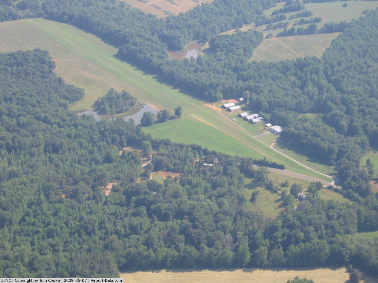
(Click on the photo to enlarge) |
Location & QuickFacts
| FAA Information Effective: | 2008-09-25 |
| Airport Identifier: | 25NC |
| Airport Status: | Operational |
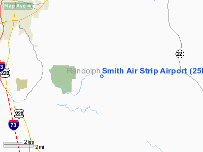
| Longitude/Latitude: | 079-42-36.0000W/35-38-00.0000N
-79.710000/35.633333 (Estimated) |
| Elevation: | 560 ft / 170.69 m (Estimated) |
| Land: | 0 acres |
| From nearest city: | 6 nautical miles SE of Asheboro, NC |
| Location: | Randolph County, NC |
| Magnetic Variation: | 07W (1995) |
Owner & Manager
| Ownership: | Privately owned |
| Owner: | Jeff Smith |
| Address: | 3318 Old Nc Hwy 13
Asheboro, NC 27205-8755 |
| Phone number: | 336-879-5440 |
| Manager: | Jeff Smith |
| Address: | 3320 Old Nc Hwy 13
Asheboro, NC 27205-8755 |
| Phone number: | 336-879-2830
AMGR ADDL PHONE 336-879-2830. |
Airport Operations and Facilities
| Airport Use: | Private |
| Wind indicator: | Yes |
| Segmented Circle: | Yes |
| Control Tower: | No |
| Lighting Schedule: | PHONE REQ
FOR ARPT BCN CALL 336-879-2830. |
| Beacon Color: | Clear-Green (lighted land airport) |
| Landing fee charge: | No |
| Sectional chart: | Charlotte |
| Region: | ASO - Southern |
| Boundary ARTCC: | ZTL - Atlanta |
| Tie-in FSS: | RDU - Raleigh |
| FSS on Airport: | No |
| FSS Toll Free: | 1-800-WX-BRIEF |
Airport Services
Runway Information
Runway 18/36
| Dimension: | 3100 x 60 ft / 944.9 x 18.3 m |
| Surface: | TURF, Good Condition |
| Edge Lights: | Low |
| |
Runway 18 |
Runway 36 |
| Traffic Pattern: | Left | Left |
| Displaced threshold: | 150.00 ft | 700.00 ft |
| Obstruction: | , 150.0 ft from runway | 60 ft pline, 300.0 ft from runway |
|
Radio Navigation Aids
| ID |
Type |
Name |
Ch |
Freq |
Var |
Dist |
| OQA | FAN MARKER | Rockingham County | | | | 48.0 nm |
| CQJ | NDB | City Lake | | 266.00 | 08W | 9.1 nm |
| TOX | NDB | Siler City | | 371.00 | 07W | 14.3 nm |
| VU | NDB | Aller | | 346.00 | 06W | 20.1 nm |
| HB | NDB | Himun | | 361.00 | 08W | 21.6 nm |
| EEJ | NDB | Lee County/dcmsnd | | 428.00 | 07W | 28.5 nm |
| TT | NDB | Leeco | | 406.00 | 08W | 29.0 nm |
| SEN | NDB | Swearing/dcmsnd | | 260.00 | 06W | 30.0 nm |
| HFF | NDB | Mackall | | 278.00 | 06W | 38.0 nm |
| RU | NDB | Rovdy | | 275.00 | 06W | 38.5 nm |
| DVZ | NDB | Davie | | 354.00 | 06W | 40.1 nm |
| AFP | NDB | Anson County | | 283.00 | 07W | 40.9 nm |
| POB | NDB | Pope | | 338.00 | 07W | 44.3 nm |
| SIF | NDB | Slammer | | 423.00 | 07W | 45.1 nm |
| RCZ | NDB | Roscoe | | 375.00 | 07W | 46.9 nm |
| HUR | NDB | Person | | 220.00 | 08W | 47.8 nm |
| POB | TACAN | Pope | 085X | | 07W | 44.1 nm |
| LIB | VORTAC | Liberty | 077X | 113.00 | 03W | 11.7 nm |
| SDZ | VORTAC | Sandhills | 055X | 111.80 | 03W | 25.8 nm |
| GSO | VORTAC | Greensboro | 109X | 116.20 | 03W | 28.0 nm |
| RDU | VORTAC | Raleigh/durham | 119X | 117.20 | 04W | 47.4 nm |
Remarks
- AVOID DIRECT OVERFLIGHT OF CHURCH 1/4 MILE SOUTH OF RY AND ZOO 2.5 MILES WEST OF ARPT.
- AEROBATIC BOX LCTD WEST OF ARPT AND CNTRLN RY 18/36.
- VFR; PVT USE.
Images and information placed above are from
http://www.airport-data.com/airport/25NC/
We thank them for the data!
| General Info
|
| Country |
United States
|
| State |
NORTH CAROLINA
|
| FAA ID |
25NC
|
| Latitude |
35-38-00.000N
|
| Longitude |
079-42-36.000W
|
| Elevation |
560 feet
|
| Near City |
ASHEBORO
|
We don't guarantee the information is fresh and accurate. The data may
be wrong or outdated.
For more up-to-date information please refer to other sources.
|
|