 |
|
Location & QuickFacts
| FAA Information Effective: | 2008-09-25 |
| Airport Identifier: | NC50 |
| Airport Status: | Operational |
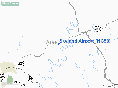
| Longitude/Latitude: | 081-21-41.3540W/36-27-36.4540N
-81.361487/36.460126 (Estimated) |
| Elevation: | 2860 ft / 871.73 m (Estimated) |
| Land: | 16 acres |
| From nearest city: | 6 nautical miles E of Jefferson, NC |
| Location: | Ashe County, NC |
| Magnetic Variation: | 05W (1985) |
Owner & Manager
| Ownership: | Privately owned |
| Owner: | James M. Stump |
| Address: | 225 Friendship Baptist Church Rd
Jefferson, NC 28640 |
| Phone number: | 336-982-3713 |
| Manager: | James M. Stump |
| Address: | 225 Friendship Baptist Church Rd
Jefferson, NC 28640 |
| Phone number: | 336-982-3899 |
Airport Operations and Facilities
| Airport Use: | Private |
| Wind indicator: | Yes |
| Segmented Circle: | No |
| Control Tower: | No |
| Landing fee charge: | No |
| Sectional chart: | Cincinnati |
| Region: | ASO - Southern |
| Boundary ARTCC: | ZTL - Atlanta |
| Tie-in FSS: | RDU - Raleigh |
| FSS on Airport: | No |
| FSS Toll Free: | 1-800-WX-BRIEF |
Airport Services
Runway Information
Runway 10/28
| Dimension: | 1460 x 20 ft / 445.0 x 6.1 m |
| Surface: | ASPH, |
| |
Runway 10 |
Runway 28 |
| Traffic Pattern: | Left | Left |
|
Radio Navigation Aids
| ID |
Type |
Name |
Ch |
Freq |
Var |
Dist |
| MRN | FAN MARKER | Lenoir | | | 03W | 41.9 nm |
| JU | NDB | Ashee | | 410.00 | 07W | 2.5 nm |
| JJO | NDB | Mountain City | | 396.00 | 04W | 22.5 nm |
| UKF | NDB | Wilki | | 209.00 | 06W | 24.5 nm |
| MK | NDB | Suzze | | 335.00 | 06W | 28.2 nm |
| BAR | NDB | Hemlock | | 320.00 | 02W | 31.1 nm |
| HLX | NDB | Hillsville | | 269.00 | 06W | 31.7 nm |
| ZEF | NDB | Zephyr | | 326.00 | 05W | 32.1 nm |
| VJ | NDB | Whine | | 236.00 | 05W | 32.8 nm |
| AZW | NDB | Mount Airy | | 223.00 | 07W | 40.0 nm |
| HK | NDB | Tawba | | 332.00 | 06W | 40.6 nm |
| VW | NDB | Temky | | 280.00 | 05W | 43.7 nm |
| EZT | NDB | Elizabethton | | 275.00 | 02W | 44.8 nm |
| FIQ | NDB | Fiddlers | | 391.00 | 07W | 47.5 nm |
| BZM | VOR/DME | Barretts Mountain | 045X | 110.80 | 06W | 36.0 nm |
| GZG | VOR/DME | Glade Spring | 039X | 110.20 | 02W | 41.0 nm |
| HMV | VORTAC | Holston Mountain | 093X | 114.60 | 04W | 37.2 nm |
| PSK | VORTAC | Pulaski | 115X | 116.80 | 06W | 49.0 nm |
| HKY | VOT | Hickory Regional | | 110.00 | | 43.3 nm |
Remarks
- VFR, PVT USE; COORD WITH ASHE CO ARPT AUTH.
Images and information placed above are from
http://www.airport-data.com/airport/NC50/
We thank them for the data!
| General Info
|
| Country |
United States
|
| State |
NORTH CAROLINA
|
| FAA ID |
NC50
|
| Latitude |
36-27-36.454N
|
| Longitude |
081-21-41.354W
|
| Elevation |
2860 feet
|
| Near City |
JEFFERSON
|
We don't guarantee the information is fresh and accurate. The data may
be wrong or outdated.
For more up-to-date information please refer to other sources.
|
|


