|
|
 |
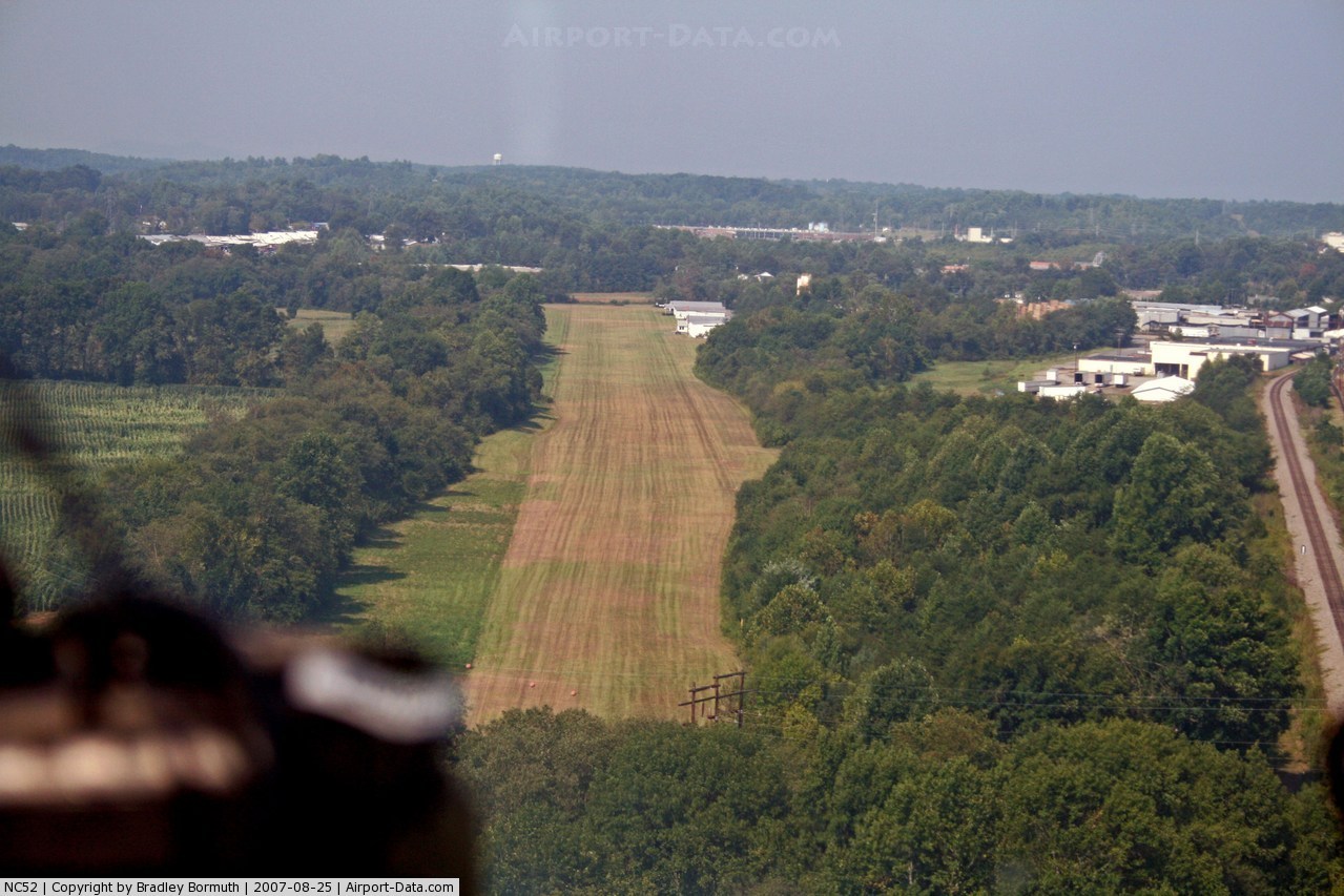
(Click on the photo to enlarge) |
 |
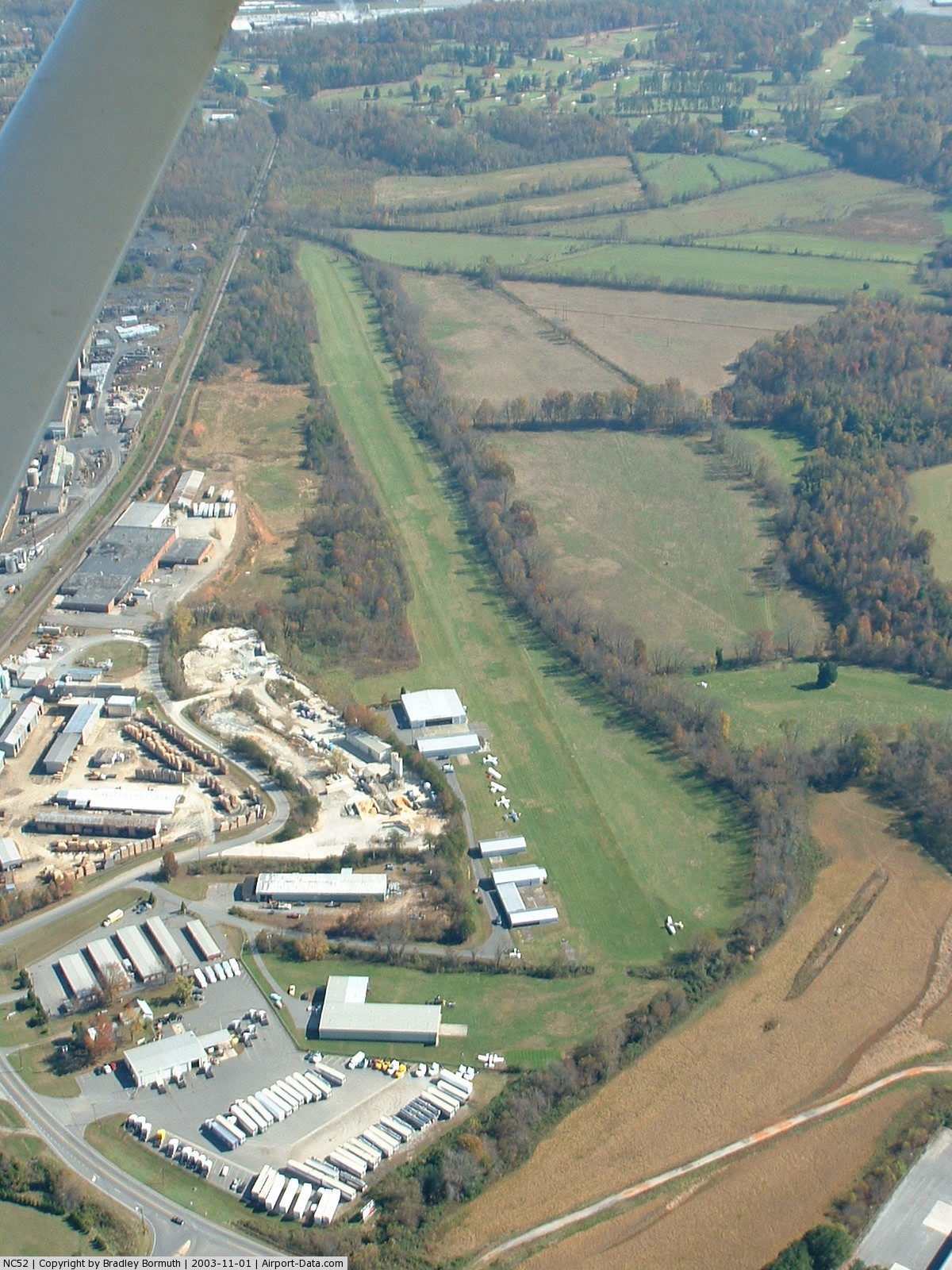
(Click on the photo to enlarge) |
Location & QuickFacts
| FAA Information Effective: | 2008-09-25 |
| Airport Identifier: | NC52 |
| Airport Status: | Operational |
| Longitude/Latitude: | 081-43-44.3510W/35-43-42.4630N
-81.728986/35.728462 (Estimated) |
| Elevation: | 1020 ft / 310.90 m (Surveyed) |
| Land: | 20 acres |
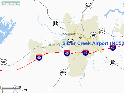
| From nearest city: | 3 nautical miles W of Morganton, NC |
| Location: | Burke County, NC |
| Magnetic Variation: | 05W (1985) |
Owner & Manager
| Ownership: | Privately owned |
| Owner: | Silver Creek Aviation Inc. |
| Address: | Po Drawer 310
Morgantown, NC 28680-0310 |
| Phone number: | 828-584-1446 |
| Manager: | Paul S. Cash |
| Address: | Po Drawer 310
Morgantown, NC 28680-0310 |
| Phone number: | 828-437-5357 |
Airport Operations and Facilities
| Airport Use: | Private |
| Wind indicator: | Yes |
| Segmented Circle: | No |
| Control Tower: | No |
| Lighting Schedule: | PHONE REQ
FOR LIRL RY 09/27 CALL 704-437-5357. |
| Landing fee charge: | No |
| Sectional chart: | Atlanta |
| Region: | ASO - Southern |
| Boundary ARTCC: | ZTL - Atlanta |
| Tie-in FSS: | RDU - Raleigh |
| FSS on Airport: | No |
| FSS Toll Free: | 1-800-WX-BRIEF |
Airport Services
| Fuel available: | 100 |
| Airframe Repair: | NONE |
| Power Plant Repair: | NONE |
Runway Information
Runway 09/27
| Dimension: | 3600 x 200 ft / 1097.3 x 61.0 m |
| Surface: | TURF, |
| Edge Lights: | Low |
| |
Runway 09 |
Runway 27 |
| Traffic Pattern: | Left | Left |
|
Radio Navigation Aids
| ID |
Type |
Name |
Ch |
Freq |
Var |
Dist |
| MRN | FAN MARKER | Lenoir | | | 03W | 6.5 nm |
| FIQ | NDB | Fiddlers | | 391.00 | 07W | 3.0 nm |
| HK | NDB | Tawba | | 332.00 | 06W | 20.9 nm |
| RFE | NDB | Rutherford | | 344.00 | 05W | 25.3 nm |
| BAR | NDB | Hemlock | | 320.00 | 02W | 26.6 nm |
| SLP | NDB | First River | | 417.00 | 06W | 29.3 nm |
| VW | NDB | Temky | | 280.00 | 05W | 32.5 nm |
| IZN | NDB | Lincolnton | | 432.00 | 06W | 33.4 nm |
| UKF | NDB | Wilki | | 209.00 | 06W | 38.4 nm |
| JJO | NDB | Mountain City | | 396.00 | 04W | 41.6 nm |
| GHJ | NDB | Stonia | | 260.00 | 06W | 42.7 nm |
| EZT | NDB | Elizabethton | | 275.00 | 02W | 44.0 nm |
| BRA | NDB | Broad River | | 379.00 | 04W | 45.5 nm |
| JU | NDB | Ashee | | 410.00 | 07W | 46.8 nm |
| BZM | VOR/DME | Barretts Mountain | 045X | 110.80 | 06W | 25.3 nm |
| CLT | VOR/DME | Charlotte | 097X | 115.00 | 05W | 49.9 nm |
| SUG | VORTAC | Sugarloaf Mountain | 059X | 112.20 | 02W | 32.7 nm |
| SPA | VORTAC | Spartanburg | 104X | 115.70 | 02W | 42.9 nm |
| HMV | VORTAC | Holston Mountain | 093X | 114.60 | 04W | 46.8 nm |
| HKY | VOT | Hickory Regional | | 110.00 | | 16.5 nm |
| CLT | VOT | Charlotte | | 112.00 | | 49.5 nm |
Images and information placed above are from
http://www.airport-data.com/airport/NC52/
We thank them for the data!
| General Info
|
| Country |
United States
|
| State |
NORTH CAROLINA
|
| FAA ID |
NC52
|
| Latitude |
35-43-42.463N
|
| Longitude |
081-43-44.351W
|
| Elevation |
1020 feet
|
| Near City |
MORGANTON
|
We don't guarantee the information is fresh and accurate. The data may
be wrong or outdated.
For more up-to-date information please refer to other sources.
|
|