|
|
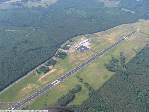 |
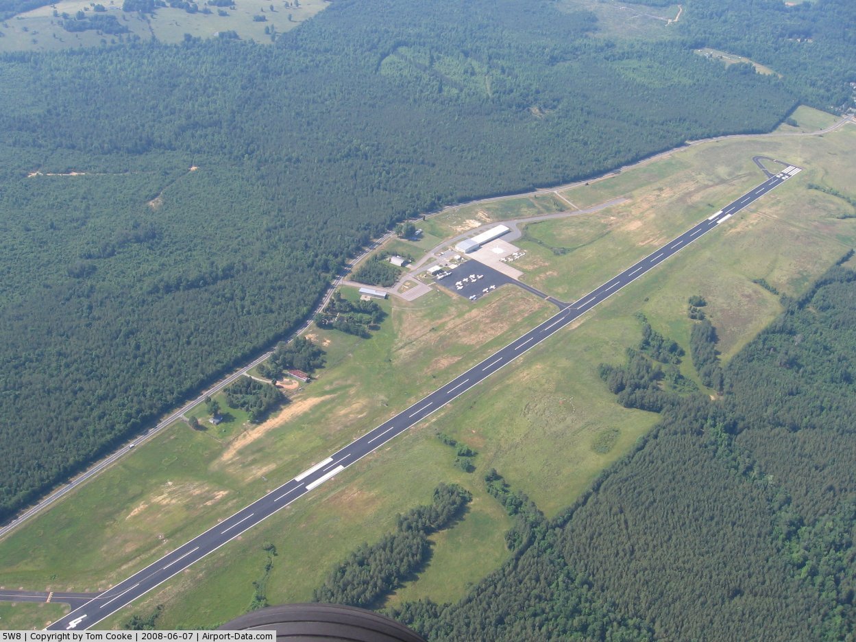
(Click on the photo to enlarge) |
 |
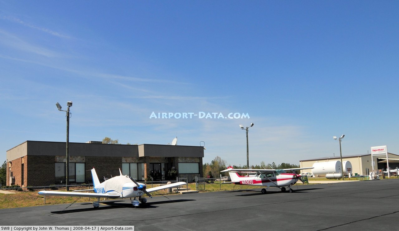
(Click on the photo to enlarge) |
Location & QuickFacts
| FAA Information Effective: | 2008-09-25 |
| Airport Identifier: | 5W8 |
| Airport Status: | Operational |
| Longitude/Latitude: | 079-30-15.0800W/35-42-15.5000N
-79.504189/35.704306 (Estimated) |
| Elevation: | 614 ft / 187.15 m (Surveyed) |
| Land: | 92 acres |
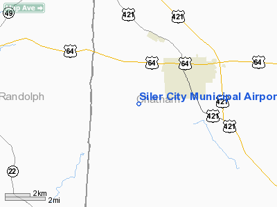
| From nearest city: | 3 nautical miles SW of Siler City, NC |
| Location: | Chatham County, NC |
| Magnetic Variation: | 07W (1990) |
Owner & Manager
| Ownership: | Publicly owned |
| Owner: | Town Of Siler City |
| Address: | Po Box 769
Siler City, NC 27344 |
| Phone number: | 919-742-4731 |
| Manager: | Cardinal Air |
| Address: | 80 Aviation Dr.
Siler City, NC 27344 |
| Phone number: | 919-742-3847 |
Airport Operations and Facilities
| Airport Use: | Open to public |
| Wind indicator: | Yes |
| Segmented Circle: | Yes |
| Control Tower: | No |
| Lighting Schedule: | DUSK-DAWN
MIRL RY 04/22 PRESET LOW INTST DUSK-0000; TO INCR INTST & ACTVT AFT 0000 - CTAF. PAPI RYS 04 & 22 OPER CONT. |
| Beacon Color: | Clear-Green (lighted land airport) |
| Landing fee charge: | No |
| Sectional chart: | Charlotte |
| Region: | ASO - Southern |
| Boundary ARTCC: | ZDC - Washington |
| Responsible ARTCC: | ZTL - Atlanta |
| Tie-in FSS: | RDU - Raleigh |
| FSS on Airport: | No |
| FSS Toll Free: | 1-800-WX-BRIEF |
| NOTAMs Facility: | RDU (NOTAM-d service avaliable) |
| Federal Agreements: | NY1 |
Airport Communications
| CTAF: | 122.700 |
| Unicom: | 122.700 |
Airport Services
| Fuel available: | 100LLA1+ |
| Airframe Repair: | MAJOR |
| Power Plant Repair: | MAJOR |
| Bulk Oxygen: | NONE |
Runway Information
Runway 04/22
| Dimension: | 5000 x 75 ft / 1524.0 x 22.9 m |
| Surface: | ASPH, Good Condition |
| Weight Limit: | Single wheel: 25000 lbs. |
| Edge Lights: | Medium |
| |
Runway 04 |
Runway 22 |
| Longitude: | 079-30-30.2500W | 079-29-58.7700W |
| Latitude: | 35-41-54.9300N | 35-42-37.2000N |
| Elevation: | 597.00 ft | 614.00 ft |
| Alignment: | 31 | 127 |
| Traffic Pattern: | Left | Left |
| Markings: | Non-precision instrument, Good Condition | Non-precision instrument, Good Condition |
| Crossing Height: | 40.00 ft | 30.00 ft |
| VASI: | 2-light PAPI on left side | 2-light PAPI on left side |
| Visual Glide Angle: | 4.00° | 3.00° |
| Obstruction: | 66 ft trees, 1045.0 ft from runway, 117 ft left of centerline, 12:1 slope to clear | 276 ft trees, 4908.0 ft from runway, 910 ft left of centerline, 17:1 slope to clear |
|
Radio Navigation Aids
| ID |
Type |
Name |
Ch |
Freq |
Var |
Dist |
| OQA | FAN MARKER | Rockingham County | | | | 46.2 nm |
| TOX | NDB | Siler City | | 371.00 | 07W | 4.0 nm |
| HB | NDB | Himun | | 361.00 | 08W | 16.9 nm |
| CQJ | NDB | City Lake | | 266.00 | 08W | 17.6 nm |
| TT | NDB | Leeco | | 406.00 | 08W | 21.7 nm |
| EEJ | NDB | Lee County/dcmsnd | | 428.00 | 07W | 24.2 nm |
| VU | NDB | Aller | | 346.00 | 06W | 31.0 nm |
| HUR | NDB | Person | | 220.00 | 08W | 38.3 nm |
| SEN | NDB | Swearing/dcmsnd | | 260.00 | 06W | 39.0 nm |
| POB | NDB | Pope | | 338.00 | 07W | 39.3 nm |
| LE | NDB | Leevy | | 350.00 | 07W | 40.4 nm |
| HFF | NDB | Mackall | | 278.00 | 06W | 40.7 nm |
| SIF | NDB | Slammer | | 423.00 | 07W | 42.7 nm |
| HQT | NDB | Harnett | | 417.00 | 08W | 43.7 nm |
| FGP | NDB | Fort Bragg | | 393.00 | 07W | 48.0 nm |
| DVZ | NDB | Davie | | 354.00 | 06W | 48.1 nm |
| RU | NDB | Rovdy | | 275.00 | 06W | 48.1 nm |
| AFP | NDB | Anson County | | 283.00 | 07W | 49.8 nm |
| POB | TACAN | Pope | 085X | | 07W | 40.4 nm |
| LIB | VORTAC | Liberty | 077X | 113.00 | 03W | 8.3 nm |
| SDZ | VORTAC | Sandhills | 055X | 111.80 | 03W | 29.7 nm |
| GSO | VORTAC | Greensboro | 109X | 116.20 | 03W | 30.8 nm |
| RDU | VORTAC | Raleigh/durham | 119X | 117.20 | 04W | 36.6 nm |
Remarks
- DEER & BIRDS ON & INVOF ARPT.
- ASPH SECTION OF RAMP PAVEMENT STRENGTH IS CONSIDERABLE LESS THAN RY.
- AFT HRS FUEL OR SVCS, CALL 919-545-0138 OR 919-619-2707.
- 100LL AVBL 24 HRS SELF SVC.
Images and information placed above are from
http://www.airport-data.com/airport/5W8/
We thank them for the data!
| General Info
|
| Country |
United States
|
| State |
NORTH CAROLINA
|
| FAA ID |
5W8
|
| Latitude |
35-42-10.503N
|
| Longitude |
079-30-19.079W
|
| Elevation |
614 feet
|
| Near City |
SILER CITY
|
We don't guarantee the information is fresh and accurate. The data may
be wrong or outdated.
For more up-to-date information please refer to other sources.
|
|