 |
|
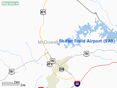
Location & QuickFacts
| FAA Information Effective: | 2008-09-25 |
| Airport Identifier: | 9A9 |
| Airport Status: | Operational |
| Longitude/Latitude: | 082-00-35.3910W/35-43-14.4470N
-82.009831/35.720680 (Estimated) |
| Elevation: | 1212 ft / 369.42 m (Surveyed) |
| Land: | 30 acres |
| From nearest city: | 3 nautical miles N of Marion, NC |
| Location: | Mc Dowell County, NC |
| Magnetic Variation: | 04W (1985) |
Owner & Manager
| Ownership: | Privately owned |
| Owner: | Marion Airport Commission |
| Address: | Po Box 1298
Marion, NC 28752 |
| Phone number: | 828-652-6872 |
| Manager: | Jean Padgett |
| Address: | 2660 Airport Rd
Marion, NC 28752 |
| Phone number: | 828-652-6872 |
Airport Operations and Facilities
| Airport Use: | Open to public |
| Wind indicator: | Yes |
| Segmented Circle: | No |
| Control Tower: | No |
| Landing fee charge: | No |
| Sectional chart: | Atlanta |
| Region: | ASO - Southern |
| Boundary ARTCC: | ZTL - Atlanta |
| Tie-in FSS: | RDU - Raleigh |
| FSS on Airport: | No |
| FSS Toll Free: | 1-800-WX-BRIEF |
| NOTAMs Facility: | RDU (NOTAM-d service avaliable) |
Airport Communications
Airport Services
| Fuel available: | 100LL
FOR FUEL CALL 828-652-3330. |
| Airframe Repair: | MAJOR |
| Power Plant Repair: | MAJOR |
| Bottled Oxygen: | NONE |
| Bulk Oxygen: | NONE |
Runway Information
Runway 10/28
| Dimension: | 3340 x 180 ft / 1018.0 x 54.9 m |
| Surface: | TURF, Good Condition
RY SUBJECT TO FLOODING AFT VERY HEAVY RAINS ON EAST END. |
| |
Runway 10 |
Runway 28 |
| Traffic Pattern: | Left | Left |
| Obstruction: | 86 ft trees, 413.0 ft from runway, 163 ft right of centerline, 4:1 slope to clear | 20 ft tree, 97.0 ft from runway, 90 ft left of centerline, 4:1 slope to clear |
|
Radio Navigation Aids
| ID |
Type |
Name |
Ch |
Freq |
Var |
Dist |
| MRN | FAN MARKER | Lenoir | | | 03W | 19.3 nm |
| FIQ | NDB | Fiddlers | | 391.00 | 07W | 16.5 nm |
| RFE | NDB | Rutherford | | 344.00 | 05W | 22.5 nm |
| BAR | NDB | Hemlock | | 320.00 | 02W | 26.8 nm |
| HK | NDB | Tawba | | 332.00 | 06W | 34.6 nm |
| SLP | NDB | First River | | 417.00 | 06W | 34.6 nm |
| BRA | NDB | Broad River | | 379.00 | 04W | 35.1 nm |
| EZT | NDB | Elizabethton | | 275.00 | 02W | 38.0 nm |
| JJO | NDB | Mountain City | | 396.00 | 04W | 42.8 nm |
| VW | NDB | Temky | | 280.00 | 05W | 46.2 nm |
| IZN | NDB | Lincolnton | | 432.00 | 06W | 46.4 nm |
| BO | NDB | Booie | | 221.00 | 04W | 47.1 nm |
| FRT | NDB | Fairmont | | 248.00 | 05W | 49.2 nm |
| DYQ | NDB | Dulaney | | 263.00 | 04W | 49.6 nm |
| BZM | VOR/DME | Barretts Mountain | 045X | 110.80 | 06W | 38.5 nm |
| SUG | VORTAC | Sugarloaf Mountain | 059X | 112.20 | 02W | 22.7 nm |
| SPA | VORTAC | Spartanburg | 104X | 115.70 | 02W | 41.5 nm |
| HMV | VORTAC | Holston Mountain | 093X | 114.60 | 04W | 43.5 nm |
| HKY | VOT | Hickory Regional | | 110.00 | | 30.2 nm |
Remarks
- LOW LYING FOG ON AIRFIELD DURING RAINY COOL WEATHER.
- NUMEROUS OBSTNS IN APCH & PRIM SFCS.
- HIGH TERRIAN ALL QUADRANTS.
- HANGERS ARE SPACED CLOSER THAN NORMAL; SLOWER TAXI SPEEDS REQUIRED.
- IN EXISTENCE IN 1952.
Images and information placed above are from
http://www.airport-data.com/airport/9A9/
We thank them for the data!
| General Info
|
| Country |
United States
|
| State |
NORTH CAROLINA
|
| FAA ID |
9A9
|
| Latitude |
35-43-14.447N
|
| Longitude |
082-00-35.391W
|
| Elevation |
1212 feet
|
| Near City |
MARION
|
We don't guarantee the information is fresh and accurate. The data may
be wrong or outdated.
For more up-to-date information please refer to other sources.
|
|


