 |
|
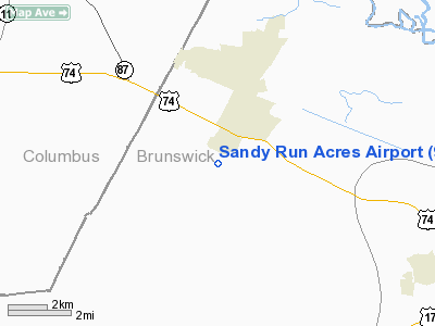
Location & QuickFacts
| FAA Information Effective: | 2008-09-25 |
| Airport Identifier: | 9NC6 |
| Airport Status: | Operational |
| Longitude/Latitude: | 078-09-38.9870W/34-16-29.6080N
-78.160830/34.274891 (Estimated) |
| Elevation: | 60 ft / 18.29 m (Estimated) |
| Land: | 114 acres |
| From nearest city: | 6 nautical miles SW of Maco, NC |
| Location: | Brunswick County, NC |
| Magnetic Variation: | 07W (1990) |
Owner & Manager
| Ownership: | Privately owned |
| Owner: | Louis E Burriss |
| Address: | 3224 Toone St
Baltimore, MD 21224-5042 |
| Phone number: | 301-732-7500 |
| Manager: | Louis E Burriss |
| Address: | 3224 Toone St
Baltimore, MD 21224-5042 |
| Phone number: | 301-732-7500 |
Airport Operations and Facilities
| Airport Use: | Private |
| Segmented Circle: | No |
| Control Tower: | No |
| Sectional chart: | Charlotte |
| Region: | ASO - Southern |
| Boundary ARTCC: | ZDC - Washington |
| Tie-in FSS: | RDU - Raleigh |
| FSS Toll Free: | 1-800-WX-BRIEF |
Runway Information
Runway 12/30
| Dimension: | 3200 x 75 ft / 975.4 x 22.9 m |
| Surface: | DIRT, |
| |
Runway 12 |
Runway 30 |
| Traffic Pattern: | Left | Left |
| Obstruction: | | 605 ft ant, 1500.0 ft from runway |
|
Radio Navigation Aids
| ID |
Type |
Name |
Ch |
Freq |
Var |
Dist |
| CLB | NDB | Carolina Beach | | 216.00 | 04W | 14.2 nm |
| SUT | NDB | Yaupon | | 233.00 | 08W | 21.3 nm |
| TGQ | NDB | Elizabethtown | | 398.00 | 08W | 23.3 nm |
| CPC | NDB | Camp | | 227.00 | 07W | 27.5 nm |
| ACZ | NDB | Pendy | | 379.00 | 09W | 27.7 nm |
| CTZ | NDB | Clinton | | 412.00 | 08W | 43.3 nm |
| NCA | NDB | New River | | 356.00 | 08W | 45.1 nm |
| RSY | NDB | Robeson | | 359.00 | 08W | 49.0 nm |
| DKA | NDB | Kenan | | 332.00 | 07W | 49.4 nm |
| DIW | NDB/DME | Dixon | 107X | 198.00 | 08W | 39.3 nm |
| NCA | TACAN | New River | 101X | | 08W | 44.2 nm |
| LBT | VOR | Lumberton | | 110.00 | 08W | 48.7 nm |
| ILM | VORTAC | Wilmington | 117X | 117.00 | 07W | 15.0 nm |
| CRE | VORTAC | Grand Strand | 123X | 117.60 | 03W | 39.4 nm |
Remarks
- PRVDD OPNS ARE CONDUCTED IN VFR WX CONDS; LNDG AREA LIMITED TO PVT USE; ALL TFC PATTERNS ESTABLISHED SOUTH OF ARPT TO AVOID CONFLICT WITH ANTENNA 1500 FT NE OF PROPOSED RY.
Images and information placed above are from
http://www.airport-data.com/airport/9NC6/
We thank them for the data!
| General Info
|
| Country |
United States
|
| State |
NORTH CAROLINA
|
| FAA ID |
9NC6
|
| Latitude |
34-16-29.608N
|
| Longitude |
078-09-38.987W
|
| Elevation |
60 feet
|
| Near City |
MACO
|
We don't guarantee the information is fresh and accurate. The data may
be wrong or outdated.
For more up-to-date information please refer to other sources.
|
|


