|
|
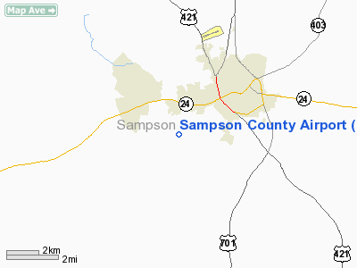
| Sampson County Airport |
| IATA: CTZ – ICAO: KCTZ – FAA LID: CTZ |
| Summary |
| Airport type |
Public |
| Operator |
Sampson County / City of Clinton |
| Location |
Clinton, North Carolina |
| Elevation AMSL |
148 ft / 45.1 m |
| Coordinates |
34°58′32″N 078°21′53″W / 34.97556°N 78.36472°W / 34.97556; -78.36472Coordinates: 34°58′32″N 078°21′53″W / 34.97556°N 78.36472°W / 34.97556; -78.36472 |
| Runways |
| Direction |
Length |
Surface |
| ft |
m |
| 6/24 |
4,220 |
1,286 |
Asphalt |
Sampson County Airport (IATA: CTZ, ICAO: KCTZ, FAA LID: CTZ) is a public airport located two miles (3 km) southwest of the central business district (CBD) of Clinton, a city in Sampson County, North Carolina, USA. This general aviation airport covers 114 acres (46 ha) and has one runway. It is operated by Sampson County and the City of Clinton.
The above content comes from Wikipedia and is published under free licenses – click here to read more.
 |
(Click on the photo to enlarge) |
Location & QuickFacts
| FAA Information Effective: | 2008-09-25 |
| Airport Identifier: | CTZ |
| Airport Status: | Operational |
| Longitude/Latitude: | 078-21-56.2650W/34-58-29.7800N
-78.365629/34.974939 (Estimated) |
| Elevation: | 148 ft / 45.11 m (Surveyed) |
| Land: | 114 acres |
| From nearest city: | 2 nautical miles SW of Clinton, NC |
| Location: | Sampson County, NC |
| Magnetic Variation: | 09W (2005) |
Owner & Manager
| Ownership: | Publicly owned |
| Owner: | Sampson Co./city Of Clinton |
| Address: | 313 Rowan Road
Clinton, NC 28328 |
| Phone number: | 910-592-6308 |
| Manager: | Sam Anders |
| Address: | 116 Airport Road
Clinton, NC 28328 |
| Phone number: | 910-592-5846 |
Airport Operations and Facilities
| Airport Use: | Open to public |
| Wind indicator: | Yes |
| Segmented Circle: | Yes |
| Control Tower: | No |
| Lighting Schedule: | DUSK-DAWN
ACTVT REIL RYS 06 & 24, MIRL RY 06/24, PAPI RY 6 - CTAF. |
| Beacon Color: | Clear-Green (lighted land airport) |
| Landing fee charge: | No |
| Sectional chart: | Charlotte |
| Region: | ASO - Southern |
| Boundary ARTCC: | ZDC - Washington |
| Tie-in FSS: | RDU - Raleigh |
| FSS on Airport: | No |
| FSS Toll Free: | 1-800-WX-BRIEF |
| NOTAMs Facility: | CTZ (NOTAM-d service avaliable) |
| Federal Agreements: | NGY |
Airport Communications
| CTAF: | 122.800 |
| Unicom: | 122.800 |
Airport Services
| Fuel available: | 100LLA1+ |
| Airframe Repair: | MAJOR |
| Power Plant Repair: | MAJOR |
| Bottled Oxygen: | NONE |
| Bulk Oxygen: | NONE |
Runway Information
Runway 06/24
| Dimension: | 5000 x 75 ft / 1524.0 x 22.9 m |
| Surface: | ASPH,
SEVERE CRACKING ON RUNWAY |
| Weight Limit: | Single wheel: 26000 lbs. |
| Edge Lights: | Medium |
| |
Runway 06 |
Runway 24 |
| Longitude: | 078-22-19.6200W | 078-21-32.9100W |
| Latitude: | 34-58-14.2100N | 34-58-45.3500N |
| Elevation: | 131.00 ft | 145.00 ft |
| Alignment: | 51 | 127 |
| ILS Type: | LOCALIZER
| |
| Traffic Pattern: | Left | Left |
| Markings: | Non-precision instrument, Good Condition | Non-precision instrument, Good Condition |
| Crossing Height: | 39.00 ft | 0.00 ft |
| VASI: | 2-light PAPI on left side
RY 06 PAPI OTS INDEFLY. | |
| Visual Glide Angle: | 3.00° | 0.00° |
| Runway End Identifier: | Yes | Yes |
| Obstruction: | 20 ft trees, 734.0 ft from runway, 225 ft left of centerline, 26:1 slope to clear | 48 ft trees, 591.0 ft from runway, 237 ft right of centerline, 8:1 slope to clear |
|
Radio Navigation Aids
| ID |
Type |
Name |
Ch |
Freq |
Var |
Dist |
| CTZ | NDB | Clinton | | 412.00 | 08W | 0.1 nm |
| DKA | NDB | Kenan | | 332.00 | 07W | 22.8 nm |
| ACZ | NDB | Pendy | | 379.00 | 09W | 23.7 nm |
| FGP | NDB | Fort Bragg | | 393.00 | 07W | 24.1 nm |
| TGQ | NDB | Elizabethtown | | 398.00 | 08W | 27.8 nm |
| JN | NDB | Jurly | | 263.00 | 09W | 30.2 nm |
| HQT | NDB | Harnett | | 417.00 | 08W | 31.5 nm |
| POB | NDB | Pope | | 338.00 | 07W | 32.7 nm |
| EUU | NDB | Jnall | | 251.00 | 07W | 38.0 nm |
| JYN | NDB | Wayne | | 208.00 | 08W | 40.2 nm |
| RSY | NDB | Robeson | | 359.00 | 08W | 40.6 nm |
| CPC | NDB | Camp | | 227.00 | 07W | 45.6 nm |
| JB | NDB | Jigel | | 384.00 | 08W | 46.1 nm |
| EEJ | NDB | Lee County/dcmsnd | | 428.00 | 07W | 48.5 nm |
| NCA | NDB | New River | | 356.00 | 08W | 48.6 nm |
| TT | NDB | Leeco | | 406.00 | 08W | 49.3 nm |
| GSB | TACAN | Seymour Johnson | 112X | | 08W | 29.0 nm |
| POB | TACAN | Pope | 085X | | 07W | 34.1 nm |
| NCA | TACAN | New River | 101X | | 08W | 48.4 nm |
| LBT | VOR | Lumberton | | 110.00 | 08W | 40.5 nm |
| FAY | VOR/DME | Fayetteville | 025X | 108.80 | 04W | 25.1 nm |
| ILM | VORTAC | Wilmington | 117X | 117.00 | 07W | 44.6 nm |
| ISO | VORTAC | Kinston | 033X | 109.60 | 05W | 46.3 nm |
Remarks
- 50' TREES 300' FROM CNTRLN PENETRATE TRANSITIONAL SURFACE NW SIDE OF RWY FROM RWY 24 APPROACH SURFACE TO RWY 6 THR.
- RY 06/24 HAS A 40 FT DROPOFF 200 FT FROM BOTH THLDS ON EXTDD CNTRLN.
Images and information placed above are from
http://www.airport-data.com/airport/CTZ/
We thank them for the data!
| General Info
|
| Country |
United States
|
| State |
NORTH CAROLINA
|
| FAA ID |
CTZ
|
| Latitude |
34-58-32.203N
|
| Longitude |
078-21-52.615W
|
| Elevation |
148 feet
|
| Near City |
CLINTON
|
We don't guarantee the information is fresh and accurate. The data may
be wrong or outdated.
For more up-to-date information please refer to other sources.
|
|