 |
|
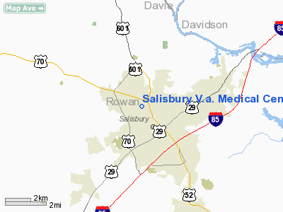
Salisbury V.a. Medical Center Heliport |
Location & QuickFacts
| FAA Information Effective: | 2008-09-25 |
| Airport Identifier: | NC46 |
| Airport Status: | Operational |
| Longitude/Latitude: | 080-29-19.2140W/35-41-00.5010N
-80.488671/35.683473 (Estimated) |
| Elevation: | 710 ft / 216.41 m (Estimated) |
| Land: | 1 acres |
| From nearest city: | 1 nautical miles NW of Salisbury, NC |
| Location: | Rowan County, NC |
| Magnetic Variation: | 05W (1985) |
Owner & Manager
| Ownership: | Publicly owned |
| Owner: | V.a. Medical Cntr |
| Address: | 1601 Brenner Ave
Salisbury, NC 28144 |
| Phone number: | 704-638-9000 |
| Manager: | R. Eugene Konik |
| Address: | 1601 Brenner Ave
Salisbury, NC 28144 |
| Phone number: | 704-638-9000 |
Airport Operations and Facilities
| Airport Use: | Private
MEDICAL |
| Wind indicator: | Yes |
| Segmented Circle: | No |
| Control Tower: | No |
| Lighting Schedule: | RDO-CTL
FOR H1 PERIMETER LGTS; PAD FLOODLIGHTS AND WIND CONE LGTS ACTVT - UNICOM OR CALL 704-638-9000. |
| Sectional chart: | Charlotte |
| Region: | ASO - Southern |
| Boundary ARTCC: | ZTL - Atlanta |
| Tie-in FSS: | RDU - Raleigh |
| FSS Toll Free: | 1-800-WX-BRIEF |
Airport Communications
Runway Information
Helipad H1
| Dimension: | 50 x 50 ft / 15.2 x 15.2 m |
| Surface: | CONC, |
| |
Runway H1 |
Runway |
| Traffic Pattern: | Left | Left |
|
Radio Navigation Aids
| ID |
Type |
Name |
Ch |
Freq |
Var |
Dist |
| RU | NDB | Rovdy | | 275.00 | 06W | 3.0 nm |
| SEN | NDB | Swearing/dcmsnd | | 260.00 | 06W | 11.0 nm |
| DVZ | NDB | Davie | | 354.00 | 06W | 13.9 nm |
| VU | NDB | Aller | | 346.00 | 06W | 23.2 nm |
| VW | NDB | Temky | | 280.00 | 05W | 28.6 nm |
| CQJ | NDB | City Lake | | 266.00 | 08W | 30.5 nm |
| IZN | NDB | Lincolnton | | 432.00 | 06W | 30.5 nm |
| UKF | NDB | Wilki | | 209.00 | 06W | 39.3 nm |
| ZEF | NDB | Zephyr | | 326.00 | 05W | 39.5 nm |
| HK | NDB | Tawba | | 332.00 | 06W | 40.3 nm |
| AZW | NDB | Mount Airy | | 223.00 | 07W | 42.0 nm |
| GHJ | NDB | Stonia | | 260.00 | 06W | 44.1 nm |
| AFP | NDB | Anson County | | 283.00 | 07W | 44.3 nm |
| TWL | NDB | Wesley | | 204.00 | 06W | 45.2 nm |
| HB | NDB | Himun | | 361.00 | 08W | 47.5 nm |
| CLT | VOR/DME | Charlotte | 097X | 115.00 | 05W | 37.3 nm |
| BZM | VOR/DME | Barretts Mountain | 045X | 110.80 | 06W | 38.3 nm |
| GSO | VORTAC | Greensboro | 109X | 116.20 | 03W | 33.1 nm |
| LIB | VORTAC | Liberty | 077X | 113.00 | 03W | 43.4 nm |
| FML | VORTAC | Fort Mill | 071X | 112.40 | 02W | 47.6 nm |
| CLT | VOT | Charlotte | | 112.00 | | 35.7 nm |
| HKY | VOT | Hickory Regional | | 110.00 | | 44.2 nm |
Images and information placed above are from
http://www.airport-data.com/airport/NC46/
We thank them for the data!
| General Info
|
| Country |
United States
|
| State |
NORTH CAROLINA
|
| FAA ID |
NC46
|
| Latitude |
35-41-00.501N
|
| Longitude |
080-29-19.214W
|
| Elevation |
710 feet
|
| Near City |
SALISBURY
|
We don't guarantee the information is fresh and accurate. The data may
be wrong or outdated.
For more up-to-date information please refer to other sources.
|
|


