 |
|
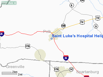
Saint Luke's Hospital Heliport |
Location & QuickFacts
| FAA Information Effective: | 2008-09-25 |
| Airport Identifier: | 9NC5 |
| Airport Status: | Operational |
| Longitude/Latitude: | 082-12-40.0000W/35-14-24.0000N
-82.211111/35.240000 (Estimated) |
| Elevation: | 1100 ft / 335.28 m (Estimated) |
| Land: | 0 acres |
| From nearest city: | 1 nautical miles SW of Columbus, NC |
| Location: | Polk County, NC |
| Magnetic Variation: | 05W (1995) |
Owner & Manager
| Ownership: | Privately owned |
| Owner: | Saint Luke's Hospital, Inc |
| Address: | 220 Hospital Drive
Columbus, NC 28722-9434 |
| Phone number: | 828-894-3311 |
| Manager: | V.p. Support Services |
| Address: | 101 Hospital Drive
Columbus, NC 28722-6418 |
| Phone number: | 828-894-3311 |
Airport Operations and Facilities
| Airport Use: | Private
MEDICAL USE. |
| Wind indicator: | Yes |
| Segmented Circle: | No |
| Control Tower: | No |
| Sectional chart: | Atlanta |
| Region: | ASO - Southern |
| Boundary ARTCC: | ZTL - Atlanta |
| Tie-in FSS: | RDU - Raleigh |
| FSS on Airport: | No |
| FSS Toll Free: | 1-800-WX-BRIEF |
Runway Information
Helipad H1
| Dimension: | 40 x 40 ft / 12.2 x 12.2 m |
| Surface: | CONC,
CIRCULAR PAD. |
| |
Runway H1 |
Runway |
| Traffic Pattern: | Left | Left |
|
Radio Navigation Aids
| ID |
Type |
Name |
Ch |
Freq |
Var |
Dist |
| MRN | FAN MARKER | Lenoir | | | 03W | 44.0 nm |
| BRA | NDB | Broad River | | 379.00 | 04W | 12.9 nm |
| RFE | NDB | Rutherford | | 344.00 | 05W | 14.3 nm |
| FRT | NDB | Fairmont | | 248.00 | 05W | 23.1 nm |
| SLP | NDB | First River | | 417.00 | 06W | 30.1 nm |
| GY | NDB | Dyana | | 338.00 | 03W | 34.9 nm |
| LQK | NDB | Lake Keowee | | 408.00 | 04W | 35.4 nm |
| FIQ | NDB | Fiddlers | | 391.00 | 07W | 38.7 nm |
| UOT | NDB | Union County | | 326.00 | 04W | 43.6 nm |
| LUX | NDB | Laurens | | 307.00 | 04W | 45.8 nm |
| CEU | NDB | Clemson | | 257.00 | 05W | 47.6 nm |
| SUG | VORTAC | Sugarloaf Mountain | 059X | 112.20 | 02W | 10.4 nm |
| SPA | VORTAC | Spartanburg | 104X | 115.70 | 02W | 18.7 nm |
Remarks
- PRVDD VFR/PVT USE; USE ACFT FLT MANUAL TO DETERMINE APCH & DEP; AREA IS MKD; WIND INDICATOR IS MAINTAINED.
Images and information placed above are from
http://www.airport-data.com/airport/9NC5/
We thank them for the data!
| General Info
|
| Country |
United States
|
| State |
NORTH CAROLINA
|
| FAA ID |
9NC5
|
| Latitude |
35-14-24.000N
|
| Longitude |
082-12-40.000W
|
| Elevation |
1100 feet
|
| Near City |
COLUMBUS
|
We don't guarantee the information is fresh and accurate. The data may
be wrong or outdated.
For more up-to-date information please refer to other sources.
|
|


