|
|
| Rowan County Airport |
 |
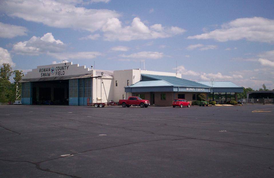
| Terminal at Rowan County Airport |
| IATA: SRW – ICAO: KRUQ – FAA LID: RUQ |
| Summary |
| Airport type |
Public |
| Operator |
Rowan County |
| Location |
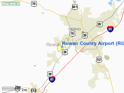
Salisbury, North Carolina |
| Elevation AMSL |
773 ft / 235.6 m |
| Coordinates |
35°38′45″N 080°31′13″W / 35.64583°N 80.52028°W / 35.64583; -80.52028Coordinates: 35°38′45″N 080°31′13″W / 35.64583°N 80.52028°W / 35.64583; -80.52028 |
| Runways |
| Direction |
Length |
Surface |
| ft |
m |
| 2/20 |
5,500 |
1,676 |
Asphalt |
Rowan County Airport (IATA: SRW, ICAO: KRUQ, FAA LID: RUQ) is a public airport located three miles (5 km) southwest of the central business district (CBD) of Salisbury, a city in Rowan County, North Carolina, USA. This general aviation airport covers 400 acres (162 ha) and has one runway.
Although most U.S. airports use the same three-letter location identifier for the FAA and IATA, Rowan County Airport is assigned RUQ by the FAA and SRW by the IATA. The airport's ICAO identifier is KRUQ.
The above content comes from Wikipedia and is published under free licenses – click here to read more.
 |
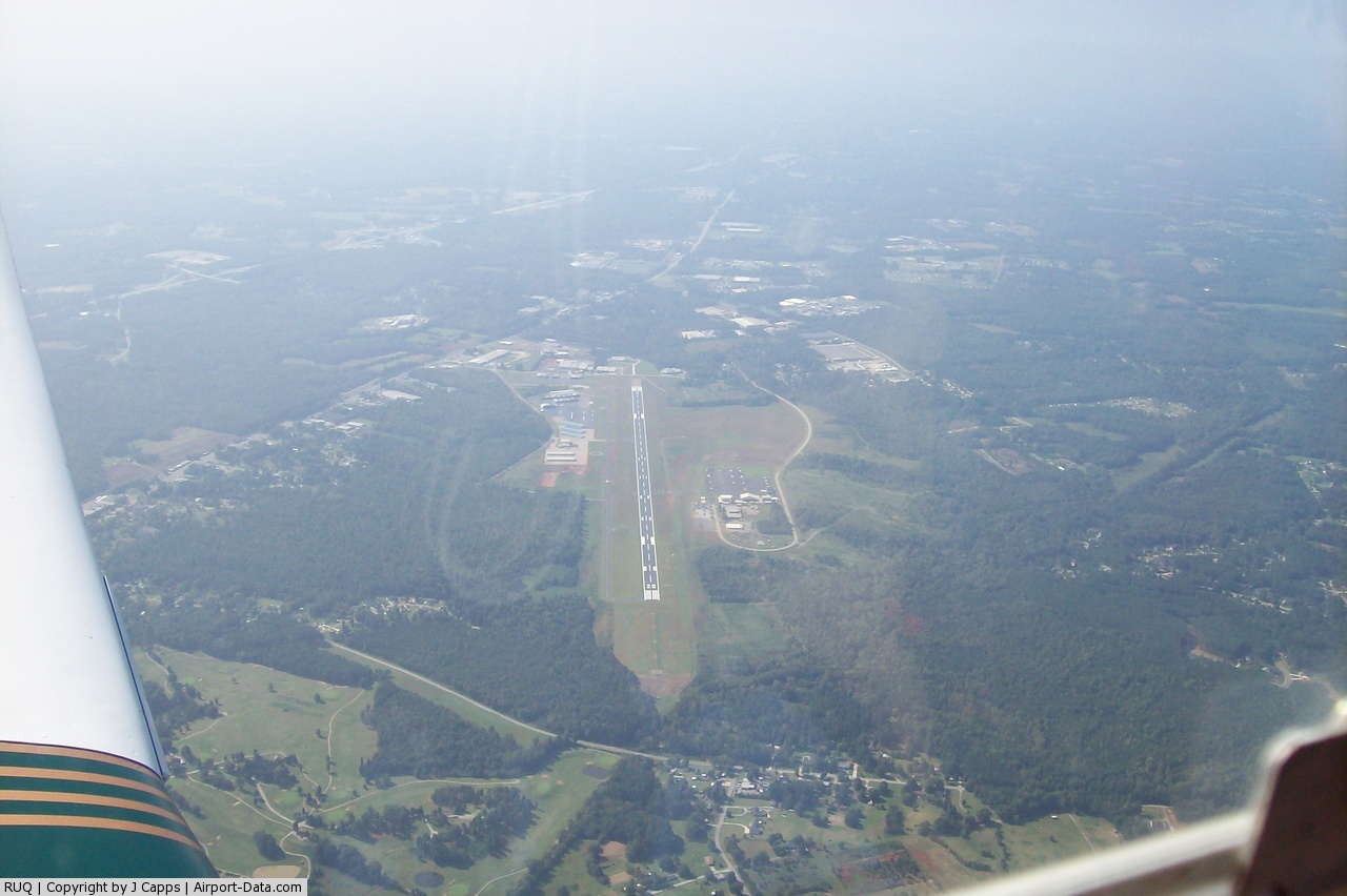
(Click on the photo to enlarge) |
 |
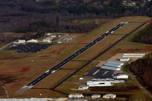
(Click on the photo to enlarge) |
Location & QuickFacts
| FAA Information Effective: | 2008-09-25 |
| Airport Identifier: | RUQ |
| Airport Status: | Operational |
| Longitude/Latitude: | 080-31-13.0600W/35-38-45.1900N
-80.520294/35.645886 (Estimated) |
| Elevation: | 773 ft / 235.61 m (Surveyed) |
| Land: | 400 acres |
| From nearest city: | 3 nautical miles SW of Salisbury, NC |
| Location: | Rowan County, NC |
| Magnetic Variation: | 06W (1985) |
Owner & Manager
| Ownership: | Publicly owned |
| Owner: | Rowan County |
| Address: | 130 W. Innes St
Salisbury, NC 28144 |
| Phone number: | 704-216-8100 |
| Manager: | Gregory Bove |
| Address: | 3670 Airport Loop
Salisbury, NC 28147-8921 |
| Phone number: | 704-216-7749 |
Airport Operations and Facilities
| Airport Use: | Open to public |
| Wind indicator: | Yes |
| Segmented Circle: | Yes |
| Control Tower: | No |
| Lighting Schedule: | DUSK-DAWN
MIRL RY 02/20 PRESET LOW INTST; TO INCR INTST & ACTVT REIL RYS 02 & 20; PAPI RYS 02 & 20 & MALSR RY 20 - CTAF. |
| Beacon Color: | Clear-Green (lighted land airport) |
| Landing fee charge: | No |
| Sectional chart: | Charlotte |
| Region: | ASO - Southern |
| Boundary ARTCC: | ZTL - Atlanta |
| Tie-in FSS: | RDU - Raleigh |
| FSS on Airport: | No |
| FSS Toll Free: | 1-800-WX-BRIEF |
| NOTAMs Facility: | RUQ (NOTAM-d service avaliable) |
| Federal Agreements: | NGY |
Airport Communications
| CTAF: | 122.800 |
| Unicom: | 122.800 |
Airport Services
| Fuel available: | 100LLA1+
24 SELF SERVICE AVAILABLE FOR 100LL WITH CREDIT CARD. |
| Airframe Repair: | MAJOR |
| Power Plant Repair: | MAJOR |
| Bottled Oxygen: | LOW |
| Bulk Oxygen: | NONE |
Runway Information
Runway 02/20
| Dimension: | 5500 x 100 ft / 1676.4 x 30.5 m |
| Surface: | ASPH, Good Condition |
| Weight Limit: | Single wheel: 16000 lbs. |
| Edge Lights: | Medium |
| |
Runway 02 |
Runway 20 |
| Longitude: | 080-31-22.2300W | 080-31-03.8700W |
| Latitude: | 35-38-19.0400N | 35-39-11.3330N |
| Elevation: | 770.00 ft | 767.00 ft |
| Alignment: | 16 | 127 |
| ILS Type: | | ILS
|
| Traffic Pattern: | Left | Left |
| Markings: | Precision instrument, Poor Condition
MARKINGS FADED | Precision instrument, Poor Condition
MARKINGS FADED |
| Crossing Height: | 39.00 ft | 38.00 ft |
| VASI: | 2-light PAPI on left side | 2-light PAPI on left side |
| Visual Glide Angle: | 3.00° | 3.00° |
| Approach lights: | | MALSR |
| Runway End Identifier: | Yes | Yes |
| Obstruction: | 47 ft trees, 919.0 ft from runway, 288 ft left of centerline, 15:1 slope to clear
8 FT TREES 0-200 FT FROM THLD 400 FT LEFT OF CNTRLN. | , 50:1 slope to clear
19 FT TREES 33 FT FROM THLD 442 FT LEFT OF CNTRLN. |
|
Radio Navigation Aids
| ID |
Type |
Name |
Ch |
Freq |
Var |
Dist |
| RU | NDB | Rovdy | | 275.00 | 06W | 5.5 nm |
| SEN | NDB | Swearing/dcmsnd | | 260.00 | 06W | 13.5 nm |
| DVZ | NDB | Davie | | 354.00 | 06W | 16.4 nm |
| VU | NDB | Aller | | 346.00 | 06W | 23.5 nm |
| VW | NDB | Temky | | 280.00 | 05W | 27.7 nm |
| IZN | NDB | Lincolnton | | 432.00 | 06W | 28.4 nm |
| CQJ | NDB | City Lake | | 266.00 | 08W | 32.3 nm |
| HK | NDB | Tawba | | 332.00 | 06W | 39.2 nm |
| UKF | NDB | Wilki | | 209.00 | 06W | 39.7 nm |
| ZEF | NDB | Zephyr | | 326.00 | 05W | 41.3 nm |
| GHJ | NDB | Stonia | | 260.00 | 06W | 41.5 nm |
| TWL | NDB | Wesley | | 204.00 | 06W | 42.6 nm |
| AFP | NDB | Anson County | | 283.00 | 07W | 43.1 nm |
| AZW | NDB | Mount Airy | | 223.00 | 07W | 44.2 nm |
| HB | NDB | Himun | | 361.00 | 08W | 49.8 nm |
| CLT | VOR/DME | Charlotte | 097X | 115.00 | 05W | 34.6 nm |
| BZM | VOR/DME | Barretts Mountain | 045X | 110.80 | 06W | 37.6 nm |
| GSO | VORTAC | Greensboro | 109X | 116.20 | 03W | 35.8 nm |
| FML | VORTAC | Fort Mill | 071X | 112.40 | 02W | 44.9 nm |
| LIB | VORTAC | Liberty | 077X | 113.00 | 03W | 45.4 nm |
| CLT | VOT | Charlotte | | 112.00 | | 33.0 nm |
| HKY | VOT | Hickory Regional | | 110.00 | | 42.9 nm |
Remarks
- ADDNL OBSTNS FOR RY 02; 20' BLDG 1100' FM THR 100' R OF CNTRLN.
- LIGHTED PARK, RAMP CLSD TO ALL TRFC EXC MIL ACFT WITH PPR. OPERATIONAL 0900-1730.
- 24 HR SVC BY REQUEST.
- TRANSIT MILITARY FUEL
Images and information placed above are from
http://www.airport-data.com/airport/RUQ/
We thank them for the data!
| General Info
|
| Country |
United States
|
| State |
NORTH CAROLINA
|
| FAA ID |
RUQ
|
| Latitude |
35-38-45.189N
|
| Longitude |
080-31-13.055W
|
| Elevation |
773 feet
|
| Near City |
SALISBURY
|
We don't guarantee the information is fresh and accurate. The data may
be wrong or outdated.
For more up-to-date information please refer to other sources.
|
|