 |
|
Location & QuickFacts
| FAA Information Effective: | 2008-09-25 |
| Airport Identifier: | 84NC |
| Airport Status: | Operational |
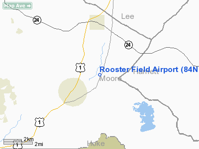
| Longitude/Latitude: | 079-14-55.0000W/35-16-24.0000N
-79.248611/35.273333 (Estimated) |
| Elevation: | 340 ft / 103.63 m (Estimated) |
| Land: | 10 acres |
| From nearest city: | 4 nautical miles S of Cameron, NC |
| Location: | Moore County, NC |
| Magnetic Variation: | () |
Owner & Manager
| Ownership: | Privately owned |
| Owner: | Charles G. Fitzgerald |
| Address: | 3676 Cypress Church Road
Cameron, NC 28326-8162 |
| Phone number: | 910-245-8620 |
| Manager: | Charles G. Fitzgerald |
| Address: | 3676 Cypress Church Road
Cameron, NC 28326-8162 |
| Phone number: | 9190-245-8620 |
Airport Operations and Facilities
| Airport Use: | Private |
| Wind indicator: | Yes |
| Control Tower: | No |
| Sectional chart: | Charlotte |
| Region: | ASO - Southern |
| Boundary ARTCC: | ZDC - Washington |
| Tie-in FSS: | RDU - Raleigh |
| FSS Toll Free: | 1-800-WX-BRIEF |
Runway Information
Runway 09/27
| Dimension: | 2155 x 132 ft / 656.8 x 40.2 m |
| Surface: | TURF, |
| |
Runway 09 |
Runway 27 |
| Traffic Pattern: | Left | Left |
|
Radio Navigation Aids
| ID |
Type |
Name |
Ch |
Freq |
Var |
Dist |
| EEJ | NDB | Lee County/dcmsnd | | 428.00 | 07W | 6.1 nm |
| TT | NDB | Leeco | | 406.00 | 08W | 14.5 nm |
| POB | NDB | Pope | | 338.00 | 07W | 14.7 nm |
| HFF | NDB | Mackall | | 278.00 | 06W | 18.8 nm |
| FGP | NDB | Fort Bragg | | 393.00 | 07W | 22.9 nm |
| HQT | NDB | Harnett | | 417.00 | 08W | 29.7 nm |
| TOX | NDB | Siler City | | 371.00 | 07W | 31.2 nm |
| RCZ | NDB | Roscoe | | 375.00 | 07W | 33.4 nm |
| ME | NDB | Maxtn | | 257.00 | 08W | 33.8 nm |
| CQJ | NDB | City Lake | | 266.00 | 08W | 40.2 nm |
| RSY | NDB | Robeson | | 359.00 | 08W | 40.7 nm |
| JN | NDB | Jurly | | 263.00 | 09W | 42.1 nm |
| VU | NDB | Aller | | 346.00 | 06W | 42.8 nm |
| AFP | NDB | Anson County | | 283.00 | 07W | 43.7 nm |
| JB | NDB | Jigel | | 384.00 | 08W | 44.1 nm |
| CQW | NDB | Cheraw | | 409.00 | 05W | 44.1 nm |
| HB | NDB | Himun | | 361.00 | 08W | 45.4 nm |
| BES | NDB | Bennettsville | | 230.00 | 07W | 45.9 nm |
| LE | NDB | Leevy | | 350.00 | 07W | 47.0 nm |
| CTZ | NDB | Clinton | | 412.00 | 08W | 47.1 nm |
| EUU | NDB | Jnall | | 251.00 | 07W | 48.2 nm |
| DLC | NDB | Dillon | | 274.00 | 05W | 49.8 nm |
| POB | TACAN | Pope | 085X | | 07W | 13.1 nm |
| LBT | VOR | Lumberton | | 110.00 | 08W | 41.0 nm |
| FAY | VOR/DME | Fayetteville | 025X | 108.80 | 04W | 25.2 nm |
| SDZ | VORTAC | Sandhills | 055X | 111.80 | 03W | 17.0 nm |
| LIB | VORTAC | Liberty | 077X | 113.00 | 03W | 36.9 nm |
| RDU | VORTAC | Raleigh/durham | 119X | 117.20 | 04W | 42.6 nm |
Remarks
- 726 FT CELL TOWER 1.5 NM NW OF RY.
- PRVDD VFR OPNS AND PVT USE.
Images and information placed above are from
http://www.airport-data.com/airport/84NC/
We thank them for the data!
|
|


