 |
|
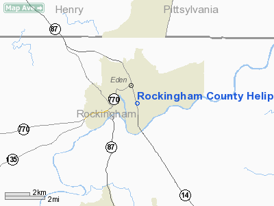
Rockingham County Heliport |
Location & QuickFacts
| FAA Information Effective: | 2008-09-25 |
| Airport Identifier: | 8N0 |
| Airport Status: | Operational |
| Longitude/Latitude: | 079-44-23.1260W/36-29-38.4970N
-79.739757/36.494027 (Estimated) |
| Elevation: | 605 ft / 184.40 m (Estimated) |
| Land: | 3 acres |
| From nearest city: | 0 nautical miles N of Eden, NC |
| Location: | Rockingham County, NC |
| Magnetic Variation: | 06W (1985) |
Owner & Manager
| Ownership: | Publicly owned |
| Owner: | Rockingham County |
| Address: | Po Box 12
Wentworth, NC 27375 |
| Phone number: | 336-573-3115 |
| Manager: | Bob Nason |
| Address: | 117 East Kings Hwy
Eden, NC 27288 |
| Phone number: | 336-573-3115 |
Airport Operations and Facilities
| Airport Use: | Open to public |
| Wind indicator: | Yes |
| Segmented Circle: | No |
| Control Tower: | No |
| Lighting Schedule: | DUSK-DAWN
ACTVT PERIMETER LGTS & VASI RY H1 - CTAF. LDIN LGTS OPR DUSK-DAWN. |
| Beacon Color: | Clear-Green-Yellow (heliport)
ROTG BCN LCTD ON HOSPITAL ROOF 300 FT NE OF LDG PAD. |
| Landing fee charge: | No |
| Sectional chart: | Cincinnati |
| Region: | ASO - Southern |
| Boundary ARTCC: | ZDC - Washington |
| Responsible ARTCC: | ZTL - Atlanta |
| Tie-in FSS: | RDU - Raleigh |
| FSS on Airport: | No |
| FSS Toll Free: | 1-800-WX-BRIEF |
| NOTAMs Facility: | RDU (NOTAM-d service avaliable) |
Airport Communications
| CTAF: | 123.050 |
| Unicom: | 123.050 |
Runway Information
Helipad H1
| Dimension: | 60 x 60 ft / 18.3 x 18.3 m |
| Surface: | CONC, Good Condition |
| |
Runway H1 |
Runway |
| Traffic Pattern: | Left | Left |
| Crossing Height: | 7.00 ft | 0.00 ft |
| VASI: | nonstandard system
NSTD TRI-COLORED SINGLE BOX. |
NSTD TRI-COLORED SINGLE BOX. |
| Approach lights: | LDIN | |
|
Radio Navigation Aids
| ID |
Type |
Name |
Ch |
Freq |
Var |
Dist |
| OQA | FAN MARKER | Rockingham County | | | | 5.9 nm |
| SIF | NDB | Slammer | | 423.00 | 07W | 6.8 nm |
| UV | NDB | Bales | | 396.00 | 07W | 10.3 nm |
| HB | NDB | Himun | | 361.00 | 08W | 31.9 nm |
| HUR | NDB | Person | | 220.00 | 08W | 36.2 nm |
| AZW | NDB | Mount Airy | | 223.00 | 07W | 39.3 nm |
| VIT | NDB | Vinton | | 277.00 | 06W | 43.2 nm |
| TOX | NDB | Siler City | | 371.00 | 07W | 46.0 nm |
| CQJ | NDB | City Lake | | 266.00 | 08W | 47.1 nm |
| ZEF | NDB | Zephyr | | 326.00 | 05W | 48.8 nm |
| DVZ | NDB | Davie | | 354.00 | 06W | 49.2 nm |
| DAN | VOR | Danville | | 113.10 | 06W | 20.0 nm |
| GSO | VORTAC | Greensboro | 109X | 116.20 | 03W | 29.3 nm |
| SBV | VORTAC | South Boston | 041X | 110.40 | 05W | 36.7 nm |
| LIB | VORTAC | Liberty | 077X | 113.00 | 03W | 41.5 nm |
Remarks
- NUMEROUS +30' LIGHT POLES IN PARKING LOT.
- + 30' ANTENNA ON TOP OF HOSPITAL (100' AGL) 300' NE OF PAD.
- PARKING AREA NW OF LANDING PAD; +4 FT PERIMETER FENCE WITHIN 13 FT OF HELIPORT SW CORNER.
- PRVDD VFR ONLY.
Images and information placed above are from
http://www.airport-data.com/airport/8N0/
We thank them for the data!
| General Info
|
| Country |
United States
|
| State |
NORTH CAROLINA
|
| FAA ID |
8N0
|
| Latitude |
36-29-38.497N
|
| Longitude |
079-44-23.126W
|
| Elevation |
605 feet
|
| Near City |
EDEN
|
We don't guarantee the information is fresh and accurate. The data may
be wrong or outdated.
For more up-to-date information please refer to other sources.
|
|


