 |
|
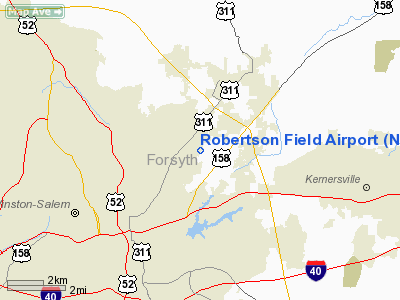
Location & QuickFacts
| FAA Information Effective: | 2008-09-25 |
| Airport Identifier: | NC63 |
| Airport Status: | Operational |
| Longitude/Latitude: | 080-11-05.1680W/36-08-06.4930N
-80.184769/36.135137 (Estimated) |
| Elevation: | 848 ft / 258.47 m (Estimated) |
| Land: | 0 acres |
| From nearest city: | 3 nautical miles SE of Winston Salem, NC |
| Location: | Forsyth County, NC |
| Magnetic Variation: | 06W (1985) |
Owner & Manager
| Ownership: | Privately owned |
| Owner: | William L. Robertson |
| Address: | 3735 Beeson Dairy Road
Winston-salem, NC 27105 |
| Phone number: | 336-725-4447 |
| Manager: | William L. Robertson |
| Address: | 3735 Beeson Dairy Road
Winston-salem, NC 27105 |
| Phone number: | 336-725-4447 |
Airport Operations and Facilities
| Airport Use: | Private |
| Wind indicator: | Yes |
| Segmented Circle: | No |
| Control Tower: | No |
| Landing fee charge: | No |
| Sectional chart: | Cincinnati |
| Region: | ASO - Southern |
| Boundary ARTCC: | ZTL - Atlanta |
| Tie-in FSS: | RDU - Raleigh |
| FSS on Airport: | No |
| FSS Toll Free: | 1-800-WX-BRIEF |
Airport Services
| Airframe Repair: | NONE |
| Power Plant Repair: | NONE |
Runway Information
Runway 03/21
| Dimension: | 1500 x 100 ft / 457.2 x 30.5 m |
| Surface: | TURF, |
| |
Runway 03 |
Runway 21 |
| Traffic Pattern: | Left | Left |
|
Radio Navigation Aids
| ID |
Type |
Name |
Ch |
Freq |
Var |
Dist |
| OQA | FAN MARKER | Rockingham County | | | | 24.5 nm |
| DVZ | NDB | Davie | | 354.00 | 06W | 18.8 nm |
| SEN | NDB | Swearing/dcmsnd | | 260.00 | 06W | 22.0 nm |
| AZW | NDB | Mount Airy | | 223.00 | 07W | 22.7 nm |
| SIF | NDB | Slammer | | 423.00 | 07W | 25.3 nm |
| ZEF | NDB | Zephyr | | 326.00 | 05W | 28.2 nm |
| RU | NDB | Rovdy | | 275.00 | 06W | 28.4 nm |
| CQJ | NDB | City Lake | | 266.00 | 08W | 29.6 nm |
| UV | NDB | Bales | | 396.00 | 07W | 30.2 nm |
| HB | NDB | Himun | | 361.00 | 08W | 30.6 nm |
| VU | NDB | Aller | | 346.00 | 06W | 39.2 nm |
| TOX | NDB | Siler City | | 371.00 | 07W | 41.7 nm |
| UKF | NDB | Wilki | | 209.00 | 06W | 44.4 nm |
| VW | NDB | Temky | | 280.00 | 05W | 48.0 nm |
| HLX | NDB | Hillsville | | 269.00 | 06W | 48.7 nm |
| DAN | VOR | Danville | | 113.10 | 06W | 48.6 nm |
| GSO | VORTAC | Greensboro | 109X | 116.20 | 03W | 11.5 nm |
| LIB | VORTAC | Liberty | 077X | 113.00 | 03W | 34.0 nm |
Remarks
- APT WOULD ADVERSLY AFFECT THE SAFE AND EFFICIENT USE OF AIRSPACE DUE TO PROXIMITY OF SOUTH REYNOLDS APT.
Images and information placed above are from
http://www.airport-data.com/airport/NC63/
We thank them for the data!
| General Info
|
| Country |
United States
|
| State |
NORTH CAROLINA
|
| FAA ID |
NC63
|
| Latitude |
36-08-06.493N
|
| Longitude |
080-11-05.168W
|
| Elevation |
848 feet
|
| Near City |
WINSTON SALEM
|
We don't guarantee the information is fresh and accurate. The data may
be wrong or outdated.
For more up-to-date information please refer to other sources.
|
|


