|
|
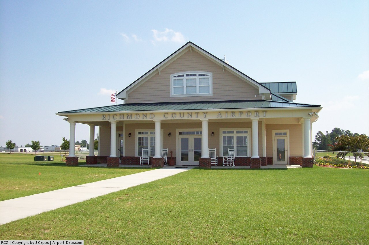
| Richmond County Airport |
 |
| Richmond County Airport |
| IATA: none – ICAO: KRCZ – FAA LID: RCZ |
| Summary |
| Airport type |
Public |
| Operator |
Richmond County |
| Location |
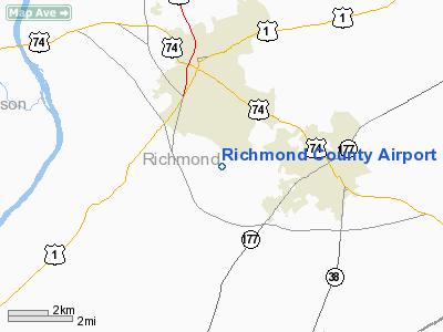
Rockingham, North Carolina |
| Elevation AMSL |
358 ft / 109.1 m |
| Coordinates |
34°53′29″N 79°45′35″W / 34.89139°N 79.75972°W / 34.89139; -79.75972Coordinates: 34°53′29″N 79°45′35″W / 34.89139°N 79.75972°W / 34.89139; -79.75972 |
| Runways |
| Direction |
Length |
Surface |
| ft |
m |
| 14/32 |
5,000 |
1,524 |
Asphalt |
| 4/22 |
3,000 |
914 |
Grass |
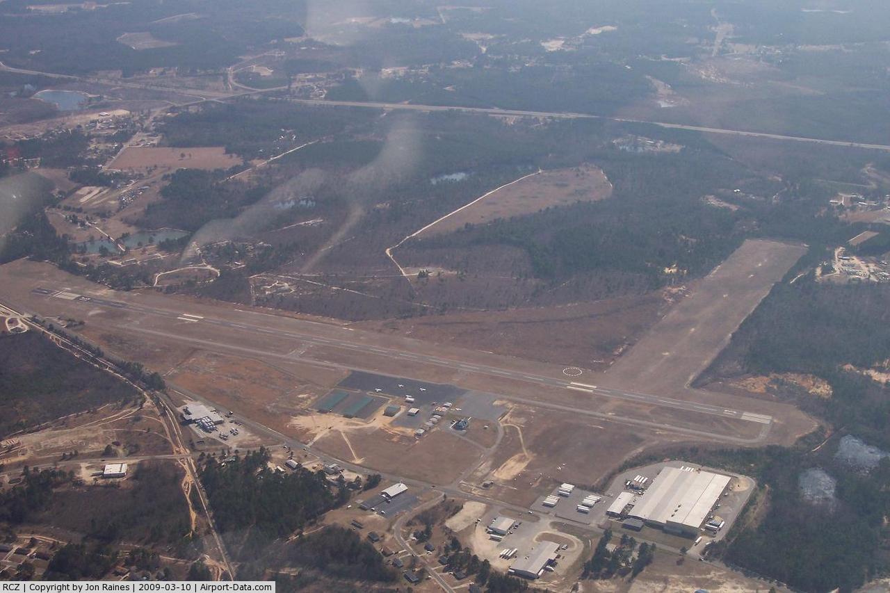
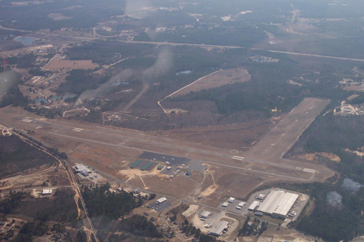
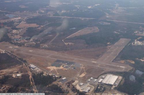
Richmond County Airport (ICAO: KRCZ, FAA LID: RCZ), formerly known as Rockingham-Hamlet Airport, is a public airport located in and operated by Richmond County, North Carolina. It is situated three miles (5 km) south of the city of Rockingham and west of the city of Hamlet. The airport is used entirely for general aviation and has undergone major renovations and expansion in recent years.
 | Facilities
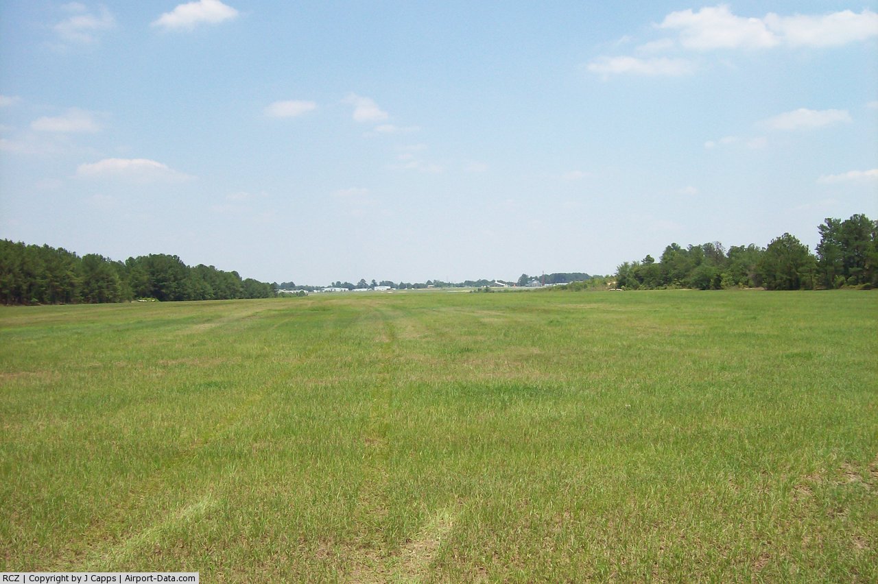
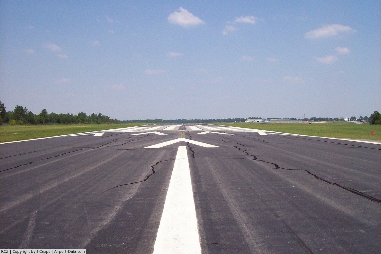
Richmond County Airport covers 316 acres (128 ha) and has two runways:
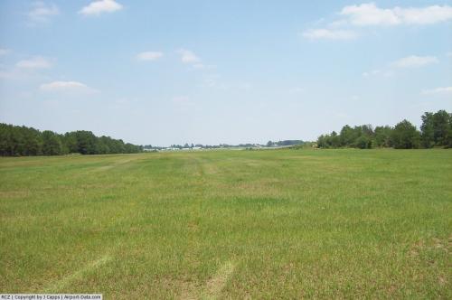
- Runway 4/22: 3,000 x 500 ft. (914 x 152 m), Surface: Turf
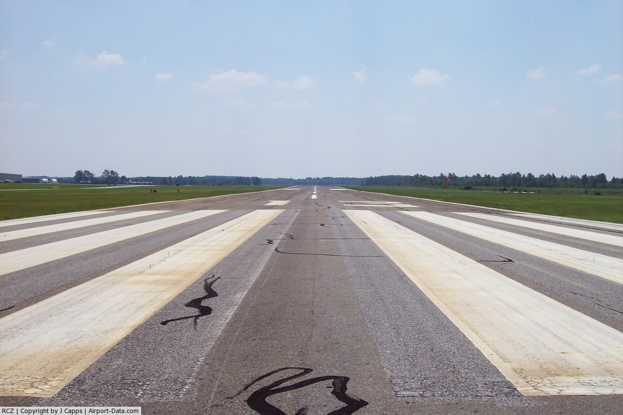
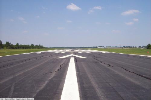
- Runway 14/32: 5,000 x 100 ft. (1,524 x 30 m), Surface: Asphalt
The above content comes from Wikipedia and is published under free licenses – click here to read more.
 |
(Click on the photo to enlarge) |
 |
(Click on the photo to enlarge) |
 |
(Click on the photo to enlarge) |
 |
(Click on the photo to enlarge) |
 |
(Click on the photo to enlarge) |
Location & QuickFacts
| FAA Information Effective: | 2008-09-25 |
| Airport Identifier: | RCZ |
| Airport Status: | Operational |
| Longitude/Latitude: | 079-45-34.6000W/34-53-28.7000N
-79.759611/34.891306 (Estimated) |
| Elevation: | 358 ft / 109.12 m (Surveyed) |
| Land: | 340 acres |
| From nearest city: | 3 nautical miles S of Rockingham, NC |
| Location: | Richmond County, NC |
| Magnetic Variation: | 07W (2000) |
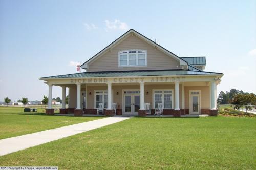
Owner & Manager
| Ownership: | Publicly owned |
| Owner: | Richmond County |
| Address: | 656 Airport Road
Rockingham, NC 28379 |
| Phone number: | 910-997-8211 |
| Manager: | Doyle Haigler |
| Address: | 656 Airport Road
Rockingham, NC 28379 |
| Phone number: | 910-997-5071 |
Airport Operations and Facilities
| Airport Use: | Open to public |
| Wind indicator: | Yes |
| Segmented Circle: | Yes |
| Control Tower: | No |
| Lighting Schedule: | DUSK-DAWN
ACTVT MIRL RY 13/31 & PAPI RYS 13 & 31 & REIL RY 31 - CTAF. |
| Beacon Color: | Clear-Green (lighted land airport) |
| Landing fee charge: | No |
| Sectional chart: | Charlotte |
| Region: | ASO - Southern |
| Boundary ARTCC: | ZDC - Washington |
| Tie-in FSS: | RDU - Raleigh |
| FSS on Airport: | No |
| FSS Toll Free: | 1-800-WX-BRIEF |
| NOTAMs Facility: | RDU (NOTAM-d service avaliable) |
| Federal Agreements: | NGY3 |
Airport Communications
| CTAF: | 122.800 |
| Unicom: | 122.800 |
Airport Services
| Fuel available: | 100LLA1+
100LL 24 HR SELF-SERVICE WITH CREDIT CARD. |
| Airframe Repair: | NONE |
| Power Plant Repair: | NONE |
| Bottled Oxygen: | NONE |
| Bulk Oxygen: | NONE |
Runway Information
Runway 04/22
| Dimension: | 3009 x 500 ft / 917.1 x 152.4 m |
| Surface: | TURF, Good Condition |
| |
Runway 04 |
Runway 22 |
| Longitude: | 079-46-04.1589W | 079-45-40.8246W |
| Latitude: | 34-53-16.1313N | 34-53-38.8520N |
| Elevation: | 356.00 ft | 348.00 ft |
| Alignment: | 41 | 127 |
| Traffic Pattern: | Left | Left |
| Obstruction: | 10 ft trees, 31.0 ft from runway, 34 ft left of centerline, 3:1 slope to clear | 68 ft trees, 1986.0 ft from runway, 230 ft right of centerline, 29:1 slope to clear |
|
Runway 13/31
| Dimension: | 5000 x 100 ft / 1524.0 x 30.5 m |
| Surface: | ASPH, Fair Condition |
| Weight Limit: | Single wheel: 30000 lbs. |
| Edge Lights: | Medium |
| |
Runway 13 |
Runway 31 |
| Longitude: | 079-45-47.8743W | 079-44-59.6367W |
| Latitude: | 34-53-44.1347N | 34-53-14.6872N |
| Elevation: | 350.00 ft | 354.00 ft |
| Alignment: | 127 | 127 |
| Traffic Pattern: | Left | Left |
| Markings: | Non-precision instrument, Fair Condition | Non-precision instrument, Fair Condition |
| Crossing Height: | 34.00 ft | 26.00 ft |
| Displaced threshold: | 0.00 ft | 200.00 ft |
| VASI: | 2-light PAPI on left side | 2-light PAPI on left side |
| Visual Glide Angle: | 3.15° | 3.15° |
| Runway End Identifier: | No | Yes |
| Obstruction: | 3 ft trees, 233.0 ft from runway, 13 ft right of centerline, 11:1 slope to clear
10 FT BRUSH 120 FT FM END OF RY AND OFFSET 190 FT RIGHT OF CNTRLN. | 23 ft rr, 309.0 ft from runway, 156 ft right of centerline, 4:1 slope to clear
RY 31 APCH SLOPE 12:1 AT DSPLCD THR; RR 29 FT HIGH 570 FT FROM DSPLCD THLD 229 FT RIGHT OF CNTRLN.
15 FT ROAD 174 FT FM RY END 197 FT RIGHT AND LEFT OF CNTRLN. |
|
Radio Navigation Aids
| ID |
Type |
Name |
Ch |
Freq |
Var |
Dist |
| RCZ | NDB | Roscoe | | 375.00 | 07W | 4.0 nm |
| CQW | NDB | Cheraw | | 409.00 | 05W | 10.4 nm |
| HFF | NDB | Mackall | | 278.00 | 06W | 15.8 nm |
| BES | NDB | Bennettsville | | 230.00 | 07W | 16.3 nm |
| AFP | NDB | Anson County | | 283.00 | 07W | 17.8 nm |
| ME | NDB | Maxtn | | 257.00 | 08W | 18.2 nm |
| UDG | NDB | Darlington | | 245.00 | 06W | 27.7 nm |
| PYG | NDB | Pageland | | 270.00 | 06W | 29.9 nm |
| DLC | NDB | Dillon | | 274.00 | 05W | 32.8 nm |
| HVS | NDB | Hartsville | | 341.00 | 07W | 34.2 nm |
| JB | NDB | Jigel | | 384.00 | 08W | 37.1 nm |
| RSY | NDB | Robeson | | 359.00 | 08W | 38.4 nm |
| EEJ | NDB | Lee County/dcmsnd | | 428.00 | 07W | 39.2 nm |
| VU | NDB | Aller | | 346.00 | 06W | 39.2 nm |
| POB | NDB | Pope | | 338.00 | 07W | 44.5 nm |
| TWL | NDB | Wesley | | 204.00 | 06W | 46.7 nm |
| MAO | NDB | Marion | | 388.00 | 06W | 47.4 nm |
| TT | NDB | Leeco | | 406.00 | 08W | 47.5 nm |
| FGP | NDB | Fort Bragg | | 393.00 | 07W | 48.9 nm |
| CQJ | NDB | City Lake | | 266.00 | 08W | 49.9 nm |
| POB | TACAN | Pope | 085X | | 07W | 39.8 nm |
| LBT | VOR | Lumberton | | 110.00 | 08W | 38.7 nm |
| CTF | VOR/DME | Chesterfield | 019X | 108.20 | 03W | 29.3 nm |
| FAY | VOR/DME | Fayetteville | 025X | 108.80 | 04W | 44.0 nm |
| SDZ | VORTAC | Sandhills | 055X | 111.80 | 03W | 21.2 nm |
| FLO | VORTAC | Florence | 099X | 115.20 | 03W | 39.9 nm |
Remarks
- RY 13 INADEQUATE SAFETY AREA 60 FT DROP OFF 125 FT FM THR BOTH SIDES.
- RY 04/22 CLSD TO ALL TURBINE ENGINE ACFT.
Images and information placed above are from
http://www.airport-data.com/airport/RCZ/
We thank them for the data!
| General Info
|
| Country |
United States
|
| State |
NORTH CAROLINA
|
| FAA ID |
RCZ
|
| Time |
UTC-5(-4DT)
|
| Latitude |
34.891331
34° 53' 28.79" N
|
| Longitude |
-79.759586
079° 45' 34.51" W
|
| Elevation |
358 feet
109 meters
|
| Magnetic Variation |
007° W (01/06)
|
| Beacon |
Yes
|
| Operating Agency |
U.S.CIVIL AIRPORT WHEREIN PERMIT COVERS USE BY TRANSIT MILITARY AIRCRAFT
|
| Near City |
ROCKINGHAM
|
| Operating Hours |
SEE REMARKS FOR OPERATING HOURS OR COMMUNICATIONS FOR POSSIBLE HOURS
|
| Daylight Saving Time |
Second Sunday in March at 0200 to first Sunday in November at 0200 local time (Exception Arizona and that portion of Indiana in the Eastern Time Zone)
|
We don't guarantee the information is fresh and accurate. The data may
be wrong or outdated.
For more up-to-date information please refer to other sources.
|
|
|
|
|
|
Copyright 2004-2026 © by Airports-Worldwide.com, Vyshenskoho st. 36, Lviv 79010, Ukraine Legal Disclaimer |
|
|