 |
|
Location & QuickFacts
| FAA Information Effective: | 2008-09-25 |
| Airport Identifier: | 39NC |
| Airport Status: | Operational |
| Longitude/Latitude: | 081-56-45.0000W/35-19-29.0000N
-81.945833/35.324722 (Estimated) |
| Elevation: | 1078 ft / 328.57 m (Estimated) |
| Land: | 0 acres |
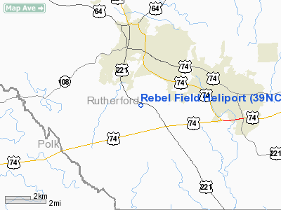
| From nearest city: | 3 nautical miles S of Rutherfordton, NC |
| Location: | Rutherford County, NC |
| Magnetic Variation: | 05W (1995) |
Owner & Manager
| Ownership: | Privately owned |
| Owner: | D.g. Pat Peterson |
| Address: | 172 Heliport Drive
Rutherfordton, NC 28139 |
| Phone number: | 828-287-4466 |
| Manager: | D.g. Pat Peterson |
| Address: | 172 Heliport Drive
Rutherfordton, NC 28139 |
| Phone number: | 828-287-4466 |
Airport Operations and Facilities
| Airport Use: | Private |
| Wind indicator: | Yes |
| Segmented Circle: | No |
| Control Tower: | No |
| Sectional chart: | Atlanta |
| Region: | ASO - Southern |
| Boundary ARTCC: | ZTL - Atlanta |
| Tie-in FSS: | RDU - Raleigh |
| FSS on Airport: | No |
| FSS Toll Free: | 1-800-WX-BRIEF |
Runway Information
Helipad H1
| Dimension: | 40 x 40 ft / 12.2 x 12.2 m |
| Surface: | TURF, |
| |
Runway H1 |
Runway |
| Traffic Pattern: | Left | Left |
|
Radio Navigation Aids
| ID |
Type |
Name |
Ch |
Freq |
Var |
Dist |
| MRN | FAN MARKER | Lenoir | | | 03W | 32.4 nm |
| RFE | NDB | Rutherford | | 344.00 | 05W | 1.5 nm |
| SLP | NDB | First River | | 417.00 | 06W | 17.6 nm |
| FRT | NDB | Fairmont | | 248.00 | 05W | 25.5 nm |
| BRA | NDB | Broad River | | 379.00 | 04W | 26.0 nm |
| FIQ | NDB | Fiddlers | | 391.00 | 07W | 26.8 nm |
| GHJ | NDB | Stonia | | 260.00 | 06W | 39.5 nm |
| UOT | NDB | Union County | | 326.00 | 04W | 41.3 nm |
| HK | NDB | Tawba | | 332.00 | 06W | 41.8 nm |
| IZN | NDB | Lincolnton | | 432.00 | 06W | 44.0 nm |
| GY | NDB | Dyana | | 338.00 | 03W | 45.3 nm |
| LQK | NDB | Lake Keowee | | 408.00 | 04W | 48.4 nm |
| DCM | NDB | Chester | | 220.00 | 06W | 48.9 nm |
| LUX | NDB | Laurens | | 307.00 | 04W | 49.1 nm |
| BAR | NDB | Hemlock | | 320.00 | 02W | 49.9 nm |
| UZ | NDB | Rally | | 227.00 | 05W | 49.9 nm |
| BZM | VOR/DME | Barretts Mountain | 045X | 110.80 | 06W | 47.5 nm |
| CLT | VOR/DME | Charlotte | 097X | 115.00 | 05W | 49.5 nm |
| SUG | VORTAC | Sugarloaf Mountain | 059X | 112.20 | 02W | 16.6 nm |
| SPA | VORTAC | Spartanburg | 104X | 115.70 | 02W | 17.5 nm |
| HKY | VOT | Hickory Regional | | 110.00 | | 36.9 nm |
| CLT | VOT | Charlotte | | 112.00 | | 49.9 nm |
Remarks
- OWNER LIVES AT ARPT.
- HELIPAD TO BE USED FOR ANTIDRUG WORK, OPEN TO NATIONAL GUARD, HIGHWAY PATROL & LOCAL DRUG TASK FORCE.
- PRVDD VFR/PVT USE ONLY; ALL APCH/DEP ROUTE HELICOPTER OPNS CONDUCTED IN AREA FROM 180-320 USING THE TOUCHDOWN PAD AS CENTER OF COMPASS ROSE.
Images and information placed above are from
http://www.airport-data.com/airport/39NC/
We thank them for the data!
| General Info
|
| Country |
United States
|
| State |
NORTH CAROLINA
|
| FAA ID |
39NC
|
| Latitude |
35-19-29.000N
|
| Longitude |
081-56-45.000W
|
| Elevation |
1078 feet
|
| Near City |
RUTHERFORDTON
|
We don't guarantee the information is fresh and accurate. The data may
be wrong or outdated.
For more up-to-date information please refer to other sources.
|
|


