 |
|
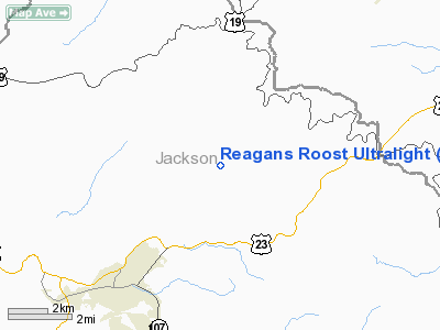
Reagans Roost Ultralight Airport |
Location & QuickFacts
| FAA Information Effective: | 2008-09-25 |
| Airport Identifier: | 85NC |
| Airport Status: | Operational |
| Longitude/Latitude: | 083-10-00.4200W/35-25-45.1000N
-83.166783/35.429194 (Estimated) |
| Elevation: | 2080 ft / 633.98 m (Estimated) |
| Land: | 0 acres |
| From nearest city: | 3 nautical miles W of Whittier, NC |
| Location: | Jackson County, NC |
| Magnetic Variation: | 05W (2000) |
Owner & Manager
| Ownership: | Privately owned |
| Owner: | Mark Reagan |
| Address: | 400 Becks Br Road
Whittier, NC 28789 |
| Phone number: | 828-497-2074 |
| Manager: | Mark Reagan |
| Address: | 400 Becks Br Road
Whittier, NC 28789 |
| Phone number: | 828-497-2074 |
Airport Operations and Facilities
| Airport Use: | Private |
| Segmented Circle: | No |
| Control Tower: | No |
| Sectional chart: | Atlanta |
| Region: | ASO - Southern |
| Boundary ARTCC: | ZTL - Atlanta |
| Tie-in FSS: | RDU - Raleigh |
| FSS Toll Free: | 1-800-WX-BRIEF |
Runway Information
Runway 01/19
| Dimension: | 800 x 70 ft / 243.8 x 21.3 m |
| Surface: | TURF, |
| |
Runway 01 |
Runway 19 |
| Traffic Pattern: | Left | Left |
|
Radio Navigation Aids
| ID |
Type |
Name |
Ch |
Freq |
Var |
Dist |
| BRA | NDB | Broad River | | 379.00 | 04W | 35.4 nm |
| TTQ | NDB | Tomotla | | 335.00 | 01W | 43.1 nm |
| LQK | NDB | Lake Keowee | | 408.00 | 04W | 43.6 nm |
| JXT | NDB | Jefferson | | 346.00 | 04W | 43.6 nm |
| DYQ | NDB | Dulaney | | 263.00 | 04W | 44.6 nm |
| CEU | NDB | Clemson | | 257.00 | 05W | 47.4 nm |
| SOT | VORTAC | Snowbird | 025X | 108.80 | 04W | 22.4 nm |
| SUG | VORTAC | Sugarloaf Mountain | 059X | 112.20 | 02W | 44.0 nm |
| ODF | VORTAC | Foothills | 081X | 113.40 | 00E | 44.5 nm |
| VXV | VORTAC | Volunteer | 111X | 116.40 | 03W | 45.6 nm |
| HRS | VORTAC | Harris | 035X | 109.80 | 00E | 47.0 nm |
| TYS | VOT | Knoxville | | 112.00 | | 46.5 nm |
Remarks
Images and information placed above are from
http://www.airport-data.com/airport/85NC/
We thank them for the data!
|
|


