 |
|
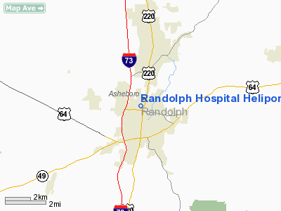
Randolph Hospital Heliport |
Location & QuickFacts
| FAA Information Effective: | 2008-09-25 |
| Airport Identifier: | NC74 |
| Airport Status: | Operational |
| Longitude/Latitude: | 079-48-56.4000W/35-42-40.1000N
-79.815667/35.711139 (Estimated) |
| Elevation: | 817 ft / 249.02 m (Estimated) |
| Land: | 0 acres |
| From nearest city: | 0 nautical miles N of Asheboro, NC |
| Location: | Randolph County, NC |
| Magnetic Variation: | () |
Owner & Manager
| Ownership: | Privately owned |
| Owner: | Randolph Hospital |
| Address: | 364 White Oak Street
Asheboro, NC 27203 |
| Phone number: | 336-625-5151 |
| Manager: | Randolph Hospital Security Office |
| Address: | 364 White Oak Street
Asheboro, NC 27203 |
| Phone number: | 336-625-5151
EXT 5176 |
Airport Operations and Facilities
| Airport Use: | Private
MEDICAL USE. |
| Wind indicator: | Yes |
| Control Tower: | No |
| Lighting Schedule: | DUSK-DAWN |
| Sectional chart: | Charlotte |
| Region: | ASO - Southern |
| Boundary ARTCC: | ZTL - Atlanta |
| Tie-in FSS: | RDU - Raleigh |
| FSS Toll Free: | 1-800-WX-BRIEF |
Runway Information
Helipad H1
| Dimension: | 122 x 122 ft / 37.2 x 37.2 m |
| Surface: | CONC, |
| |
Runway H1 |
Runway |
| Traffic Pattern: | Left | Left |
|
Radio Navigation Aids
| ID |
Type |
Name |
Ch |
Freq |
Var |
Dist |
| OQA | FAN MARKER | Rockingham County | | | | 43.0 nm |
| CQJ | NDB | City Lake | | 266.00 | 08W | 2.4 nm |
| TOX | NDB | Siler City | | 371.00 | 07W | 17.5 nm |
| VU | NDB | Aller | | 346.00 | 06W | 18.6 nm |
| HB | NDB | Himun | | 361.00 | 08W | 19.6 nm |
| SEN | NDB | Swearing/dcmsnd | | 260.00 | 06W | 23.9 nm |
| RU | NDB | Rovdy | | 275.00 | 06W | 32.9 nm |
| DVZ | NDB | Davie | | 354.00 | 06W | 33.5 nm |
| EEJ | NDB | Lee County/dcmsnd | | 428.00 | 07W | 35.4 nm |
| TT | NDB | Leeco | | 406.00 | 08W | 35.4 nm |
| SIF | NDB | Slammer | | 423.00 | 07W | 40.4 nm |
| AFP | NDB | Anson County | | 283.00 | 07W | 43.3 nm |
| HFF | NDB | Mackall | | 278.00 | 06W | 44.1 nm |
| HUR | NDB | Person | | 220.00 | 08W | 48.1 nm |
| LIB | VORTAC | Liberty | 077X | 113.00 | 03W | 11.6 nm |
| GSO | VORTAC | Greensboro | 109X | 116.20 | 03W | 21.6 nm |
| SDZ | VORTAC | Sandhills | 055X | 111.80 | 03W | 31.8 nm |
Remarks
- PRVDD VFR OPNS, PVT USE, AREA IS MARKED, WIND INDICATOR IS MAINTAINED, AND APCH 180-200 DEG AND DEP 360-020 DEG.
Images and information placed above are from
http://www.airport-data.com/airport/NC74/
We thank them for the data!
|
|


