|
|
 |
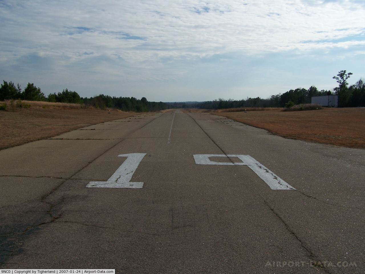
(Click on the photo to enlarge) |
 |
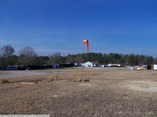
(Click on the photo to enlarge) |
Location & QuickFacts
| FAA Information Effective: | 2008-09-25 |
| Airport Identifier: | 9NC0 |
| Airport Status: | Operational |
| Longitude/Latitude: | 078-26-13.2350W/35-47-51.8000N
-78.437010/35.797722 (Estimated) |
| Elevation: | 313 ft / 95.40 m (Surveyed) |
| Land: | 55 acres |
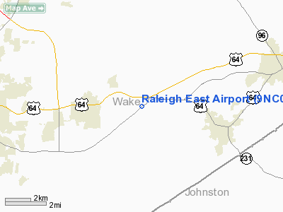
| From nearest city: | 2 nautical miles E of Knightdale, NC |
| Location: | Wake County, NC |
| Magnetic Variation: | 07W (1985) |
Owner & Manager
| Ownership: | Privately owned |
| Owner: | J. T. Knott, Jr. |
| Address: | 9001 Hwy 64 East
Knightdale, NC 27545 |
| Phone number: | 919-266-1298 |
| Manager: | Marshall Sanderson |
| Address: | 13301 Melvin Arnold Road
Raleigh, NC 27613 |
| Phone number: | 919-676-8479 |
Airport Operations and Facilities
| Airport Use: | Private |
| Segmented Circle: | No |
| Control Tower: | No |
| Lighting Schedule: | DUSK-DAWN |
| Landing fee charge: | No |
| Sectional chart: | Charlotte |
| Region: | ASO - Southern |
| Boundary ARTCC: | ZDC - Washington |
| Tie-in FSS: | RDU - Raleigh |
| FSS on Airport: | No |
| FSS Toll Free: | 1-800-WX-BRIEF |
Airport Communications
Airport Services
| Airframe Repair: | MAJOR |
| Power Plant Repair: | MAJOR |
| Bottled Oxygen: | NONE |
| Bulk Oxygen: | NONE |
Runway Information
Runway 01/19
| Dimension: | 3000 x 36 ft / 914.4 x 11.0 m |
| Surface: | ASPH, Poor Condition
RY 01/19 ROLLING PAVEMENT, RY CRACKS & SFC VARIATIONS. |
| Weight Limit: | Single wheel: 4000 lbs. |
| Edge Lights: | Non-standard lighting system
NSTD LIRL; THR LGTS ARE WHITE; RY 19 LGTD THR RELOCATED 70 FT; 2930 FT OF RY 01/19 USBL AT NIGHT; EDGE LGTS ARE 17 FT FM RY EDGE. |
| |
Runway 01 |
Runway 19 |
| Traffic Pattern: | Left | Left |
| Markings: | Nonstandard, Fair Condition
01/19 NSTD SMALL MARKINGS AND SOLID CNTRLN. | Nonstandard, Fair Condition |
| Obstruction: | 75 ft trees, 1700.0 ft from runway, 140 ft right of centerline, 20:1 slope to clear
RY 01 +35 FT TREES AT THLD 110 FT RIGHT OF CNTRLN. | 15 ft acft, 200.0 ft from runway, 75 ft left of centerline
HAS +10' GND & PARKED ACFT 0-200' FM THR 75' L & R OF CNTRLN. |
|
Radio Navigation Aids
| ID |
Type |
Name |
Ch |
Freq |
Var |
Dist |
| EUU | NDB | Jnall | | 251.00 | 07W | 12.2 nm |
| LE | NDB | Leevy | | 350.00 | 07W | 15.9 nm |
| JN | NDB | Jurly | | 263.00 | 09W | 19.4 nm |
| RW | NDB | Jambe | | 235.00 | 09W | 23.1 nm |
| HQT | NDB | Harnett | | 417.00 | 08W | 24.8 nm |
| JYN | NDB | Wayne | | 208.00 | 08W | 30.9 nm |
| HXO | NDB | Huntsboro | | 271.00 | 07W | 31.5 nm |
| TT | NDB | Leeco | | 406.00 | 08W | 38.8 nm |
| HUR | NDB | Person | | 220.00 | 08W | 40.3 nm |
| POB | NDB | Pope | | 338.00 | 07W | 42.6 nm |
| FGP | NDB | Fort Bragg | | 393.00 | 07W | 43.7 nm |
| ETC | NDB | Tarboro | | 257.00 | 08W | 44.2 nm |
| EEJ | NDB | Lee County/dcmsnd | | 428.00 | 07W | 46.1 nm |
| CTZ | NDB | Clinton | | 412.00 | 08W | 49.6 nm |
| GSB | TACAN | Seymour Johnson | 112X | | 08W | 35.9 nm |
| POB | TACAN | Pope | 085X | | 07W | 47.8 nm |
| RDU | VORTAC | Raleigh/durham | 119X | 117.20 | 04W | 17.5 nm |
| TYI | VORTAC | Tar River | 125X | 117.80 | 05W | 37.3 nm |
Remarks
- +10' TERRAIN 20' FROM RWY EDGE WEST SIDE SOUTH 2/3 OF RWY.
- +8 FT TREES FIRST 1000 FT OF RY 01; 30 FT LEFT.
- +25 FT TREES 95 FT EAST OF RY.
- RY 19 THR APRXLY 40' HIGHER THAN RY 01 THR (SLOPES UPHILL TO THE NORTH).
- RY 19 SAFETY AREA HAS +20' BLDGS & PARKED ACFT.
- VFR ONLY
Images and information placed above are from
http://www.airport-data.com/airport/9NC0/
We thank them for the data!
| General Info
|
| Country |
United States
|
| State |
NORTH CAROLINA
|
| FAA ID |
9NC0
|
| Latitude |
35-47-51.800N
|
| Longitude |
078-26-13.235W
|
| Elevation |
313 feet
|
| Near City |
KNIGHTDALE
|
We don't guarantee the information is fresh and accurate. The data may
be wrong or outdated.
For more up-to-date information please refer to other sources.
|
|