 |
|
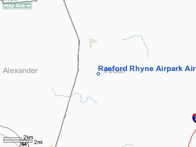
Raeford Rhyne Airpark Airport |
Location & QuickFacts
| FAA Information Effective: | 2008-09-25 |
| Airport Identifier: | NC15 |
| Airport Status: | Operational |
| Longitude/Latitude: | 080-58-44.2740W/35-57-25.4790N
-80.978965/35.957078 (Estimated) |
| Elevation: | 1140 ft / 347.47 m (Estimated) |
| Land: | 10 acres |
| From nearest city: | 11 nautical miles N of Statesville, NC |
| Location: | Iredell County, NC |
| Magnetic Variation: | 05W (1985) |
Owner & Manager
| Ownership: | Privately owned |
| Owner: | Raeford Rhyne |
| Address: | Rt 2, Box 110
Statesville, NC 28677 |
| Phone number: | 704-873-2871 |
| Manager: | Raeford Phyne |
| Address: | Rt 2 Box 110
Statesville, NC 28677 |
| Phone number: | 704-876-0760 |
Airport Operations and Facilities
| Airport Use: | Private |
| Wind indicator: | Yes |
| Segmented Circle: | No |
| Control Tower: | No |
| Landing fee charge: | No |
| Sectional chart: | Charlotte |
| Region: | ASO - Southern |
| Boundary ARTCC: | ZTL - Atlanta |
| Tie-in FSS: | RDU - Raleigh |
| FSS on Airport: | No |
| FSS Toll Free: | 1-800-WX-BRIEF |
Airport Services
| Airframe Repair: | NONE |
| Power Plant Repair: | NONE |
Runway Information
Runway 02/20
| Dimension: | 2500 x 200 ft / 762.0 x 61.0 m |
| Surface: | TURF, Good Condition |
| |
Runway 02 |
Runway 20 |
| Traffic Pattern: | Right | Left |
| Obstruction: | 25 ft trees, 200.0 ft from runway, 8:1 slope to clear
ADDL OBSTN: ROAD 0' FROM THR BTN RWY 20 AND POWERLINE. | 25 ft pline, 50.0 ft from runway |
|
Radio Navigation Aids
| ID |
Type |
Name |
Ch |
Freq |
Var |
Dist |
| MRN | FAN MARKER | Lenoir | | | 03W | 32.9 nm |
| UKF | NDB | Wilki | | 209.00 | 06W | 11.0 nm |
| VW | NDB | Temky | | 280.00 | 05W | 11.7 nm |
| HK | NDB | Tawba | | 332.00 | 06W | 18.9 nm |
| ZEF | NDB | Zephyr | | 326.00 | 05W | 24.7 nm |
| DVZ | NDB | Davie | | 354.00 | 06W | 25.6 nm |
| IZN | NDB | Lincolnton | | 432.00 | 06W | 25.8 nm |
| RU | NDB | Rovdy | | 275.00 | 06W | 27.4 nm |
| JU | NDB | Ashee | | 410.00 | 07W | 33.1 nm |
| AZW | NDB | Mount Airy | | 223.00 | 07W | 33.2 nm |
| SEN | NDB | Swearing/dcmsnd | | 260.00 | 06W | 34.8 nm |
| FIQ | NDB | Fiddlers | | 391.00 | 07W | 36.9 nm |
| BAR | NDB | Hemlock | | 320.00 | 02W | 45.3 nm |
| GHJ | NDB | Stonia | | 260.00 | 06W | 46.8 nm |
| HLX | NDB | Hillsville | | 269.00 | 06W | 49.0 nm |
| JJO | NDB | Mountain City | | 396.00 | 04W | 49.4 nm |
| BZM | VOR/DME | Barretts Mountain | 045X | 110.80 | 06W | 13.8 nm |
| CLT | VOR/DME | Charlotte | 097X | 115.00 | 05W | 46.1 nm |
| GSO | VORTAC | Greensboro | 109X | 116.20 | 03W | 49.0 nm |
| HKY | VOT | Hickory Regional | | 110.00 | | 23.9 nm |
| CLT | VOT | Charlotte | | 112.00 | | 44.7 nm |
Remarks
- HOT AIR BALLOON ACTIVITY ON RWY & SURROUNDING SITE.
- VFR, PVT USE ONLY.
Images and information placed above are from
http://www.airport-data.com/airport/NC15/
We thank them for the data!
| General Info
|
| Country |
United States
|
| State |
NORTH CAROLINA
|
| FAA ID |
NC15
|
| Latitude |
35-57-25.479N
|
| Longitude |
080-58-44.274W
|
| Elevation |
1140 feet
|
| Near City |
STATESVILLE
|
We don't guarantee the information is fresh and accurate. The data may
be wrong or outdated.
For more up-to-date information please refer to other sources.
|
|


