 |
|
Location & QuickFacts
| FAA Information Effective: | 2008-09-25 |
| Airport Identifier: | NC31 |
| Airport Status: | Operational |
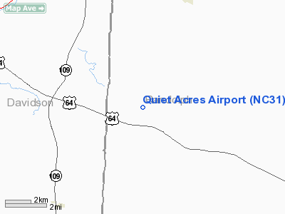
| Longitude/Latitude: | 080-01-27.1510W/35-45-53.4900N
-80.024209/35.764858 (Estimated) |
| Elevation: | 740 ft / 225.55 m (Estimated) |
| Land: | 0 acres |
| From nearest city: | 8 nautical miles SE of Thomasville, NC |
| Location: | Randolph County, NC |
| Magnetic Variation: | 06W (1985) |
Owner & Manager
| Ownership: | Privately owned |
| Owner: | M. L. Mendenhall |
| Address: | 6691 Wildwood Trail
Thomasville, NC 27360-4974 |
| Phone number: | 336-475-4495 |
| Manager: | M. L. Mendenhall |
| Address: | 100 Wildwood Trail
Thomasville, NC 27360 |
| Phone number: | 336-240-7607 |
Airport Operations and Facilities
| Airport Use: | Private |
| Wind indicator: | No |
| Segmented Circle: | No |
| Control Tower: | No |
| Landing fee charge: | No |
| Sectional chart: | Charlotte |
| Region: | ASO - Southern |
| Boundary ARTCC: | ZTL - Atlanta |
| Tie-in FSS: | RDU - Raleigh |
| FSS on Airport: | No |
| FSS Toll Free: | 1-800-WX-BRIEF |
Runway Information
Runway 09/27
| Dimension: | 1800 x 75 ft / 548.6 x 22.9 m |
| Surface: | TURF, |
| |
Runway 09 |
Runway 27 |
| Traffic Pattern: | Left | Left |
|
Radio Navigation Aids
| ID |
Type |
Name |
Ch |
Freq |
Var |
Dist |
| OQA | FAN MARKER | Rockingham County | | | | 40.9 nm |
| CQJ | NDB | City Lake | | 266.00 | 08W | 8.3 nm |
| SEN | NDB | Swearing/dcmsnd | | 260.00 | 06W | 13.4 nm |
| VU | NDB | Aller | | 346.00 | 06W | 16.8 nm |
| RU | NDB | Rovdy | | 275.00 | 06W | 22.8 nm |
| DVZ | NDB | Davie | | 354.00 | 06W | 22.9 nm |
| HB | NDB | Himun | | 361.00 | 08W | 25.0 nm |
| TOX | NDB | Siler City | | 371.00 | 07W | 27.4 nm |
| SIF | NDB | Slammer | | 423.00 | 07W | 39.2 nm |
| AFP | NDB | Anson County | | 283.00 | 07W | 44.6 nm |
| AZW | NDB | Mount Airy | | 223.00 | 07W | 44.7 nm |
| EEJ | NDB | Lee County/dcmsnd | | 428.00 | 07W | 45.7 nm |
| TT | NDB | Leeco | | 406.00 | 08W | 46.1 nm |
| ZEF | NDB | Zephyr | | 326.00 | 05W | 47.3 nm |
| UV | NDB | Bales | | 396.00 | 07W | 49.9 nm |
| GSO | VORTAC | Greensboro | 109X | 116.20 | 03W | 17.0 nm |
| LIB | VORTAC | Liberty | 077X | 113.00 | 03W | 20.3 nm |
| SDZ | VORTAC | Sandhills | 055X | 111.80 | 03W | 39.3 nm |
Remarks
- VFR ONLY, LANDING AREA LIMITED TO PERSONAL USE.
Images and information placed above are from
http://www.airport-data.com/airport/NC31/
We thank them for the data!
| General Info
|
| Country |
United States
|
| State |
NORTH CAROLINA
|
| FAA ID |
NC31
|
| Latitude |
35-45-53.490N
|
| Longitude |
080-01-27.151W
|
| Elevation |
740 feet
|
| Near City |
THOMASVILLE
|
We don't guarantee the information is fresh and accurate. The data may
be wrong or outdated.
For more up-to-date information please refer to other sources.
|
|


