 |
|
Location & QuickFacts
| FAA Information Effective: | 2008-09-25 |
| Airport Identifier: | NC38 |
| Airport Status: | Operational |
| Longitude/Latitude: | 081-22-30.0000W/35-37-42.0000N
-81.375000/35.628333 (Estimated) |
| Elevation: | 1020 ft / 310.90 m (Estimated) |
| Land: | 0 acres |
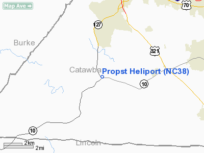
| From nearest city: | 0 nautical miles S of Hickory, NC |
| Location: | Catawba County, NC |
| Magnetic Variation: | () |
Owner & Manager
| Ownership: | Privately owned |
| Owner: | Propst Ems Station |
| Address: | 5392 S. Nc 127 Hwy
Hickory, NC 28602 |
| Phone number: | 704-462-2993 |
| Manager: | Ems Shift Supervisor |
| Address: | 5392 S. Nc 127 Hwy
Hickory, NC 28602 |
| Phone number: | 704-462-2993 |
Airport Operations and Facilities
| Airport Use: | Private
MEDICAL USE. |
| Wind indicator: | Yes |
| Control Tower: | No |
| Sectional chart: | Atlanta |
| Region: | ASO - Southern |
| Boundary ARTCC: | ZTL - Atlanta |
| Tie-in FSS: | RDU - Raleigh |
| FSS Toll Free: | 1-800-WX-BRIEF |
| NOTAMs Facility: | RDU |
Runway Information
Helipad H1
| Dimension: | 55 x 55 ft / 16.8 x 16.8 m |
| Surface: | CONC, |
| |
Runway H1 |
Runway |
| Traffic Pattern: | Left | Left |
|
Radio Navigation Aids
| ID |
Type |
Name |
Ch |
Freq |
Var |
Dist |
| MRN | FAN MARKER | Lenoir | | | 03W | 15.8 nm |
| HK | NDB | Tawba | | 332.00 | 06W | 10.1 nm |
| IZN | NDB | Lincolnton | | 432.00 | 06W | 15.1 nm |
| FIQ | NDB | Fiddlers | | 391.00 | 07W | 15.3 nm |
| VW | NDB | Temky | | 280.00 | 05W | 17.5 nm |
| SLP | NDB | First River | | 417.00 | 06W | 25.1 nm |
| GHJ | NDB | Stonia | | 260.00 | 06W | 28.4 nm |
| UKF | NDB | Wilki | | 209.00 | 06W | 32.1 nm |
| RFE | NDB | Rutherford | | 344.00 | 05W | 32.9 nm |
| BAR | NDB | Hemlock | | 320.00 | 02W | 40.0 nm |
| RU | NDB | Rovdy | | 275.00 | 06W | 43.7 nm |
| UZ | NDB | Rally | | 227.00 | 05W | 46.7 nm |
| DVZ | NDB | Davie | | 354.00 | 06W | 48.0 nm |
| JU | NDB | Ashee | | 410.00 | 07W | 48.5 nm |
| BZM | VOR/DME | Barretts Mountain | 045X | 110.80 | 06W | 15.9 nm |
| CLT | VOR/DME | Charlotte | 097X | 115.00 | 05W | 33.5 nm |
| FML | VORTAC | Fort Mill | 071X | 112.40 | 02W | 43.6 nm |
| SPA | VORTAC | Spartanburg | 104X | 115.70 | 02W | 44.8 nm |
| SUG | VORTAC | Sugarloaf Mountain | 059X | 112.20 | 02W | 45.7 nm |
| HKY | VOT | Hickory Regional | | 110.00 | | 6.8 nm |
| CLT | VOT | Charlotte | | 112.00 | | 32.8 nm |
Remarks
- SEE AIRSPACE CASE 2005-ASO-534-NRA.
Images and information placed above are from
http://www.airport-data.com/airport/NC38/
We thank them for the data!
| General Info
|
| Country |
United States
|
| State |
NORTH CAROLINA
|
| FAA ID |
NC38
|
| Latitude |
36-05-53.493N
|
| Longitude |
080-08-44.162W
|
| Elevation |
975 feet
|
| Near City |
WINSTON-SALEM
|
We don't guarantee the information is fresh and accurate. The data may
be wrong or outdated.
For more up-to-date information please refer to other sources.
|
|


