 |
|
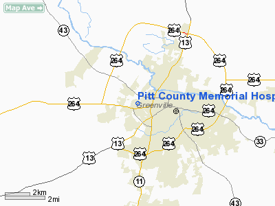
Pitt County Memorial Hospital Heliport |
Location & QuickFacts
| FAA Information Effective: | 2008-09-25 |
| Airport Identifier: | NC91 |
| Airport Status: | Operational |
| Longitude/Latitude: | 077-24-27.0000W/35-36-31.0000N
-77.407500/35.608611 (Estimated) |
| Elevation: | 76 ft / 23.16 m (Estimated) |
| Land: | 1 acres |
| From nearest city: | 0 nautical miles N of Greenville, NC |
| Location: | Pitt County, NC |
| Magnetic Variation: | 08W (1985) |
Owner & Manager
| Ownership: | Privately owned |
| Owner: | Pitt County Memorial Hospital |
| Address: | Po Box 6028
Greenville, NC 27834 |
| Phone number: | 252-816-4100 |
| Manager: | Dave Mc Rae, President/ceo |
| Address: | 2100 Stantonsburg Rd.
Greenville, NC 27834 |
| Phone number: | 252-816-4451 |
Airport Operations and Facilities
| Airport Use: | Private
MEDICAL. |
| Wind indicator: | Yes |
| Segmented Circle: | No |
| Control Tower: | No |
| Lighting Schedule: | SS-SR |
| Landing fee charge: | No |
| Sectional chart: | Charlotte |
| Region: | ASO - Southern |
| Boundary ARTCC: | ZDC - Washington |
| Tie-in FSS: | RDU - Raleigh |
| FSS on Airport: | No |
| FSS Toll Free: | 1-800-WX-BRIEF |
Airport Communications
Airport Services
Runway Information
Helipad H1
| Dimension: | 100 x 100 ft / 30.5 x 30.5 m |
| Surface: | CONC, |
| |
Runway H1 |
Runway |
| Traffic Pattern: | Left | Left |
|
Helipad H2
| Dimension: | 100 x 100 ft / 30.5 x 30.5 m |
| Surface: | CONC, |
| |
Runway H2 |
Runway |
| Traffic Pattern: | Left | Left |
|
Radio Navigation Aids
| ID |
Type |
Name |
Ch |
Freq |
Var |
Dist |
| PGV | FAN MARKER | Belvoir | | | 06W | 2.2 nm |
| AQE | NDB | Alwood | | 230.00 | 09W | 6.2 nm |
| RNW | NDB | Chocowinity | | 388.00 | 07W | 15.9 nm |
| MCZ | NDB | Williamston | | 336.00 | 09W | 18.8 nm |
| ETC | NDB | Tarboro | | 257.00 | 08W | 20.8 nm |
| JYN | NDB | Wayne | | 208.00 | 08W | 24.6 nm |
| RW | NDB | Jambe | | 235.00 | 09W | 28.8 nm |
| PMZ | NDB | Plymouth | | 221.00 | 10W | 33.7 nm |
| DKA | NDB | Kenan | | 332.00 | 07W | 40.8 nm |
| ASJ | NDB | Ahoskie | | 415.00 | 10W | 43.0 nm |
| EUU | NDB | Jnall | | 251.00 | 07W | 46.3 nm |
| EDE | NDB | Edenton | | 265.00 | 10W | 48.0 nm |
| GSB | TACAN | Seymour Johnson | 112X | | 08W | 32.1 nm |
| NKT | TACAN | Cherry Point | 075X | | 09W | 49.9 nm |
| EWN | VOR/DME | New Bern | 083X | 113.60 | 08W | 36.8 nm |
| ISO | VORTAC | Kinston | 033X | 109.60 | 05W | 16.1 nm |
| TYI | VORTAC | Tar River | 125X | 117.80 | 05W | 26.4 nm |
Remarks
- PRVDD VFR; PVT USE; AREA MARKED; WIND INDICATOR MAINTAINED; APCH/DEP COORDINATED WITH PITT-GREENVILLE ARPT & ALL APCH/DEP FM 350 DEG CLOCKWISE 020 DEG & 135 DEG CLOCKWISE 290 DEG.
Images and information placed above are from
http://www.airport-data.com/airport/NC91/
We thank them for the data!
| General Info
|
| Country |
United States
|
| State |
NORTH CAROLINA
|
| FAA ID |
NC91
|
| Latitude |
35-36-31.000N
|
| Longitude |
077-24-27.000W
|
| Elevation |
76 feet
|
| Near City |
GREENVILLE
|
We don't guarantee the information is fresh and accurate. The data may
be wrong or outdated.
For more up-to-date information please refer to other sources.
|
|


