 |
|
| Pitt-Greenville Airport |
| IATA: PGV – ICAO: KPGV – FAA LID: PGV |
| Summary |
| Airport type |
Public |
| Operator |
Pitt County & Greenville City |
| Serves |
Greenville, North Carolina |
| Elevation AMSL |
27 ft / 8.2 m |
| Coordinates |
35°38′07″N 77°23′07″W / 35.63528°N 77.38528°W / 35.63528; -77.38528 |
| Website |
www.pitt-greenvilleairport.com |
| Runways |
| Direction |
Length |
Surface |
| ft |
m |
| 2/20 |
6,500 |
1,981 |
Asphalt |
| 8/26 |
4,997 |
1,523 |
Asphalt |
| 15/33 |
2,687 |
819 |
Asphalt |
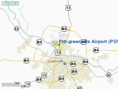
Pitt-Greenville Airport (IATA: PGV, ICAO: KPGV, FAA LID: PGV) is a public airport located two miles (3 km) north of East Carolina University, the central business district (CBD) of Greenville, a city in Pitt County, North Carolina, USA. The airport covers 872 acres (353 ha) and has three runways. It is mostly used for general aviation, but is also served by one commercial airline. The airport manager is Jerry Vickers. History
The Works Progress Administration constructed the Greenville Airport in 1940 on land that was jointly owned by the city of Greenville and Pitt County. A Civil Pilot training Program operated from the airport until it was leased by the United States Navy on May 1, 1942 to be an outlying field of Marine Corps Air Station Cherry Point. The field was under utilized until November 30, 1942, when it was announced that it would be upgraded by the Civil Aeronautics Administration.
The first Marine Corps flying squadrons to arrive were scout bombing squadrons VMSB-343 and VMSB-344 in January of 1944. July saw the arrival of fighter squadrons VMF-913 and VMF-914 and October brought the photo reconnaissance squadrons VMD-354 and VMD-954. During the war Outlying Field Greenville was the busiest of MCAS Cherry Point's outlying fields.
Airlines and destinations
Scheduled airlines
| Airlines |
Destinations |
| US Airways Express operated by Piedmont Airlines |
Charlotte |
| US Airways Express operated by PSA Airlines |
Charlotte |
Cargo airlines
- Ram Air Freight (Raleigh-Durham, Rocky Mount-Wilson)
The above content comes from Wikipedia and is published under free licenses – click here to read more.
Location & QuickFacts
| FAA Information Effective: | 2008-09-25 |
| Airport Identifier: | PGV |
| Airport Status: | Operational |
| Longitude/Latitude: | 077-23-07.1000W/35-38-06.9000N
-77.385306/35.635250 (Estimated) |
| Elevation: | 26 ft / 7.92 m (Surveyed) |
| Land: | 872 acres |
| From nearest city: | 2 nautical miles N of Greenville, NC |
| Location: | Pitt County, NC |
| Magnetic Variation: | 09W (2000) |
Owner & Manager
| Ownership: | Publicly owned |
| Owner: | Pitt Co & Greenville City |
| Address: | Po Box 671
Greenville, NC 27835 |
| Phone number: | 252-758-4707 |
| Manager: | James G Turcotte |
| Address: | Po Box 671
Greenville, NC 27835 |
| Phone number: | 252-758-4707
EXT. 6 |
Airport Operations and Facilities
| Airport Use: | Open to public |
| Wind indicator: | Yes |
| Segmented Circle: | Yes |
| Control Tower: | No |
| Lighting Schedule: | DUSK-DAWN
ACTVT MIRL RY 08/26, HIRL RY 02/20 & MALSR RY 20 - CTAF. PAPI RYS 02, 20, 08 & 26 OPER CONT. |
| Beacon Color: | Clear-Green (lighted land airport) |
| Landing fee charge: | No |
| Sectional chart: | Charlotte |
| Region: | ASO - Southern |
| Boundary ARTCC: | ZDC - Washington |
| Tie-in FSS: | RDU - Raleigh |
| FSS on Airport: | No |
| FSS Toll Free: | 1-800-WX-BRIEF |
| NOTAMs Facility: | PGV (NOTAM-d service avaliable) |
| Certification type/date: | I B S 07/1979
ARPT CLSD TO UNSKED ACR OPNS WITH MORE THAN 30 PSGR SEATS EXCP 24 HRS PPR CALL AMGR 252-758-4707. INDEX C ARFF EQUIP AVBL UPON REQ. |
| Federal Agreements: | NGRY3 |
Airport Communications
| CTAF: | 122.800 |
| Unicom: | 122.800 |
Airport Services
| Fuel available: | 100LLA |
| Airframe Repair: | MAJOR |
| Power Plant Repair: | MAJOR |
| Bottled Oxygen: | NONE |
| Bulk Oxygen: | NONE |
Runway Information
Runway 02/20
| Dimension: | 6505 x 150 ft / 1982.7 x 45.7 m |
| Surface: | ASPH, Good Condition
MULTIPLE LARGE CRACKS IN PAVEMENT. GRASS GROWING OUT OF CRACKS. |
| Surface Treatment: | Saw-cut or plastic Grooved |
| Weight Limit: | Single wheel: 40000 lbs.
Dual wheel: 65000 lbs. |
| Edge Lights: | High |
| |
Runway 02 |
Runway 20 |
| Longitude: | 077-23-08.8808W | 077-22-58.5010W |
| Latitude: | 35-37-33.1241N | 35-38-36.8932N |
| Elevation: | 21.00 ft | 26.00 ft |
| Alignment: | 8 | 127 |
| ILS Type: | | ILS/DME
|
| Traffic Pattern: | Left | Left |
| Markings: | Precision instrument, Good Condition | Precision instrument, Good Condition |
| Crossing Height: | 42.00 ft | 25.00 ft |
| Displaced threshold: | 0.00 ft | 350.00 ft |
| VASI: | 4-light PAPI on left side | 4-light PAPI on left side |
| Visual Glide Angle: | 3.00° | 3.00° |
| Approach lights: | | MALSR |
| Runway End Identifier: | Yes | No |
| Obstruction: | 13 ft trees, 1000.0 ft from runway, 200 ft right of centerline, 33:1 slope to clear | 65 ft trees, 2800.0 ft from runway, 800 ft left of centerline, 40:1 slope to clear |
|
Runway 08/26
| Dimension: | 4997 x 150 ft / 1523.1 x 45.7 m |
| Surface: | ASPH, Good Condition
MULTIPLE LARGE CRACKS IN PAVEMENT. GRASS GROWING OUT OF CRACKS. |
| Weight Limit: | Single wheel: 40000 lbs.
Dual wheel: 65000 lbs. |
| Edge Lights: | Medium |
| |
Runway 08 |
Runway 26 |
| Longitude: | 077-23-29.8330W | 077-22-34.2191W |
| Latitude: | 35-37-59.0414N | 35-38-18.5650N |
| Elevation: | 24.00 ft | 23.00 ft |
| Alignment: | 67 | 127 |
| Traffic Pattern: | Left | Left |
| Markings: | Non-precision instrument, Good Condition
RY 08 MARKINGS FADED | Non-precision instrument, Good Condition
RY 26 MARKINGS FADED |
| Crossing Height: | 42.00 ft | 31.00 ft |
| VASI: | 4-light PAPI on left side | 4-light PAPI on left side |
| Visual Glide Angle: | 4.00° | 3.00° |
| Runway End Identifier: | Yes | Yes |
| Obstruction: | 110 ft trees, 1526.0 ft from runway, 200 ft right of centerline, 12:1 slope to clear | 37 ft pole, 1441.0 ft from runway, 77 ft right of centerline, 33:1 slope to clear |
|
Runway 15/33
| Dimension: | 2687 x 150 ft / 819.0 x 45.7 m |
| Surface: | ASPH,
MULTIPLE LARGE CRACKS IN PAVEMENT. GRASS GROWING OUT OF CRACKS. |
| Weight Limit: | Single wheel: 40000 lbs.
Dual wheel: 65000 lbs. |
| |
Runway 15 |
Runway 33 |
| Longitude: | 077-23-37.8915W | 077-23-12.0886W |
| Latitude: | 35-38-15.8653N | 35-37-59.6625N |
| Elevation: | 25.00 ft | 23.00 ft |
| Alignment: | 127 | 127 |
| Traffic Pattern: | Left | Left |
| Markings: | Numbers only, Poor Condition
NO RY CENTERLINE MARKINGS. | Numbers only, Poor Condition
NO RY CENTERLINE MARKINGS. |
| Obstruction: | 40 ft trees, 1000.0 ft from runway, 25 ft left of centerline, 20:1 slope to clear | 69 ft trees, 2500.0 ft from runway, 100 ft left of centerline, 33:1 slope to clear |
|
Radio Navigation Aids
| ID |
Type |
Name |
Ch |
Freq |
Var |
Dist |
| PGV | FAN MARKER | Belvoir | | | 06W | 0.3 nm |
| AQE | NDB | Alwood | | 230.00 | 09W | 4.4 nm |
| RNW | NDB | Chocowinity | | 388.00 | 07W | 15.6 nm |
| MCZ | NDB | Williamston | | 336.00 | 09W | 16.8 nm |
| ETC | NDB | Tarboro | | 257.00 | 08W | 19.7 nm |
| JYN | NDB | Wayne | | 208.00 | 08W | 26.0 nm |
| RW | NDB | Jambe | | 235.00 | 09W | 29.4 nm |
| PMZ | NDB | Plymouth | | 221.00 | 10W | 32.1 nm |
| ASJ | NDB | Ahoskie | | 415.00 | 10W | 41.2 nm |
| DKA | NDB | Kenan | | 332.00 | 07W | 42.8 nm |
| EDE | NDB | Edenton | | 265.00 | 10W | 46.3 nm |
| EUU | NDB | Jnall | | 251.00 | 07W | 47.4 nm |
| GSB | TACAN | Seymour Johnson | 112X | | 08W | 33.9 nm |
| EWN | VOR/DME | New Bern | 083X | 113.60 | 08W | 37.7 nm |
| ISO | VORTAC | Kinston | 033X | 109.60 | 05W | 18.0 nm |
| TYI | VORTAC | Tar River | 125X | 117.80 | 05W | 25.7 nm |
Remarks
- 24 HR HELICOPTER OPNS AT HOSPITAL 1.5 NM SSW OF ARPT; MONITORING CTAF.
- RY 15/33 NON-ACR AIRCRAFT ONLY.
Images and information placed above are from
http://www.airport-data.com/airport/PGV/
We thank them for the data!
| General Info
|
| Country |
United States
|
| State |
NORTH CAROLINA
|
| FAA ID |
PGV
|
| Latitude |
35-38-06.862N
|
| Longitude |
077-23-07.153W
|
| Elevation |
27 feet
|
| Near City |
GREENVILLE
|
We don't guarantee the information is fresh and accurate. The data may
be wrong or outdated.
For more up-to-date information please refer to other sources.
|
|


