 |
|
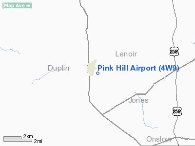
Location & QuickFacts
| FAA Information Effective: | 2008-09-25 |
| Airport Identifier: | 4W9 |
| Airport Status: | Operational |
| Longitude/Latitude: | 077-44-09.9130W/35-03-02.5890N
-77.736087/35.050719 (Estimated) |
| Elevation: | 144 ft / 43.89 m (Surveyed) |
| Land: | 5 acres |
| From nearest city: | 1 nautical miles E of Pink Hill, NC |
| Location: | Lenoir County, NC |
| Magnetic Variation: | 08W (1985) |
Owner & Manager
| Ownership: | Privately owned |
| Owner: | Pink Hill Aero Club |
| Address: | 2556 Pinewood Home Dr.
Pink Hill, NC 28572 |
| Phone number: | 252-568-9981 |
| Manager: | Cullen Turner |
| Address: | 2556 Pinewood Home Dr.
Pink Hill, NC 28572 |
| Phone number: | 252-568-9981 |
Airport Operations and Facilities
| Airport Use: | Open to public |
| Wind indicator: | Yes |
| Segmented Circle: | No |
| Control Tower: | No |
| Lighting Schedule: | DUSK-DAWN
ACTVT LIRL RY 01/19 - CTAF. |
| Beacon Color: | Clear-Green (lighted land airport)
OTS INDEFLY. |
| Landing fee charge: | No |
| Sectional chart: | Charlotte |
| Region: | ASO - Southern |
| Boundary ARTCC: | ZDC - Washington |
| Tie-in FSS: | RDU - Raleigh |
| FSS on Airport: | No |
| FSS Toll Free: | 1-800-WX-BRIEF |
| NOTAMs Facility: | RDU (NOTAM-d service avaliable) |
Airport Communications
| CTAF: | 122.700 |
| Unicom: | 122.700 |
Airport Services
Runway Information
Runway 01/19
| Dimension: | 2800 x 85 ft / 853.4 x 25.9 m |
| Surface: | TURF, Fair Condition |
| Edge Lights: | Non-standard lighting system
RY 01/19 NSTD LIRL; NOT FAA APPROVED L-800 SERIES, NO THR LGTS. LIRL RY 01/19 OTS INDEFLY. |
| |
Runway 01 |
Runway 19 |
| Traffic Pattern: | Left | Left |
| Displaced threshold: | 200.00 ft | 200.00 ft |
| Obstruction: | 65 ft trees, 79.0 ft from runway, 93 ft left of centerline, 1:1 slope to clear
APCH RATIO 4:1 TO DSPLCD THLD. | 6 ft fence, 0.0 ft from runway, 75 ft right of centerline
APCH RATIO 26:1 TO DSPLCD THLD. |
|
Radio Navigation Aids
| ID |
Type |
Name |
Ch |
Freq |
Var |
Dist |
| PGV | FAN MARKER | Belvoir | | | 06W | 39.4 nm |
| DKA | NDB | Kenan | | 332.00 | 07W | 9.1 nm |
| ACZ | NDB | Pendy | | 379.00 | 09W | 24.0 nm |
| NCA | NDB | New River | | 356.00 | 08W | 24.9 nm |
| JYN | NDB | Wayne | | 208.00 | 08W | 29.7 nm |
| CTZ | NDB | Clinton | | 412.00 | 08W | 31.2 nm |
| RNW | NDB | Chocowinity | | 388.00 | 07W | 41.4 nm |
| JN | NDB | Jurly | | 263.00 | 09W | 42.4 nm |
| AQE | NDB | Alwood | | 230.00 | 09W | 43.3 nm |
| RW | NDB | Jambe | | 235.00 | 09W | 44.5 nm |
| EUU | NDB | Jnall | | 251.00 | 07W | 45.1 nm |
| TGQ | NDB | Elizabethtown | | 398.00 | 08W | 49.7 nm |
| DIW | NDB/DME | Dixon | 107X | 198.00 | 08W | 32.2 nm |
| GSB | TACAN | Seymour Johnson | 112X | | 08W | 20.6 nm |
| NCA | TACAN | New River | 101X | | 08W | 25.3 nm |
| NJM | TACAN | Bogue Mcalf | 067X | | 08W | 41.2 nm |
| NKT | TACAN | Cherry Point | 075X | | 09W | 43.3 nm |
| EWN | VOR/DME | New Bern | 083X | 113.60 | 08W | 34.0 nm |
| ISO | VORTAC | Kinston | 033X | 109.60 | 05W | 21.1 nm |
| ILM | VORTAC | Wilmington | 117X | 117.00 | 07W | 42.6 nm |
Remarks
- 5' DEEP DITCH ACROSS RY AT THR RY 01 WITH 1' BERM.
- 65 FT TREES 50 FT FM RY EDGES BOTH SIDES SOUTH HALF OF RY: 40 FT TREES 50 FT FM E EDGE N HALF OF RY.
- ARPT IS UNDER SEVERAL MILITARY VR ROUTES. JET ACFT CROSS AP UNDER 500' IN EXCESS OF 200 KNOTS.
- NO LINE OF SIGHT BETWEEN RY ENDS.
- +5 FT GRAPE VINEYARDS 50 FT LEFT & RIGHT OF CNTRLN FIRST HALF OF RY 19.
- VFR OPERATIONS ONLY.
Images and information placed above are from
http://www.airport-data.com/airport/4W9/
We thank them for the data!
| General Info
|
| Country |
United States
|
| State |
NORTH CAROLINA
|
| FAA ID |
4W9
|
| Latitude |
35-03-02.589N
|
| Longitude |
077-44-09.913W
|
| Elevation |
144 feet
|
| Near City |
PINK HILL
|
We don't guarantee the information is fresh and accurate. The data may
be wrong or outdated.
For more up-to-date information please refer to other sources.
|
|


