 |
|
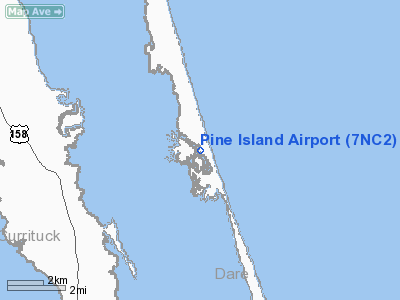
Location & QuickFacts
| FAA Information Effective: | 2008-09-25 |
| Airport Identifier: | 7NC2 |
| Airport Status: | Operational |
| Longitude/Latitude: | 075-47-18.6850W/36-15-12.5830N
-75.788524/36.253495 (Estimated) |
| Elevation: | 16 ft / 4.88 m (Estimated) |
| Land: | 0 acres |
| From nearest city: | 9 nautical miles S of Corolla, NC |
| Location: | Currituck County, NC |
| Magnetic Variation: | 09W (1985) |
Owner & Manager
| Ownership: | Privately owned |
| Owner: | Turnpike Properties, Llc |
| Address: | 100 N. Cherry Street, Suite 600
Winston Salem, NC 27101 |
| Phone number: | 919-426-5494 |
| Manager: | Flightgest, Inc. |
| Address: | P.o. Box 98084
Raleigh, NC 27624 |
| Phone number: | 919-840-4444 |
Airport Operations and Facilities
| Airport Use: | Private |
| Wind indicator: | Yes |
| Segmented Circle: | No |
| Control Tower: | No |
| Sectional chart: | Washington |
| Region: | ASO - Southern |
| Boundary ARTCC: | ZDC - Washington |
| Tie-in FSS: | RDU - Raleigh |
| FSS Toll Free: | 1-800-WX-BRIEF |
Runway Information
Runway 17/35
| Dimension: | 3450 x 55 ft / 1051.6 x 16.8 m |
| Surface: | ASPH, |
| |
Runway 17 |
Runway 35 |
| Traffic Pattern: | Left | Right |
|
Radio Navigation Aids
| ID |
Type |
Name |
Ch |
Freq |
Var |
Dist |
| MQI | NDB | Manteo | | 370.00 | 09W | 20.8 nm |
| LLW | NDB | Woodville | | 254.00 | 10W | 24.7 nm |
| EY | NDB | Chesi | | 233.00 | 09W | 35.5 nm |
| EDE | NDB | Edenton | | 265.00 | 10W | 40.2 nm |
| PVG | NDB | Portsmouth | | 241.00 | 10W | 44.8 nm |
| RK | NDB | Waley | | 249.00 | 10W | 46.5 nm |
| NTU | TACAN | Oceana | 113X | | 10W | 36.3 nm |
| NGU | TACAN | Chambers | 048X | | 10W | 47.5 nm |
| ECG | VOR/DME | Elizabeth City | 072X | 112.50 | 07W | 18.8 nm |
| RBX | VOR/DME | Wright Brothers | 053X | 111.60 | 08W | 20.5 nm |
| ORF | VORTAC | Norfolk | 116X | 116.90 | 07W | 43.2 nm |
Remarks
- MONITOR 122.8 FOR TRAFFIC INVOF DARE COUNTY REGIONAL ARPT.
- MONITOR 122.9 WHEN IN TRAFFIC PATTERN.
- WRITTEN PERMISSION REQUIRED TO LAND, CONTACT AIRPORT MANAGER AT 919-840-4444.
- NO PARKING OF ACFT OR CARS.
- PRVDD VFR/PVT USE ONLY; RY IS LAID OUT SO IT IS NOT A HAZARD TO VEHICLES/PERSONS USING ROADWAY.
Images and information placed above are from
http://www.airport-data.com/airport/7NC2/
We thank them for the data!
| General Info
|
| Country |
United States
|
| State |
NORTH CAROLINA
|
| FAA ID |
7NC2
|
| Latitude |
36-15-12.583N
|
| Longitude |
075-47-18.685W
|
| Elevation |
16 feet
|
| Near City |
COROLLA
|
We don't guarantee the information is fresh and accurate. The data may
be wrong or outdated.
For more up-to-date information please refer to other sources.
|
|


