|
|
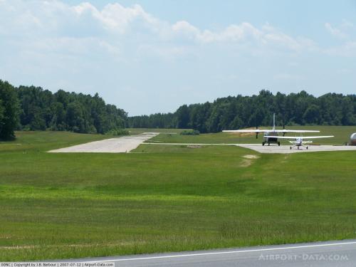 |
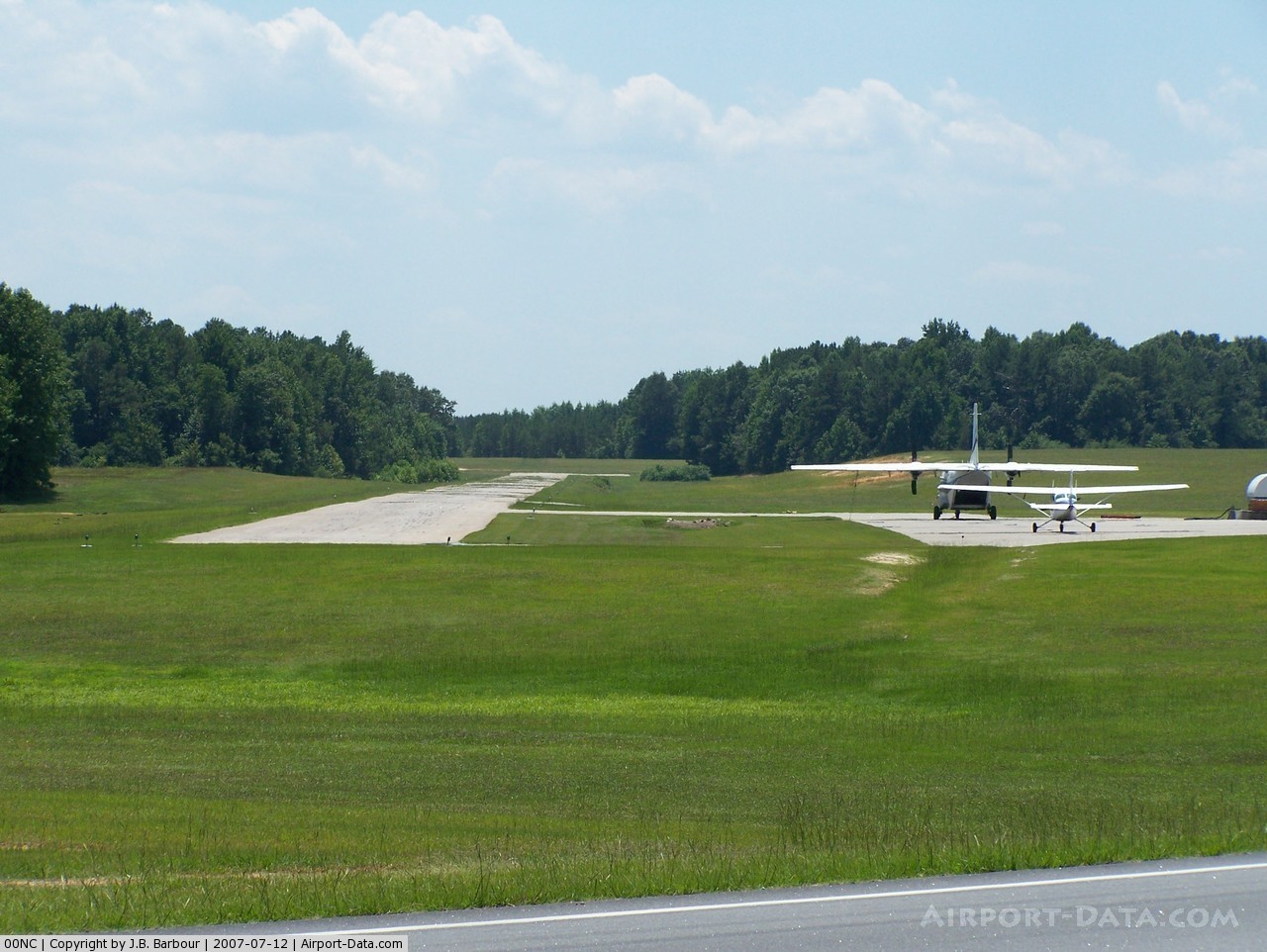
(Click on the photo to enlarge) |
Location & QuickFacts
| FAA Information Effective: | 2008-09-25 |
| Airport Identifier: | 00NC |
| Airport Status: | Operational |
| Longitude/Latitude: | 078-22-16.9880W/36-05-06.5410N
-78.371386/36.085150 (Estimated) |
| Elevation: | 348 ft / 106.07 m (Surveyed) |
| Land: | 30 acres |
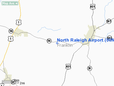
| From nearest city: | 3 nautical miles SW of Louisburg, NC |
| Location: | Franklin County, NC |
| Magnetic Variation: | 07W (1985) |
Owner & Manager
| Ownership: | Privately owned |
| Owner: | Nancy Fayard |
| Address: | Po Box 703
Louisburg, NC 27549 |
| Phone number: | 919-496-2224 |
| Manager: | Paul Fayard |
| Address: | 6966 Nc56 Hwy
Franklinton, NC 27525 |
| Phone number: | 919-496-5153 |
Airport Operations and Facilities
| Airport Use: | Private |
| Wind indicator: | Yes |
| Segmented Circle: | No |
| Control Tower: | No |
| Landing fee charge: | No |
| Sectional chart: | Washington |
| Region: | ASO - Southern |
| Boundary ARTCC: | ZDC - Washington |
| Tie-in FSS: | RDU - Raleigh |
| FSS on Airport: | No |
| FSS Toll Free: | 1-800-WX-BRIEF |
Airport Services
| Fuel available: | 100LL |
| Airframe Repair: | MAJOR |
| Power Plant Repair: | MAJOR |
| Bottled Oxygen: | NONE |
| Bulk Oxygen: | NONE |
Runway Information
Runway 05/23
| Dimension: | 2650 x 36 ft / 807.7 x 11.0 m |
| Surface: | ASPH, Good Condition |
| Weight Limit: | Single wheel: 10000 lbs. |
| |
Runway 05 |
Runway 23 |
| Traffic Pattern: | Right | Left |
| Obstruction: | 8 ft gnd, 200.0 ft from runway | 50 ft trees, 200.0 ft from runway, 85 ft right of centerline
HAS +23 FT TREES 0-200 FT FROM THR 85 FT R. |
|
Radio Navigation Aids
| ID |
Type |
Name |
Ch |
Freq |
Var |
Dist |
| HXO | NDB | Huntsboro | | 271.00 | 07W | 17.6 nm |
| LE | NDB | Leevy | | 350.00 | 07W | 19.5 nm |
| RW | NDB | Jambe | | 235.00 | 09W | 27.5 nm |
| EUU | NDB | Jnall | | 251.00 | 07W | 28.8 nm |
| HUR | NDB | Person | | 220.00 | 08W | 34.9 nm |
| AEA | NDB | Jones | | 373.00 | 09W | 35.4 nm |
| JN | NDB | Jurly | | 263.00 | 09W | 36.8 nm |
| RZZ | NDB | Rapids | | 407.00 | 08W | 38.6 nm |
| MBV | NDB | Mecklenburg/dcmsnd | | 356.00 | 08W | 39.6 nm |
| JYN | NDB | Wayne | | 208.00 | 08W | 40.7 nm |
| ETC | NDB | Tarboro | | 257.00 | 08W | 41.1 nm |
| HQT | NDB | Harnett | | 417.00 | 08W | 41.9 nm |
| GSB | TACAN | Seymour Johnson | 112X | | 08W | 49.1 nm |
| RDU | VORTAC | Raleigh/durham | 119X | 117.20 | 04W | 23.8 nm |
| TYI | VORTAC | Tar River | 125X | 117.80 | 05W | 33.1 nm |
| SBV | VORTAC | South Boston | 041X | 110.40 | 05W | 47.2 nm |
| LVL | VORTAC | Lawrenceville | 076X | 112.90 | 08W | 49.5 nm |
Remarks
- RWY 05 10-30' TREES AT THR 40' EACH SIDE OF CNTRLN; +50' TREES 500' FROM THR 100' RIGHT OF CNTRLN.
- HEAVY PARACHUTE JUMPING OVER ARPT (DROP ZONE NORTH OF RY).
- RWY 05 +15' TERRAIN ON CL 200' FROM THR.
- RWY 23 +100' UNMARKED ANTENNA 1000' FROM THR; 600' LEFT OF CENTERLINE.
- FLY AT LEAST ONE MILE WIDE DOWN WIND LEG TO PREVENT CONFLICTS WITH PARACHUTE JUMPING ACTVY.
Images and information placed above are from
http://www.airport-data.com/airport/00NC/
We thank them for the data!
| General Info
|
| Country |
United States
|
| State |
NORTH CAROLINA
|
| FAA ID |
00NC
|
| Latitude |
36-05-06.541N
|
| Longitude |
078-22-16.988W
|
| Elevation |
348 feet
|
| Near City |
LOUISBURG
|
We don't guarantee the information is fresh and accurate. The data may
be wrong or outdated.
For more up-to-date information please refer to other sources.
|
|