 |
|
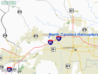
North Carolina Helicopters Heliport |
Location & QuickFacts
| FAA Information Effective: | 2008-09-25 |
| Airport Identifier: | 6NC6 |
| Airport Status: | Operational |
| Longitude/Latitude: | 081-14-49.2000W/35-16-55.8000N
-81.247000/35.282167 (Estimated) |
| Elevation: | 814 ft / 248.11 m (Estimated) |
| Land: | 0 acres |
| From nearest city: | 0 nautical miles S of Gastonia, NC |
| Location: | Gaston County, NC |
| Magnetic Variation: | 06W (2000) |
Owner & Manager
| Ownership: | Privately owned |
| Owner: | Reece Kelso |
| Address: | 125 Fraley Road
Gastonia, NC 28052 |
| Phone number: | 704-629-4677 |
| Manager: | Reece Kelso |
| Address: | 125 Fraley Road
Gastonia, NC 28052 |
| Phone number: | 704-629-4677 |
Airport Operations and Facilities
| Airport Use: | Private |
| Segmented Circle: | No |
| Control Tower: | No |
| Region: | ASO - Southern |
| Boundary ARTCC: | ZTL - Atlanta |
| Tie-in FSS: | RDU - Raleigh |
| FSS Toll Free: | 1-800-WX-BRIEF |
Runway Information
Helipad H1
| Dimension: | 25 x 25 ft / 7.6 x 7.6 m |
| Surface: | CONC, |
| |
Runway H1 |
Runway |
| Traffic Pattern: | Left | Left |
|
Radio Navigation Aids
| ID |
Type |
Name |
Ch |
Freq |
Var |
Dist |
| MRN | FAN MARKER | Lenoir | | | 03W | 36.0 nm |
| GHJ | NDB | Stonia | | 260.00 | 06W | 7.0 nm |
| IZN | NDB | Lincolnton | | 432.00 | 06W | 17.3 nm |
| SLP | NDB | First River | | 417.00 | 06W | 17.4 nm |
| UZ | NDB | Rally | | 227.00 | 05W | 24.9 nm |
| DCM | NDB | Chester | | 220.00 | 06W | 29.9 nm |
| HK | NDB | Tawba | | 332.00 | 06W | 30.5 nm |
| VW | NDB | Temky | | 280.00 | 05W | 30.9 nm |
| FIQ | NDB | Fiddlers | | 391.00 | 07W | 33.1 nm |
| TWL | NDB | Wesley | | 204.00 | 06W | 33.2 nm |
| RFE | NDB | Rutherford | | 344.00 | 05W | 34.9 nm |
| LKR | NDB | Lancaster | | 400.00 | 07W | 38.6 nm |
| UOT | NDB | Union County | | 326.00 | 04W | 40.9 nm |
| FRT | NDB | Fairmont | | 248.00 | 05W | 42.9 nm |
| RU | NDB | Rovdy | | 275.00 | 06W | 45.9 nm |
| CLT | VOR/DME | Charlotte | 097X | 115.00 | 05W | 15.5 nm |
| BZM | VOR/DME | Barretts Mountain | 045X | 110.80 | 06W | 35.3 nm |
| FML | VORTAC | Fort Mill | 071X | 112.40 | 02W | 22.7 nm |
| SPA | VORTAC | Spartanburg | 104X | 115.70 | 02W | 36.6 nm |
| CLT | VOT | Charlotte | | 112.00 | | 15.7 nm |
| HKY | VOT | Hickory Regional | | 110.00 | | 28.4 nm |
Remarks
- TALL TREES ALL QUADRANTS 180 FT FROM HELIPAD.
- PRVDD USE VFR TAKEOFF LANDING AREA APPROPRIATELY MKD; NON-OBSTRUCTING WING INDICATOR MAINTINED ADJACENT TO TAKEOFF/LANDING AREA.
Images and information placed above are from
http://www.airport-data.com/airport/6NC6/
We thank them for the data!
|
|


