|
|
 |
(Click on the photo to enlarge) |
Location & QuickFacts
| FAA Information Effective: | 2008-09-25 |
| Airport Identifier: | NC10 |
| Airport Status: | Operational |
| Longitude/Latitude: | 078-03-28.9740W/36-32-30.5270N
-78.058048/36.541813 (Estimated) |
| Elevation: | 275 ft / 83.82 m (Estimated) |
| Land: | 7 acres |
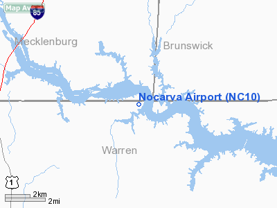
| From nearest city: | 6 nautical miles N of Macon, NC |
| Location: | Warren County, NC |
| Magnetic Variation: | 08W (1985) |
Owner & Manager
| Ownership: | Privately owned |
| Owner: | Nocarva Landowers Inc |
| Address: | Route 1 Box 49c
Macon, NC 27551 |
| Phone number: | 252-257-2881 |
| Manager: | Mr Milian
BOARD OF DIRECTORS NOCARVA LANDOWNERS. |
| Address: | Route 1 Box 92
Macon, NC 27551 |
| Phone number: | 252-257-4733 |
Airport Operations and Facilities
| Airport Use: | Private |
| Wind indicator: | No |
| Segmented Circle: | No |
| Control Tower: | No |
| Landing fee charge: | No |
| Sectional chart: | Washington |
| Region: | ASO - Southern |
| Boundary ARTCC: | ZDC - Washington |
| Tie-in FSS: | RDU - Raleigh |
| FSS on Airport: | No |
| FSS Toll Free: | 1-800-WX-BRIEF |
Airport Services
| Airframe Repair: | NONE |
| Power Plant Repair: | NONE |
| Bottled Oxygen: | NONE |
| Bulk Oxygen: | NONE |
Runway Information
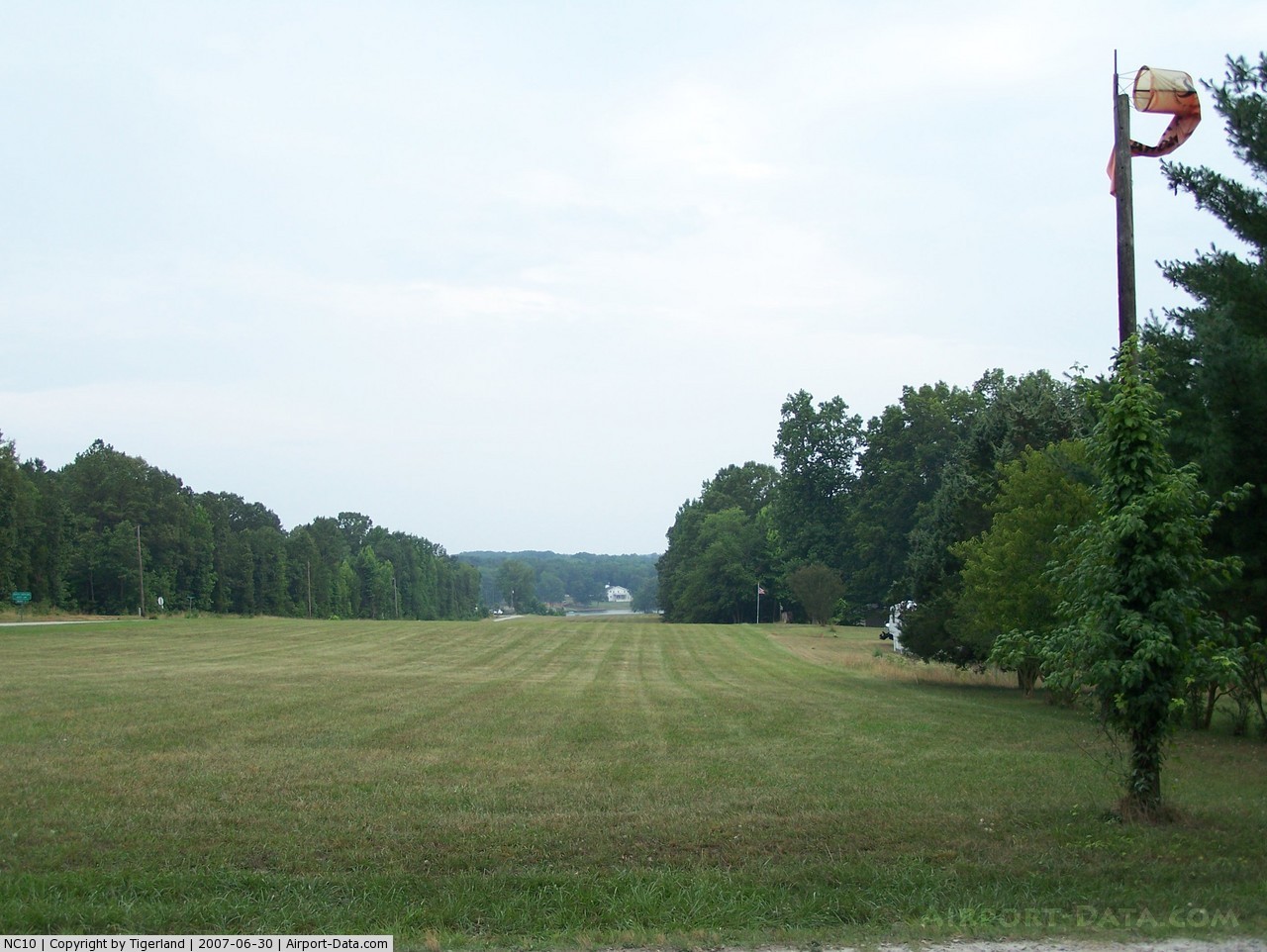
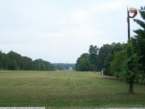
Runway 18/36
| Dimension: | 1900 x 100 ft / 579.1 x 30.5 m |
| Surface: | TURF, Fair Condition
HAS OCNL EROSION DAMAGE ON BARE AREAS. |
| |
Runway 18 |
Runway 36 |
| Traffic Pattern: | Left | Left |
| Obstruction: | 40 ft pline, 90 ft left of centerline | 90 ft trees, 0.0 ft from runway, 90 ft right of centerline |
|
Radio Navigation Aids
| ID |
Type |
Name |
Ch |
Freq |
Var |
Dist |
| AEA | NDB | Jones | | 373.00 | 09W | 4.4 nm |
| MBV | NDB | Mecklenburg/dcmsnd | | 356.00 | 08W | 9.0 nm |
| RZZ | NDB | Rapids | | 407.00 | 08W | 18.0 nm |
| HXO | NDB | Huntsboro | | 271.00 | 07W | 30.8 nm |
| ELQ | NDB | Emporia | | 261.00 | 10W | 30.9 nm |
| BKT | NDB | Blackstone | | 326.00 | 09W | 35.2 nm |
| PTB | NDB | Petersburg | | 284.00 | 08W | 42.3 nm |
| ETC | NDB | Tarboro | | 257.00 | 08W | 44.1 nm |
| ASJ | NDB | Ahoskie | | 415.00 | 10W | 45.1 nm |
| RW | NDB | Jambe | | 235.00 | 09W | 46.8 nm |
| LE | NDB | Leevy | | 350.00 | 07W | 49.0 nm |
| LVL | VORTAC | Lawrenceville | 076X | 112.90 | 08W | 18.2 nm |
| TYI | VORTAC | Tar River | 125X | 117.80 | 05W | 38.1 nm |
| SBV | VORTAC | South Boston | 041X | 110.40 | 05W | 46.8 nm |
Remarks
- WHEN WINDS PERMITS ALL TAKEOFFS SHOULD BE MADE TO AND ALL LANDINGS MADE FROM THE SOUTH BECAUSE OF STEEP GRADE OF STRIP.
- RWY 36 FIRST 800' HAS AREAS OF ROCKS & GRAVEL.
- NUMEROUS OBSTR INVOF ARPT AND PEOPLE ON RWY.
- RY 18/36 HAS -4 FT DITCH AT BOTH THRS.
- RY 36 HAS UPHILL GRADE.
- BOATS & TRAILERS OCNLLY PARKED ON SOUTH END RY 18/36.
- TERRAIN ELEVATION DROPS AT RY 36 END; LAKE 150 FT FROM THLD.
Images and information placed above are from
http://www.airport-data.com/airport/NC10/
We thank them for the data!
| General Info
|
| Country |
United States
|
| State |
NORTH CAROLINA
|
| FAA ID |
NC10
|
| Latitude |
36-32-30.527N
|
| Longitude |
078-03-28.974W
|
| Elevation |
275 feet
|
| Near City |
MACON
|
We don't guarantee the information is fresh and accurate. The data may
be wrong or outdated.
For more up-to-date information please refer to other sources.
|
|