 |
|
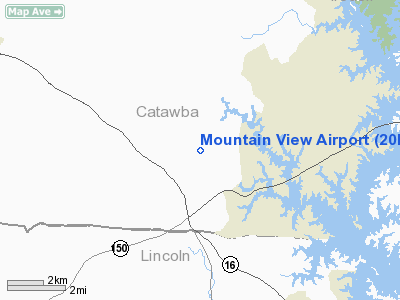
Location & QuickFacts
| FAA Information Effective: | 2008-09-25 |
| Airport Identifier: | 20NC |
| Airport Status: | Operational |
| Longitude/Latitude: | 081-03-21.2800W/35-35-32.4820N
-81.055911/35.592356 (Estimated) |
| Elevation: | 1020 ft / 310.90 m (Estimated) |
| Land: | 13 acres |
| From nearest city: | 6 nautical miles NW of Sherrills Ford, NC |
| Location: | Catawba County, NC |
| Magnetic Variation: | 05W (1990) |
Owner & Manager
| Ownership: | Privately owned |
| Owner: | R A Jeffords Jr |
| Address: | 3545 Mt Beulah Rd
Sherrills Ford, NC 28673 |
| Phone number: | 704-483-4330 |
| Address: |
|
Airport Operations and Facilities
| Airport Use: | Private |
| Wind indicator: | Yes |
| Segmented Circle: | No |
| Control Tower: | No |
| Sectional chart: | Charlotte |
| Region: | ASO - Southern |
| Boundary ARTCC: | ZTL - Atlanta |
| Tie-in FSS: | RDU - Raleigh |
| FSS Toll Free: | 1-800-WX-BRIEF |
Runway Information
Runway 03/21
| Dimension: | 2000 x 50 ft / 609.6 x 15.2 m |
| Surface: | TURF, |
| |
Runway 03 |
Runway 21 |
| Traffic Pattern: | Left | Left |
|
Radio Navigation Aids
| ID |
Type |
Name |
Ch |
Freq |
Var |
Dist |
| MRN | FAN MARKER | Lenoir | | | 03W | 30.3 nm |
| IZN | NDB | Lincolnton | | 432.00 | 06W | 3.6 nm |
| VW | NDB | Temky | | 280.00 | 05W | 11.0 nm |
| HK | NDB | Tawba | | 332.00 | 06W | 16.9 nm |
| GHJ | NDB | Stonia | | 260.00 | 06W | 24.6 nm |
| RU | NDB | Rovdy | | 275.00 | 06W | 28.9 nm |
| FIQ | NDB | Fiddlers | | 391.00 | 07W | 30.9 nm |
| UKF | NDB | Wilki | | 209.00 | 06W | 31.4 nm |
| SLP | NDB | First River | | 417.00 | 06W | 33.5 nm |
| DVZ | NDB | Davie | | 354.00 | 06W | 35.0 nm |
| SEN | NDB | Swearing/dcmsnd | | 260.00 | 06W | 38.7 nm |
| TWL | NDB | Wesley | | 204.00 | 06W | 42.1 nm |
| UZ | NDB | Rally | | 227.00 | 05W | 42.2 nm |
| ZEF | NDB | Zephyr | | 326.00 | 05W | 46.3 nm |
| RFE | NDB | Rutherford | | 344.00 | 05W | 46.3 nm |
| VU | NDB | Aller | | 346.00 | 06W | 48.1 nm |
| DCM | NDB | Chester | | 220.00 | 06W | 48.9 nm |
| BZM | VOR/DME | Barretts Mountain | 045X | 110.80 | 06W | 18.9 nm |
| CLT | VOR/DME | Charlotte | 097X | 115.00 | 05W | 24.7 nm |
| FML | VORTAC | Fort Mill | 071X | 112.40 | 02W | 36.6 nm |
| HKY | VOT | Hickory Regional | | 110.00 | | 18.6 nm |
| CLT | VOT | Charlotte | | 112.00 | | 23.4 nm |
Remarks
- VFR PVT USE; ALL TFC REMAIN E OF RY.
Images and information placed above are from
http://www.airport-data.com/airport/20NC/
We thank them for the data!
| General Info
|
| Country |
United States
|
| State |
NORTH CAROLINA
|
| FAA ID |
20NC
|
| Latitude |
35-35-32.482N
|
| Longitude |
081-03-21.280W
|
| Elevation |
1020 feet
|
| Near City |
SHERRILLS FORD
|
We don't guarantee the information is fresh and accurate. The data may
be wrong or outdated.
For more up-to-date information please refer to other sources.
|
|


