 |
|
Location & QuickFacts
| FAA Information Effective: | 2008-09-25 |
| Airport Identifier: | 2NC0 |
| Airport Status: | Operational |
| Longitude/Latitude: | 082-20-30.4590W/35-52-07.4080N
-82.341794/35.868724 (Estimated) |
| Elevation: | 4432 ft / 1350.87 m (Estimated) |
| Land: | 10 acres |
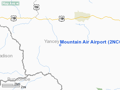
| From nearest city: | 6 nautical miles SW of Burnsville, NC |
| Location: | Yancey County, NC |
| Magnetic Variation: | 04W (1985) |
Owner & Manager
| Ownership: | Privately owned |
| Owner: | Mountain Air Development Corp |
| Address: | Po Box 1037
Burnsville, NC 28714 |
| Phone number: | 828-682-5600 |
| Manager: | Randy Banks |
| Address: | 321 Clubhouse Drive
Burnsville, NC 28714 |
| Phone number: | 828-682-4600 |
Airport Operations and Facilities
| Airport Use: | Private |
| Wind indicator: | Yes |
| Segmented Circle: | No |
| Control Tower: | No |
| Sectional chart: | Atlanta |
| Region: | ASO - Southern |
| Boundary ARTCC: | ZTL - Atlanta |
| Tie-in FSS: | RDU - Raleigh |
| FSS Toll Free: | 1-800-WX-BRIEF |
Airport Communications
Runway Information
Runway 14/32
| Dimension: | 2900 x 50 ft / 883.9 x 15.2 m |
| Surface: | ASPH, |
| |
Runway 14 |
Runway 32 |
| Traffic Pattern: | Left | Right |
|
Radio Navigation Aids
| ID |
Type |
Name |
Ch |
Freq |
Var |
Dist |
| MRN | FAN MARKER | Lenoir | | | 03W | 35.2 nm |
| EZT | NDB | Elizabethton | | 275.00 | 02W | 27.1 nm |
| BAR | NDB | Hemlock | | 320.00 | 02W | 28.2 nm |
| DYQ | NDB | Dulaney | | 263.00 | 04W | 31.1 nm |
| BO | NDB | Booie | | 221.00 | 04W | 32.7 nm |
| FIQ | NDB | Fiddlers | | 391.00 | 07W | 34.0 nm |
| BRA | NDB | Broad River | | 379.00 | 04W | 36.4 nm |
| RFE | NDB | Rutherford | | 344.00 | 05W | 36.6 nm |
| JJO | NDB | Mountain City | | 396.00 | 04W | 41.4 nm |
| RVN | NDB | Rogersville | | 329.00 | 04W | 44.0 nm |
| SUG | VORTAC | Sugarloaf Mountain | 059X | 112.20 | 02W | 28.0 nm |
| SOT | VORTAC | Snowbird | 025X | 108.80 | 04W | 34.9 nm |
| HMV | VORTAC | Holston Mountain | 093X | 114.60 | 04W | 35.7 nm |
| HKY | VOT | Hickory Regional | | 110.00 | | 47.0 nm |
Remarks
- PRVDD VFR, PRIVATE USE ONLY.
Images and information placed above are from
http://www.airport-data.com/airport/2NC0/
We thank them for the data!
| General Info
|
| Country |
United States
|
| State |
NORTH CAROLINA
|
| FAA ID |
2NC0
|
| Latitude |
35-52-07.408N
|
| Longitude |
082-20-30.459W
|
| Elevation |
4432 feet
|
| Near City |
BURNSVILLE
|
We don't guarantee the information is fresh and accurate. The data may
be wrong or outdated.
For more up-to-date information please refer to other sources.
|
|


