 |
|
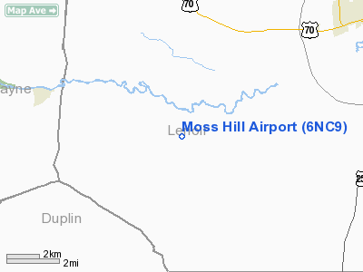
Location & QuickFacts
| FAA Information Effective: | 2008-09-25 |
| Airport Identifier: | 6NC9 |
| Airport Status: | Operational |
| Longitude/Latitude: | 077-45-01.9140W/35-12-07.5870N
-77.750532/35.202107 (Estimated) |
| Elevation: | 30 ft / 9.14 m (Estimated) |
| Land: | 0 acres |
| From nearest city: | 9 nautical miles SW of Kinston, NC |
| Location: | Lenoir County, NC |
| Magnetic Variation: | 07W (1985) |
Owner & Manager
| Ownership: | Privately owned |
| Owner: | Moss Hill Airport, Inc. |
| Address: | 4180 Davis Hardy Road
Kinston, NC 28504-7446 |
| Phone number: | 252-569-8161 |
| Manager: | John S. Davis |
| Address: | 4180 Davis Hardy Road
Kinston, NC 28504-7446 |
| Phone number: | 252-569-3956 |
Airport Operations and Facilities
| Airport Use: | Private |
| Wind indicator: | Yes |
| Segmented Circle: | No |
| Control Tower: | No |
| Sectional chart: | Charlotte |
| Region: | ASO - Southern |
| Boundary ARTCC: | ZDC - Washington |
| Tie-in FSS: | RDU - Raleigh |
| FSS Toll Free: | 1-800-WX-BRIEF |
Runway Information
Runway 01/19
| Dimension: | 3000 x 60 ft / 914.4 x 18.3 m |
| Surface: | TURF, |
| |
Runway 01 |
Runway 19 |
| Traffic Pattern: | Left | Left |
| Displaced threshold: | 0.00 ft | 300.00 ft |
|
Runway 13/31
| Dimension: | 1000 x 100 ft / 304.8 x 30.5 m |
| Surface: | TURF, |
| |
Runway 13 |
Runway 31 |
| Traffic Pattern: | Left | Left |
|
Radio Navigation Aids
| ID |
Type |
Name |
Ch |
Freq |
Var |
Dist |
| PGV | FAN MARKER | Belvoir | | | 06W | 31.9 nm |
| DKA | NDB | Kenan | | 332.00 | 07W | 11.4 nm |
| JYN | NDB | Wayne | | 208.00 | 08W | 20.8 nm |
| ACZ | NDB | Pendy | | 379.00 | 09W | 31.8 nm |
| NCA | NDB | New River | | 356.00 | 08W | 32.9 nm |
| CTZ | NDB | Clinton | | 412.00 | 08W | 33.1 nm |
| AQE | NDB | Alwood | | 230.00 | 09W | 35.6 nm |
| RW | NDB | Jambe | | 235.00 | 09W | 35.6 nm |
| RNW | NDB | Chocowinity | | 388.00 | 07W | 36.6 nm |
| JN | NDB | Jurly | | 263.00 | 09W | 36.9 nm |
| EUU | NDB | Jnall | | 251.00 | 07W | 38.3 nm |
| ETC | NDB | Tarboro | | 257.00 | 08W | 45.2 nm |
| HQT | NDB | Harnett | | 417.00 | 08W | 47.4 nm |
| MCZ | NDB | Williamston | | 336.00 | 09W | 48.4 nm |
| DIW | NDB/DME | Dixon | 107X | 198.00 | 08W | 40.8 nm |
| GSB | TACAN | Seymour Johnson | 112X | | 08W | 13.5 nm |
| NCA | TACAN | New River | 101X | | 08W | 33.4 nm |
| NKT | TACAN | Cherry Point | 075X | | 09W | 46.7 nm |
| NJM | TACAN | Bogue Mcalf | 067X | | 08W | 47.1 nm |
| EWN | VOR/DME | New Bern | 083X | 113.60 | 08W | 35.5 nm |
| ISO | VORTAC | Kinston | 033X | 109.60 | 05W | 13.9 nm |
| TYI | VORTAC | Tar River | 125X | 117.80 | 05W | 46.6 nm |
Remarks
Images and information placed above are from
http://www.airport-data.com/airport/6NC9/
We thank them for the data!
| General Info
|
| Country |
United States
|
| State |
NORTH CAROLINA
|
| FAA ID |
6NC9
|
| Latitude |
35-12-07.587N
|
| Longitude |
077-45-01.914W
|
| Elevation |
30 feet
|
| Near City |
KINSTON
|
We don't guarantee the information is fresh and accurate. The data may
be wrong or outdated.
For more up-to-date information please refer to other sources.
|
|


