|
|
| Moore County Airport |
| IATA: SOP – ICAO: KSOP – FAA LID: SOP |
| Summary |
| Operator |
Moore County |
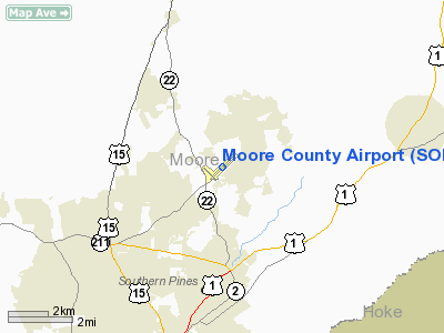
| Location |
Whispering Pines, North Carolina |
| Elevation AMSL |
461 ft / 140.5 m |
| Coordinates |
35°14′14″N 79°23′28″W / 35.23722°N 79.39111°W / 35.23722; -79.39111Coordinates: 35°14′14″N 79°23′28″W / 35.23722°N 79.39111°W / 35.23722; -79.39111 |
| Website |
http://www.moorecountyairport.com/ |
| Runways |
| Direction |
Length |
Surface |
| ft |
m |
| 5/23 |
5,503 |
1,677 |
Asphalt |
Moore County Airport (IATA: SOP, ICAO: KSOP, FAA LID: SOP) is a public airport located 3 miles (5 km) north of Southern Pines and 5 miles northeast of Pinehurst, in Moore County, North Carolina, USA. The airport covers 500 acres (202 ha) and has one runway, in the past it had a grass runway. The airport is used for general aviation, but has had commercial air service in the past.
On November 23, 2007, Delta Air Lines ended its seasonal service to Atlanta citing "poor load factors" and "insufficient facilities". A local task force did recently state that it would actively pursue a new carrier to serve the major golf destination. [1]
Relationship with Whispering Pines
Most of the Moore County Airport property lies within the extraterritorial jurisdiction of Whispering Pines, NC, prompting debate over who had ultimate regulatory power over it — the village of Whispering Pines or the Moore County Airport Authority. Because of this, the Airport Authority and the Whispering Pines Village Council have butted heads on occasion.
The rift was exacerbated by the Airport Authority's $2 million proposal which was approved by lawmakers, to build several large hangers using taxpayer funds. There was some concern within the village that the hangers would attract more aircraft and create additional noise. As a result, the Whispering Pines Village Council hinted at its desire to limit the airport's growth.[2]
However, a recent court ruling said the village had no legal juristiction over the airport because it operates under an independent authority that was established in 1993. Whispering Pines decided not to appeal the ruling as a result.[3]
The above content comes from Wikipedia and is published under free licenses – click here to read more.
 |
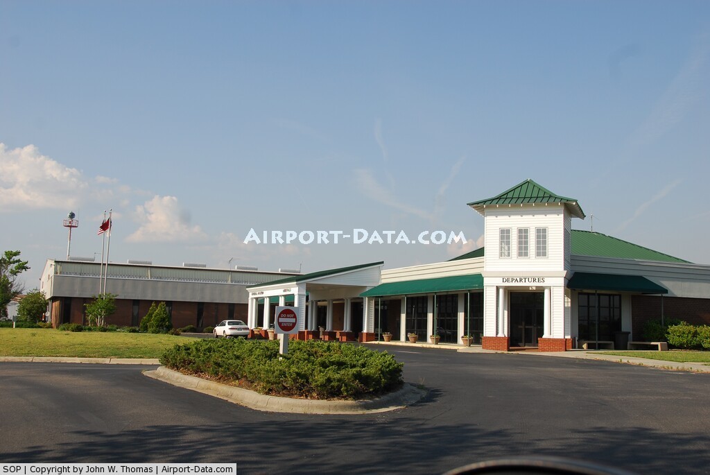
(Click on the photo to enlarge) |
 |
(Click on the photo to enlarge) |
Location & QuickFacts
| FAA Information Effective: | 2008-09-25 |
| Airport Identifier: | SOP |
| Airport Status: | Operational |
| Longitude/Latitude: | 079-23-19.6650W/35-14-15.4000N
-79.388796/35.237611 (Estimated) |
| Elevation: | 455 ft / 138.68 m (Estimated) |
| Land: | 500 acres |
| From nearest city: | 3 nautical miles N of Pinehurst/southern Pines, NC |
| Location: | Moore County, NC |
| Magnetic Variation: | 08W (2000) |
Owner & Manager
| Ownership: | Publicly owned |
| Owner: | County Of Moore |
| Address: | P O Box 905
Carthage, NC 28327 |
| Phone number: | 910-692-3212 |
| Manager: | Gary Barnum |
| Address: | 7865 Nc Hwy 22
Carthage, NC 28327 |
| Phone number: | 910-692-3212 |
Airport Operations and Facilities
| Airport Use: | Open to public |
| Wind indicator: | Yes |
| Segmented Circle: | Yes |
| Control Tower: | No |
| Lighting Schedule: | DUSK-DAWN
ACTVT HIRL RY 05/23, REIL RY 23 & TWY LGTS - CTAF. |
| Beacon Color: | Clear-Green (lighted land airport) |
| Landing fee charge: | No |
| Sectional chart: | Charlotte |
| Region: | ASO - Southern |
| Boundary ARTCC: | ZDC - Washington |
| Tie-in FSS: | RDU - Raleigh |
| FSS on Airport: | No |
| FSS Toll Free: | 1-800-WX-BRIEF |
| NOTAMs Facility: | SOP (NOTAM-d service avaliable) |
| Certification type/date: | IV A S 08/200
PPR FOR UNSKED ACR OPNS WITH MORE THAN 30 PSGR SEATS; CALL AMGR 910-692-3212. |
| Federal Agreements: | NGRY |
Airport Communications
| CTAF: | 123.050 |
| Unicom: | 123.050 |
Airport Services
| Fuel available: | 100LLA |
| Airframe Repair: | MAJOR |
| Power Plant Repair: | MAJOR |
| Bottled Oxygen: | HIGH |
| Bulk Oxygen: | NONE |
Runway Information
Runway 05/23
| Dimension: | 5503 x 150 ft / 1677.3 x 45.7 m |
| Surface: | ASPH, Good Condition |
| Surface Treatment: | Saw-cut or plastic Grooved |
| Weight Limit: | Single wheel: 30000 lbs.
Dual wheel: 58000 lbs. |
| Edge Lights: | High |
| |
Runway 05 |
Runway 23 |
| Longitude: | 079-23-43.6200W | 079-22-55.7100W |
| Latitude: | 35-13-56.5800N | 35-14-34.2200N |
| Elevation: | 456.00 ft | 431.00 ft |
| Alignment: | 46 | 127 |
| ILS Type: | ILS
| |
| Traffic Pattern: | Left | Left |
| Markings: | Precision instrument, Good Condition | Precision instrument, Good Condition |
| Crossing Height: | 48.00 ft | 39.00 ft |
| VASI: | 4-box on left side | 4-box on left side |
| Visual Glide Angle: | 3.00° | 3.00° |
| Approach lights: | MALS | |
| Runway End Identifier: | | Yes |
| Obstruction: | 14 ft road, 850.0 ft from runway, 220 ft left of centerline, 46:1 slope to clear | 20 ft tree, 700.0 ft from runway, 500 ft left of centerline, 25:1 slope to clear |
|
Radio Navigation Aids
| ID |
Type |
Name |
Ch |
Freq |
Var |
Dist |
| EEJ | NDB | Lee County/dcmsnd | | 428.00 | 07W | 11.5 nm |
| HFF | NDB | Mackall | | 278.00 | 06W | 13.5 nm |
| TT | NDB | Leeco | | 406.00 | 08W | 19.8 nm |
| POB | NDB | Pope | | 338.00 | 07W | 21.3 nm |
| RCZ | NDB | Roscoe | | 375.00 | 07W | 27.6 nm |
| FGP | NDB | Fort Bragg | | 393.00 | 07W | 28.9 nm |
| ME | NDB | Maxtn | | 257.00 | 08W | 30.4 nm |
| TOX | NDB | Siler City | | 371.00 | 07W | 31.7 nm |
| AFP | NDB | Anson County | | 283.00 | 07W | 36.5 nm |
| HQT | NDB | Harnett | | 417.00 | 08W | 36.9 nm |
| CQJ | NDB | City Lake | | 266.00 | 08W | 37.0 nm |
| VU | NDB | Aller | | 346.00 | 06W | 37.1 nm |
| CQW | NDB | Cheraw | | 409.00 | 05W | 37.9 nm |
| BES | NDB | Bennettsville | | 230.00 | 07W | 40.8 nm |
| RSY | NDB | Robeson | | 359.00 | 08W | 40.9 nm |
| JB | NDB | Jigel | | 384.00 | 08W | 43.4 nm |
| HB | NDB | Himun | | 361.00 | 08W | 45.5 nm |
| DLC | NDB | Dillon | | 274.00 | 05W | 47.3 nm |
| JN | NDB | Jurly | | 263.00 | 09W | 49.3 nm |
| POB | TACAN | Pope | 085X | | 07W | 18.6 nm |
| LBT | VOR | Lumberton | | 110.00 | 08W | 41.1 nm |
| FAY | VOR/DME | Fayetteville | 025X | 108.80 | 04W | 29.5 nm |
| SDZ | VORTAC | Sandhills | 055X | 111.80 | 03W | 9.9 nm |
| LIB | VORTAC | Liberty | 077X | 113.00 | 03W | 36.2 nm |
| RDU | VORTAC | Raleigh/durham | 119X | 117.20 | 04W | 48.3 nm |
Remarks
- NOISE ABATEMENT PROCEDURES IN EFFECT EXCEPT IN EMERG. HELICOPTERS USE RY 14/32 IN VFR CONDS. AVOID OVERFLY OF RESIDENTIAL AREA NE OF ARPT. MULTI ENGINE ACFT DEPARTING RWY 05 OR 23 MAINTAIN HEADING UNTIL REACHING 1500 FT MSL BEFORE TURNING.
- BIRD ACTVTY ON & INVOF ARPT APR-OCT.
- 12 HR PPR FOR JET OPNS CONDUCTED 2300-0600, CTC AMGR 910-692-3212.
Images and information placed above are from
http://www.airport-data.com/airport/SOP/
We thank them for the data!
| General Info
|
| Country |
United States
|
| State |
NORTH CAROLINA
|
| FAA ID |
SOP
|
| Latitude |
35-14-14.470N
|
| Longitude |
079-23-28.210W
|
| Elevation |
461 feet
|
| Near City |
PINEHURST/SOUTHERN PINES
|
We don't guarantee the information is fresh and accurate. The data may
be wrong or outdated.
For more up-to-date information please refer to other sources.
|
|