 |
|
| Charlotte-Monroe Executive Airport |
| IATA: none – ICAO: KEQY – FAA LID: EQY |
| Summary |
| Airport type |
Public |
| Owner |
City of Monroe |
| Serves |
Monroe, North Carolina |
| Elevation AMSL |
679 ft / 207 m |
| Coordinates |
35°01′08″N 080°37′13″W / 35.01889°N 80.62028°W / 35.01889; -80.62028 |
| Runways |
| Direction |
Length |
Surface |
| ft |
m |
| 5/23 |
5,500 |
1,676 |
Asphalt |
| Statistics (2008) |
| Aircraft operations |
56,100 |
| Based aircraft |
86 |
| Source: Federal Aviation Administration |
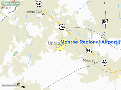
Charlotte-Monroe Executive Airport (ICAO: KEQY, FAA LID: EQY) is a public use airport located five nautical miles (9 km) northwest of the central business district of Monroe, a city in Union County, North Carolina, United States. It is owned by the City of Monroe and was formerly known as Monroe Regional Airport.
According to the FAA's National Plan of Integrated Airport Systems for 2009–2013, it is a reliever airport for Charlotte/Douglas International Airport.
Although many U.S. airports use the same three-letter location identifier for the FAA and IATA, this airport is assigned EQY by the FAA but has no designation from the IATA.
Facilities and aircraft
Charlotte-Monroe Executive Airport covers an area of 206 acres (83 ha) at an elevation of 679 feet (207 m) above mean sea level. It has one runway designated 5/23 with an asphalt surface measuring 5,500 by 100 feet (1,676 x 30 m).
For the 12-month period ending August 20, 2008, the airport had 56,100 aircraft operations, an average of 153 per day: 91% general aviation, 7% air taxi, and 1% military. At that time there were 86 aircraft based at this airport: 82.6% single-engine, 11.6% multi-engine, 3.5% jet and 2.3% helicopter.
As of October 18, 2007, the City of Monroe was requesting funding from state and federal sources for $25 million in improvements to Monroe Regional Airport. These improvements, to be finished by the summer of 2009, included extending the runway to up to 7500 feet, adding more hangars, and expanding the terminal.
The above content comes from Wikipedia and is published under free licenses – click here to read more.
Location & QuickFacts
| FAA Information Effective: | 2008-09-25 |
| Airport Identifier: | EQY |
| Airport Status: | Operational |
| Longitude/Latitude: | 080-37-12.8440W/35-01-07.8400N
-80.620234/35.018844 (Estimated) |
| Elevation: | 679 ft / 206.96 m (Surveyed) |
| Land: | 206 acres |
| From nearest city: | 5 nautical miles NW of Monroe, NC |
| Location: | Union County, NC |
| Magnetic Variation: | 06W (1990) |
Owner & Manager
| Ownership: | Publicly owned |
| Owner: | City Of Monroe |
| Address: | City Hall, P.o. Box 69
Monroe, NC 28111 |
| Phone number: | 704-282-4510 |
| Manager: | John Brattain |
| Address: | 3900 Paul J. Helms Drive
Monroe, NC 28110 |
| Phone number: | 704-226-2300 |
Airport Operations and Facilities
| Airport Use: | Open to public |
| Wind indicator: | Yes |
| Segmented Circle: | Yes |
| Control Tower: | No |
| Lighting Schedule: | DUSK-DAWN
ACTVT HIRL RY 05/23, MALSR RY 05 - CTAF. REIL RYS 05 & 23 OPER DUSK-0000. AFTER 0000, ACTVT - CTAF. |
| Beacon Color: | Clear-Green (lighted land airport) |
| Landing fee charge: | No |
| Sectional chart: | Charlotte |
| Region: | ASO - Southern |
| Boundary ARTCC: | ZTL - Atlanta |
| Tie-in FSS: | RDU - Raleigh |
| FSS on Airport: | No |
| FSS Toll Free: | 1-800-WX-BRIEF |
| NOTAMs Facility: | EQY (NOTAM-d service avaliable) |
| Federal Agreements: | NGY |
Airport Communications
| CTAF: | 122.700 |
| Unicom: | 122.700 |
Airport Services
| Fuel available: | 100LLA |
| Airframe Repair: | MAJOR |
| Power Plant Repair: | MAJOR |
| Bulk Oxygen: | HIGH/LOW |
Runway Information
Runway 05/23
| Dimension: | 5500 x 100 ft / 1676.4 x 30.5 m |
| Surface: | ASPH, Good Condition |
| Weight Limit: | Single wheel: 25000 lbs.
Dual wheel: 38000 lbs. |
| Edge Lights: | High |
| |
Runway 05 |
Runway 23 |
| Longitude: | 080-37-37.0100W | 080-36-48.6500W |
| Latitude: | 35-00-49.2300N | 35-01-26.3300N |
| Elevation: | 679.00 ft | 662.00 ft |
| Alignment: | 47 | 127 |
| ILS Type: | LOC/GS
| |
| Traffic Pattern: | Left | Left |
| Markings: | Precision instrument, Fair Condition | Precision instrument, Good Condition |
| Crossing Height: | 41.00 ft | 44.00 ft |
| VASI: | 2-light PAPI on left side | 2-light PAPI on left side |
| Visual Glide Angle: | 3.00° | 3.00° |
| Approach lights: | MALSR | |
| Runway End Identifier: | Yes | Yes |
| Obstruction: | , 50:1 slope to clear | 15 ft road, 210.0 ft from runway, 260 ft left of centerline
+15 FT ROAD 260 FT L FM THLD 200 FT OUT. |
|
Radio Navigation Aids
| ID |
Type |
Name |
Ch |
Freq |
Var |
Dist |
| TWL | NDB | Wesley | | 204.00 | 06W | 5.8 nm |
| LKR | NDB | Lancaster | | 400.00 | 07W | 21.3 nm |
| PYG | NDB | Pageland | | 270.00 | 06W | 21.6 nm |
| UZ | NDB | Rally | | 227.00 | 05W | 24.0 nm |
| AFP | NDB | Anson County | | 283.00 | 07W | 26.4 nm |
| GHJ | NDB | Stonia | | 260.00 | 06W | 28.4 nm |
| DCM | NDB | Chester | | 220.00 | 06W | 31.9 nm |
| IZN | NDB | Lincolnton | | 432.00 | 06W | 38.7 nm |
| VU | NDB | Aller | | 346.00 | 06W | 38.7 nm |
| CQW | NDB | Cheraw | | 409.00 | 05W | 40.8 nm |
| RU | NDB | Rovdy | | 275.00 | 06W | 43.4 nm |
| CDN | NDB | Camden | | 263.00 | 05W | 44.3 nm |
| HVS | NDB | Hartsville | | 341.00 | 07W | 44.3 nm |
| RCZ | NDB | Roscoe | | 375.00 | 07W | 46.7 nm |
| SEN | NDB | Swearing/dcmsnd | | 260.00 | 06W | 48.4 nm |
| FDW | NDB | Winnsboro | | 414.00 | 05W | 48.8 nm |
| BES | NDB | Bennettsville | | 230.00 | 07W | 49.9 nm |
| CLT | VOR/DME | Charlotte | 097X | 115.00 | 05W | 19.3 nm |
| CTF | VOR/DME | Chesterfield | 019X | 108.20 | 03W | 27.9 nm |
| FML | VORTAC | Fort Mill | 071X | 112.40 | 02W | 16.6 nm |
| CLT | VOT | Charlotte | | 112.00 | | 19.6 nm |
Remarks
- ARPT PHONE NUMBER 704-226-2300.
- HOLD LINES ARE NSTD; CLOSER THAN RECOMMENDED.
- PAEW INVOF RY 05 & AER.
Images and information placed above are from
http://www.airport-data.com/airport/EQY/
We thank them for the data!
| General Info
|
| Country |
United States
|
| State |
NORTH CAROLINA
|
| FAA ID |
EQY
|
| Latitude |
35-01-07.835N
|
| Longitude |
080-37-12.844W
|
| Elevation |
679 feet
|
| Near City |
MONROE
|
We don't guarantee the information is fresh and accurate. The data may
be wrong or outdated.
For more up-to-date information please refer to other sources.
|
|


