 |
|
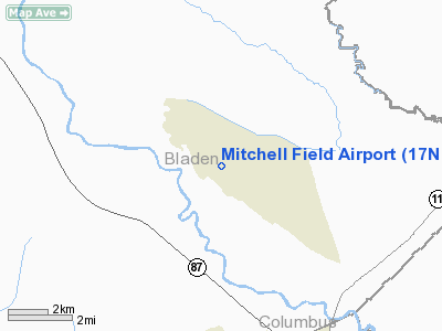
Location & QuickFacts
| FAA Information Effective: | 2008-09-25 |
| Airport Identifier: | 17NC |
| Airport Status: | Operational |
| Longitude/Latitude: | 078-19-43.0050W/34-27-58.6070N
-78.328613/34.466280 (Estimated) |
| Elevation: | 23 ft / 7.01 m (Estimated) |
| Land: | 0 acres |
| From nearest city: | 17 nautical miles SE of Elizabethtown, NC |
| Location: | Bladen County, NC |
| Magnetic Variation: | 07W (1990) |
Owner & Manager
| Ownership: | Privately owned |
| Owner: | Charles G. Mitchell |
| Address: | Route 1 Box 113
Kelly, NC 28448 |
| Phone number: | 910-669-2045 |
| Manager: | Charles G. Mitchell |
| Address: | Route 1 Box 113
Kelly, NC 28448 |
| Phone number: | 919-669-2045 |
Airport Operations and Facilities
| Airport Use: | Private |
| Wind indicator: | Yes |
| Segmented Circle: | No |
| Control Tower: | No |
| Sectional chart: | Charlotte |
| Region: | ASO - Southern |
| Boundary ARTCC: | ZDC - Washington |
| Tie-in FSS: | RDU - Raleigh |
| FSS on Airport: | No |
| FSS Toll Free: | 1-800-WX-BRIEF |
Runway Information
Runway 15/33
| Dimension: | 2100 x 90 ft / 640.1 x 27.4 m |
| Surface: | TURF, |
| Weight Limit: | Dual wheel: 180000 lbs. |
| |
Runway 15 |
Runway 33 |
| Traffic Pattern: | Left | Left |
| Obstruction: | | 132 ft , 3450.0 ft from runway, 24:1 slope to clear |
|
Radio Navigation Aids
| ID |
Type |
Name |
Ch |
Freq |
Var |
Dist |
| TGQ | NDB | Elizabethtown | | 398.00 | 08W | 10.0 nm |
| ACZ | NDB | Pendy | | 379.00 | 09W | 22.0 nm |
| CPC | NDB | Camp | | 227.00 | 07W | 22.4 nm |
| CLB | NDB | Carolina Beach | | 216.00 | 04W | 28.3 nm |
| CTZ | NDB | Clinton | | 412.00 | 08W | 30.7 nm |
| SUT | NDB | Yaupon | | 233.00 | 08W | 34.7 nm |
| RSY | NDB | Robeson | | 359.00 | 08W | 37.3 nm |
| JB | NDB | Jigel | | 384.00 | 08W | 40.4 nm |
| DKA | NDB | Kenan | | 332.00 | 07W | 41.7 nm |
| FGP | NDB | Fort Bragg | | 393.00 | 07W | 47.0 nm |
| NCA | NDB | New River | | 356.00 | 08W | 47.1 nm |
| DIW | NDB/DME | Dixon | 107X | 198.00 | 08W | 43.8 nm |
| NCA | TACAN | New River | 101X | | 08W | 46.3 nm |
| LBT | VOR | Lumberton | | 110.00 | 08W | 37.0 nm |
| FAY | VOR/DME | Fayetteville | 025X | 108.80 | 04W | 41.3 nm |
| ILM | VORTAC | Wilmington | 117X | 117.00 | 07W | 23.6 nm |
| CRE | VORTAC | Grand Strand | 123X | 117.60 | 03W | 43.9 nm |
Remarks
Images and information placed above are from
http://www.airport-data.com/airport/17NC/
We thank them for the data!
| General Info
|
| Country |
United States
|
| State |
NORTH CAROLINA
|
| FAA ID |
17NC
|
| Latitude |
34-27-58.607N
|
| Longitude |
078-19-43.005W
|
| Elevation |
23 feet
|
| Near City |
ELIZABETHTOWN
|
We don't guarantee the information is fresh and accurate. The data may
be wrong or outdated.
For more up-to-date information please refer to other sources.
|
|


