 |
|
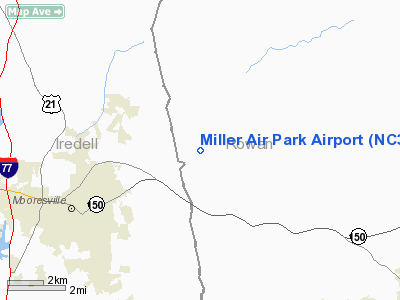
Location & QuickFacts
| FAA Information Effective: | 2008-09-25 |
| Airport Identifier: | NC30 |
| Airport Status: | Operational |
| Longitude/Latitude: | 080-44-29.2530W/35-36-50.4990N
-80.741459/35.614027 (Estimated) |
| Elevation: | 864 ft / 263.35 m (Surveyed) |
| Land: | 10 acres |
| From nearest city: | 3 nautical miles NE of Mooresville, NC |
| Location: | Rowan County, NC |
| Magnetic Variation: | 05W (1985) |
Owner & Manager
| Ownership: | Privately owned |
| Owner: | Miller Air Park |
| Address: | 120 Airpark Drive
Mooresville, NC 28115-6966 |
| Phone number: | 704-664-2831 |
| Manager: | Howard Miller |
| Address: | 2970 Hope Valley Rd
Winston Salem, NC 27106 |
| Phone number: | 336-765-6857 |
Airport Operations and Facilities
| Airport Use: | Private |
| Wind indicator: | Yes |
| Segmented Circle: | No |
| Control Tower: | No |
| Sectional chart: | Charlotte |
| Region: | ASO - Southern |
| Boundary ARTCC: | ZTL - Atlanta |
| Tie-in FSS: | RDU - Raleigh |
| FSS Toll Free: | 1-800-WX-BRIEF |
Airport Services
Runway Information
Runway 18/36
| Dimension: | 2060 x 100 ft / 627.9 x 30.5 m |
| Surface: | TURF, Fair Condition |
| |
Runway 18 |
Runway 36 |
| Traffic Pattern: | Left | Left |
| Markings: | None, | None, |
| Runway End Identifier: | No | No |
| Centerline Lights: | No | No |
| Touchdown Lights: | No | No |
| Obstruction: | 50 ft trees, 200.0 ft from runway, 4:1 slope to clear | 30 ft trees, 0.0 ft from runway, 100 ft left of centerline |
|
Radio Navigation Aids
| ID |
Type |
Name |
Ch |
Freq |
Var |
Dist |
| MRN | FAN MARKER | Lenoir | | | 03W | 44.5 nm |
| RU | NDB | Rovdy | | 275.00 | 06W | 14.2 nm |
| IZN | NDB | Lincolnton | | 432.00 | 06W | 17.5 nm |
| VW | NDB | Temky | | 280.00 | 05W | 18.5 nm |
| DVZ | NDB | Davie | | 354.00 | 06W | 22.8 nm |
| SEN | NDB | Swearing/dcmsnd | | 260.00 | 06W | 23.8 nm |
| HK | NDB | Tawba | | 332.00 | 06W | 29.4 nm |
| GHJ | NDB | Stonia | | 260.00 | 06W | 32.6 nm |
| VU | NDB | Aller | | 346.00 | 06W | 33.2 nm |
| UKF | NDB | Wilki | | 209.00 | 06W | 34.7 nm |
| TWL | NDB | Wesley | | 204.00 | 06W | 39.8 nm |
| ZEF | NDB | Zephyr | | 326.00 | 05W | 42.0 nm |
| CQJ | NDB | City Lake | | 266.00 | 08W | 43.2 nm |
| FIQ | NDB | Fiddlers | | 391.00 | 07W | 45.8 nm |
| UZ | NDB | Rally | | 227.00 | 05W | 46.6 nm |
| AZW | NDB | Mount Airy | | 223.00 | 07W | 47.1 nm |
| SLP | NDB | First River | | 417.00 | 06W | 47.3 nm |
| AFP | NDB | Anson County | | 283.00 | 07W | 48.0 nm |
| CLT | VOR/DME | Charlotte | 097X | 115.00 | 05W | 27.5 nm |
| BZM | VOR/DME | Barretts Mountain | 045X | 110.80 | 06W | 28.8 nm |
| FML | VORTAC | Fort Mill | 071X | 112.40 | 02W | 39.0 nm |
| GSO | VORTAC | Greensboro | 109X | 116.20 | 03W | 45.4 nm |
| CLT | VOT | Charlotte | | 112.00 | | 25.9 nm |
| HKY | VOT | Hickory Regional | | 110.00 | | 32.6 nm |
Remarks
- VFR OPERATIONS ONLY.
- PRIOR TO 1958
Images and information placed above are from
http://www.airport-data.com/airport/NC30/
We thank them for the data!
| General Info
|
| Country |
United States
|
| State |
NORTH CAROLINA
|
| FAA ID |
NC30
|
| Latitude |
35-36-50.499N
|
| Longitude |
080-44-29.253W
|
| Elevation |
864 feet
|
| Near City |
MOORESVILLE
|
We don't guarantee the information is fresh and accurate. The data may
be wrong or outdated.
For more up-to-date information please refer to other sources.
|
|


