 |
|
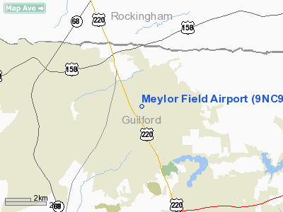
Location & QuickFacts
| FAA Information Effective: | 2008-09-25 |
| Airport Identifier: | 9NC9 |
| Airport Status: | Operational |
| Longitude/Latitude: | 079-53-42.1290W/36-12-36.4880N
-79.895036/36.210136 (Estimated) |
| Elevation: | 910 ft / 277.37 m (Estimated) |
| Land: | 28 acres |
| From nearest city: | 5 nautical miles NW of Greensboro, NC |
| Location: | Guilford County, NC |
| Magnetic Variation: | 07W (1990) |
Owner & Manager
| Ownership: | Privately owned |
| Owner: | Dean Meylor |
| Address: | 306a Muirs Chapel Rd
Greensboro, NC 27410 |
| Phone number: | 336-852-2222 |
| Manager: | Dean Meylor |
| Address: | 2237 Scalesville Road
Summerfield, NC 27358 |
| Phone number: | 336-643-9797 |
Airport Operations and Facilities
| Airport Use: | Private
PERSONAL USE. |
| Wind indicator: | Yes |
| Segmented Circle: | No |
| Control Tower: | No |
| Sectional chart: | Charlotte |
| Region: | ASO - Southern |
| Boundary ARTCC: | ZDC - Washington |
| Tie-in FSS: | RDU - Raleigh |
| FSS on Airport: | No |
| FSS Toll Free: | 1-800-WX-BRIEF |
Runway Information
Runway 09/27
| Dimension: | 1500 x 50 ft / 457.2 x 15.2 m |
| Surface: | TURF, |
| |
Runway 09 |
Runway 27 |
| Traffic Pattern: | Right | Right |
|
Radio Navigation Aids
| ID |
Type |
Name |
Ch |
Freq |
Var |
Dist |
| OQA | FAN MARKER | Rockingham County | | | | 13.4 nm |
| SIF | NDB | Slammer | | 423.00 | 07W | 12.2 nm |
| HB | NDB | Himun | | 361.00 | 08W | 20.5 nm |
| UV | NDB | Bales | | 396.00 | 07W | 22.8 nm |
| CQJ | NDB | City Lake | | 266.00 | 08W | 29.7 nm |
| SEN | NDB | Swearing/dcmsnd | | 260.00 | 06W | 32.4 nm |
| DVZ | NDB | Davie | | 354.00 | 06W | 32.6 nm |
| AZW | NDB | Mount Airy | | 223.00 | 07W | 32.9 nm |
| TOX | NDB | Siler City | | 371.00 | 07W | 34.2 nm |
| HUR | NDB | Person | | 220.00 | 08W | 40.2 nm |
| ZEF | NDB | Zephyr | | 326.00 | 05W | 40.6 nm |
| RU | NDB | Rovdy | | 275.00 | 06W | 40.7 nm |
| VU | NDB | Aller | | 346.00 | 06W | 44.3 nm |
| DAN | VOR | Danville | | 113.10 | 06W | 34.6 nm |
| GSO | VORTAC | Greensboro | 109X | 116.20 | 03W | 10.6 nm |
| LIB | VORTAC | Liberty | 077X | 113.00 | 03W | 27.6 nm |
Remarks
- PRVDD OPNS CONDUCTED IN VFR WEATHER CONDITIONS; LMTD TO PVT USE.
Images and information placed above are from
http://www.airport-data.com/airport/9NC9/
We thank them for the data!
| General Info
|
| Country |
United States
|
| State |
NORTH CAROLINA
|
| FAA ID |
9NC9
|
| Latitude |
36-12-36.488N
|
| Longitude |
079-53-42.129W
|
| Elevation |
910 feet
|
| Near City |
GREENSBORO
|
We don't guarantee the information is fresh and accurate. The data may
be wrong or outdated.
For more up-to-date information please refer to other sources.
|
|


