 |
|
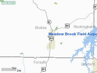
Meadow Brook Field Airport |
Location & QuickFacts
| FAA Information Effective: | 2008-09-25 |
| Airport Identifier: | N63 |
| Airport Status: | Operational |
| Longitude/Latitude: | 080-08-54.1650W/36-18-05.4940N
-80.148379/36.301526 (Estimated) |
| Elevation: | 631 ft / 192.33 m (Surveyed) |
| Land: | 24 acres |
| From nearest city: | 1 nautical miles NW of Walnut Cove, NC |
| Location: | Stokes County, NC |
| Magnetic Variation: | 06W (1980) |
Owner & Manager
| Ownership: | Privately owned |
| Owner: | Charles E. Lasley |
| Address: | 1060 Airport Road
Walnut Cove, NC 27052 |
| Phone number: | 336-591-7881 |
| Manager: | Charles E. Lasley |
| Address: | 1060 Airport Road
Walnut Cove, NC 27052 |
| Phone number: | 336-591-5784 |
Airport Operations and Facilities
| Airport Use: | Open to public |
| Wind indicator: | Yes |
| Segmented Circle: | No |
| Control Tower: | No |
| Lighting Schedule: | RDO-CTL
ACTVT LIRL RY 16/34 - CTAF. |
| Landing fee charge: | No |
| Sectional chart: | Cincinnati |
| Region: | ASO - Southern |
| Boundary ARTCC: | ZTL - Atlanta |
| Tie-in FSS: | RDU - Raleigh |
| FSS on Airport: | No |
| FSS Toll Free: | 1-800-WX-BRIEF |
| NOTAMs Facility: | RDU (NOTAM-d service avaliable) |
Airport Communications
| CTAF: | 123.000 |
| Unicom: | 123.000 |
Airport Services
| Fuel available: | 100LL |
| Airframe Repair: | MAJOR |
| Power Plant Repair: | MAJOR |
Runway Information
Runway 16/34
| Dimension: | 2725 x 30 ft / 830.6 x 9.1 m |
| Surface: | ASPH, Good Condition |
| Edge Lights: | Non-standard lighting system
NSTD LIRL; LGTS 30 FT EITHER SIDE OF ASPH ALONG OLD TURF RY. 3 THR LGTS WITH BLUE LENS. |
| |
Runway 16 |
Runway 34 |
| Latitude: | | 36-17-52.8300N |
| Elevation: | 0.00 ft | 631.00 ft |
| Traffic Pattern: | Left | Left |
| Markings: | Nonstandard, Fair Condition
RY 16/34 NRS NSTD - SMALLER THAN NORMAL AND FADED. | Nonstandard, Fair Condition |
| Obstruction: | 90 ft trees, 765.0 ft from runway, 250 ft right of centerline, 6:1 slope to clear
+6 FT TREES 75 FT FROM THLD 125 FT RIGHT. | 85 ft trees, 830.0 ft from runway, 310 ft left of centerline, 7:1 slope to clear
RWY 34 +3 FT FENCE 30 FT FM THR BOTH SIDES OF CNTRLN. |
|
Radio Navigation Aids
| ID |
Type |
Name |
Ch |
Freq |
Var |
Dist |
| OQA | FAN MARKER | Rockingham County | | | | 17.2 nm |
| SIF | NDB | Slammer | | 423.00 | 07W | 19.3 nm |
| AZW | NDB | Mount Airy | | 223.00 | 07W | 19.6 nm |
| UV | NDB | Bales | | 396.00 | 07W | 20.6 nm |
| DVZ | NDB | Davie | | 354.00 | 06W | 27.7 nm |
| ZEF | NDB | Zephyr | | 326.00 | 05W | 27.9 nm |
| SEN | NDB | Swearing/dcmsnd | | 260.00 | 06W | 32.2 nm |
| HB | NDB | Himun | | 361.00 | 08W | 33.6 nm |
| CQJ | NDB | City Lake | | 266.00 | 08W | 37.8 nm |
| RU | NDB | Rovdy | | 275.00 | 06W | 38.0 nm |
| HLX | NDB | Hillsville | | 269.00 | 06W | 42.7 nm |
| TOX | NDB | Siler City | | 371.00 | 07W | 46.5 nm |
| UKF | NDB | Wilki | | 209.00 | 06W | 47.4 nm |
| VU | NDB | Aller | | 346.00 | 06W | 49.0 nm |
| DAN | VOR | Danville | | 113.10 | 06W | 42.4 nm |
| GSO | VORTAC | Greensboro | 109X | 116.20 | 03W | 17.5 nm |
| LIB | VORTAC | Liberty | 077X | 113.00 | 03W | 39.3 nm |
Remarks
- HIGH TERRAIN IN ALL QUADRANTS.
- +50 FT TREES WITHIN 125 FT OF CNTRLN ON W SIDE OF RY. +65 FT TREES WITHIN 110 FT OF CNTRLN E OF RY.
- FENCING IN THE CLEAR ZONE RYS 16 & 34.
- +8 FT DROPOFF AER RY 16.
- ARPT CLSD TO TSNTS EXCP PPR CALL 336-591-7881.
- DO NOT LAND ON GRASS ADJACENT TO RWY-DEEP DITCHES
- NO TRANSIENT STOPPING TRAFFIC- WILL ALLOW TOUCH AND GO
- VFR USE ONLY.
Images and information placed above are from
http://www.airport-data.com/airport/N63/
We thank them for the data!
| General Info
|
| Country |
United States
|
| State |
NORTH CAROLINA
|
| FAA ID |
N63
|
| Latitude |
36-18-05.494N
|
| Longitude |
080-08-54.165W
|
| Elevation |
631 feet
|
| Near City |
WALNUT COVE
|
We don't guarantee the information is fresh and accurate. The data may
be wrong or outdated.
For more up-to-date information please refer to other sources.
|
|


