 |
|
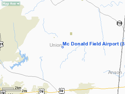
Location & QuickFacts
| FAA Information Effective: | 2008-09-25 |
| Airport Identifier: | 3NC4 |
| Airport Status: | Operational |
| Longitude/Latitude: | 080-24-32.2320W/35-03-12.5390N
-80.408953/35.053483 (Estimated) |
| Elevation: | 545 ft / 166.12 m (Estimated) |
| Land: | 0 acres |
| From nearest city: | 5 nautical miles NW of Marshville, NC |
| Location: | Union County, NC |
| Magnetic Variation: | 05W (1985) |
Owner & Manager
| Ownership: | Privately owned |
| Owner: | James R. & Margaret B. Mcdonald |
| Address: | 2708 Mills Harris Road
Marshville, NC 28103 |
| Phone number: | 704-309-6264 |
| Address: |
|
Airport Operations and Facilities
| Airport Use: | Private |
| Wind indicator: | Yes |
| Segmented Circle: | No |
| Control Tower: | No |
| Landing fee charge: | No |
| Sectional chart: | Charlotte |
| Region: | ASO - Southern |
| Boundary ARTCC: | ZTL - Atlanta |
| Tie-in FSS: | RDU - Raleigh |
| FSS on Airport: | No |
| FSS Toll Free: | 1-800-WX-BRIEF |
Runway Information
Runway 03/21
| Dimension: | 4000 x 100 ft / 1219.2 x 30.5 m |
| Surface: | TURF, |
| |
Runway 03 |
Runway 21 |
| Traffic Pattern: | Left | Left |
|
Radio Navigation Aids
| ID |
Type |
Name |
Ch |
Freq |
Var |
Dist |
| TWL | NDB | Wesley | | 204.00 | 06W | 15.8 nm |
| AFP | NDB | Anson County | | 283.00 | 07W | 16.1 nm |
| PYG | NDB | Pageland | | 270.00 | 06W | 18.9 nm |
| LKR | NDB | Lancaster | | 400.00 | 07W | 29.7 nm |
| VU | NDB | Aller | | 346.00 | 06W | 30.7 nm |
| CQW | NDB | Cheraw | | 409.00 | 05W | 32.7 nm |
| UZ | NDB | Rally | | 227.00 | 05W | 34.5 nm |
| RCZ | NDB | Roscoe | | 375.00 | 07W | 37.2 nm |
| GHJ | NDB | Stonia | | 260.00 | 06W | 37.7 nm |
| RU | NDB | Rovdy | | 275.00 | 06W | 41.0 nm |
| HVS | NDB | Hartsville | | 341.00 | 07W | 41.4 nm |
| DCM | NDB | Chester | | 220.00 | 06W | 42.2 nm |
| BES | NDB | Bennettsville | | 230.00 | 07W | 42.3 nm |
| SEN | NDB | Swearing/dcmsnd | | 260.00 | 06W | 44.0 nm |
| IZN | NDB | Lincolnton | | 432.00 | 06W | 44.2 nm |
| UDG | NDB | Darlington | | 245.00 | 06W | 44.8 nm |
| HFF | NDB | Mackall | | 278.00 | 06W | 45.5 nm |
| CDN | NDB | Camden | | 263.00 | 05W | 46.9 nm |
| CQJ | NDB | City Lake | | 266.00 | 08W | 47.9 nm |
| CTF | VOR/DME | Chesterfield | 019X | 108.20 | 03W | 25.1 nm |
| CLT | VOR/DME | Charlotte | 097X | 115.00 | 05W | 27.9 nm |
| FML | VORTAC | Fort Mill | 071X | 112.40 | 02W | 27.1 nm |
| SDZ | VORTAC | Sandhills | 055X | 111.80 | 03W | 41.5 nm |
| CLT | VOT | Charlotte | | 112.00 | | 27.8 nm |
Remarks
Images and information placed above are from
http://www.airport-data.com/airport/3NC4/
We thank them for the data!
| General Info
|
| Country |
United States
|
| State |
NORTH CAROLINA
|
| FAA ID |
3NC4
|
| Latitude |
35-03-12.539N
|
| Longitude |
080-24-32.232W
|
| Elevation |
545 feet
|
| Near City |
MARSHVILLE
|
We don't guarantee the information is fresh and accurate. The data may
be wrong or outdated.
For more up-to-date information please refer to other sources.
|
|


