 |
|
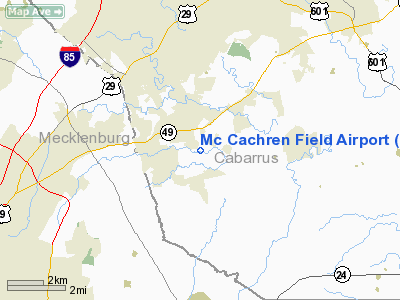
Location & QuickFacts
| FAA Information Effective: | 2008-09-25 |
| Airport Identifier: | 3NC6 |
| Airport Status: | Operational |
| Longitude/Latitude: | 080-38-39.2450W/35-18-42.5100N
-80.644235/35.311808 (Estimated) |
| Elevation: | 565 ft / 172.21 m (Estimated) |
| Land: | 20 acres |
| From nearest city: | 1 nautical miles S of Harrisburg, NC |
| Location: | Cabarrus County, NC |
| Magnetic Variation: | 05W (1984) |
Owner & Manager
| Ownership: | Privately owned |
| Owner: | Yates M. Mc Cachren, Jr. |
| Address: | 6925 Hickory Ridge Road
Harrisburg, NC 28075-9676 |
| Phone number: | 704-455-2754 |
| Manager: | Yates M. Mc Cachren, Jr. |
| Address: | 6925 Hickory Ridge Road
Harrisburg, NC 28075-9676 |
| Phone number: | 704-939-2583 |
Airport Operations and Facilities
| Airport Use: | Private |
| Wind indicator: | Yes |
| Segmented Circle: | No |
| Control Tower: | No |
| Landing fee charge: | No |
| Sectional chart: | Charlotte |
| Region: | ASO - Southern |
| Boundary ARTCC: | ZTL - Atlanta |
| Tie-in FSS: | RDU - Raleigh |
| FSS on Airport: | No |
| FSS Toll Free: | 1-800-WX-BRIEF |
Airport Communications
Runway Information
Runway 09/27
| Dimension: | 2300 x 23 ft / 701.0 x 7.0 m |
| Surface: | TURF, |
| |
Runway 09 |
Runway 27 |
| Traffic Pattern: | Left | Left |
| Displaced threshold: | 300.00 ft | 400.00 ft |
|
Radio Navigation Aids
| ID |
Type |
Name |
Ch |
Freq |
Var |
Dist |
| TWL | NDB | Wesley | | 204.00 | 06W | 21.8 nm |
| IZN | NDB | Lincolnton | | 432.00 | 06W | 25.6 nm |
| GHJ | NDB | Stonia | | 260.00 | 06W | 26.2 nm |
| RU | NDB | Rovdy | | 275.00 | 06W | 26.4 nm |
| VU | NDB | Aller | | 346.00 | 06W | 29.6 nm |
| AFP | NDB | Anson County | | 283.00 | 07W | 32.6 nm |
| SEN | NDB | Swearing/dcmsnd | | 260.00 | 06W | 32.8 nm |
| UZ | NDB | Rally | | 227.00 | 05W | 33.2 nm |
| VW | NDB | Temky | | 280.00 | 05W | 34.6 nm |
| LKR | NDB | Lancaster | | 400.00 | 07W | 36.9 nm |
| PYG | NDB | Pageland | | 270.00 | 06W | 37.3 nm |
| DVZ | NDB | Davie | | 354.00 | 06W | 37.3 nm |
| DCM | NDB | Chester | | 220.00 | 06W | 41.8 nm |
| HK | NDB | Tawba | | 332.00 | 06W | 43.1 nm |
| CQJ | NDB | City Lake | | 266.00 | 08W | 45.2 nm |
| SLP | NDB | First River | | 417.00 | 06W | 47.0 nm |
| CLT | VOR/DME | Charlotte | 097X | 115.00 | 05W | 16.8 nm |
| CTF | VOR/DME | Chesterfield | 019X | 108.20 | 03W | 43.7 nm |
| BZM | VOR/DME | Barretts Mountain | 045X | 110.80 | 06W | 44.4 nm |
| FML | VORTAC | Fort Mill | 071X | 112.40 | 02W | 24.7 nm |
| CLT | VOT | Charlotte | | 112.00 | | 15.6 nm |
| HKY | VOT | Hickory Regional | | 110.00 | | 44.7 nm |
Remarks
Images and information placed above are from
http://www.airport-data.com/airport/3NC6/
We thank them for the data!
| General Info
|
| Country |
United States
|
| State |
NORTH CAROLINA
|
| FAA ID |
3NC6
|
| Latitude |
35-18-42.510N
|
| Longitude |
080-38-39.245W
|
| Elevation |
565 feet
|
| Near City |
HARRISBURG
|
We don't guarantee the information is fresh and accurate. The data may
be wrong or outdated.
For more up-to-date information please refer to other sources.
|
|


