|
|
 |
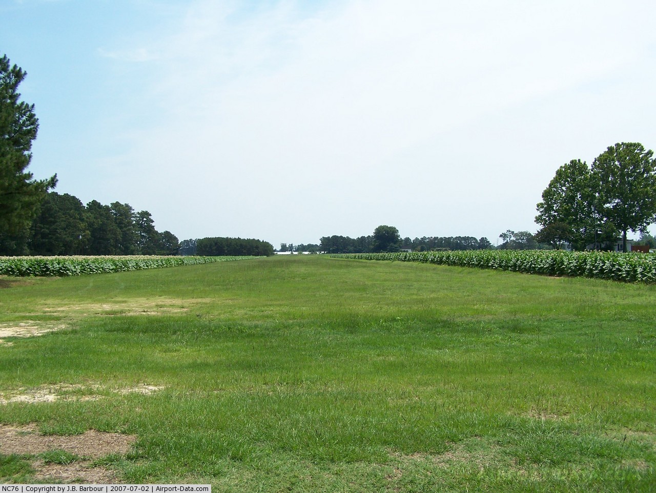
(Click on the photo to enlarge) |
Location & QuickFacts
| FAA Information Effective: | 2008-09-25 |
| Airport Identifier: | NC76 |
| Airport Status: | Operational |
| Longitude/Latitude: | 078-23-16.0120W/35-19-04.5890N
-78.387781/35.317941 (Estimated) |
| Elevation: | 190 ft / 57.91 m (Estimated) |
| Land: | 0 acres |
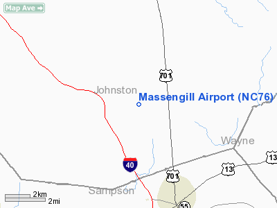
| From nearest city: | 4 nautical miles NW of Newton Grove, NC |
| Location: | Johnston County, NC |
| Magnetic Variation: | 07W (1985) |
Owner & Manager
| Ownership: | Privately owned |
| Owner: | Jimmy N. Massengill |
| Address: | Rt 2, Box 232
Benson, NC 27504 |
| Phone number: | 919-894-2343 |
| Manager: | Jimmy N. Massengill |
| Address: | Rt 2, Box 232
Benson, NC 27504 |
| Phone number: | 919-894-3387 |
Airport Operations and Facilities
| Airport Use: | Private |
| Wind indicator: | Yes |
| Segmented Circle: | No |
| Control Tower: | No |
| Landing fee charge: | No |
| Sectional chart: | Charlotte |
| Region: | ASO - Southern |
| Boundary ARTCC: | ZDC - Washington |
| Tie-in FSS: | RDU - Raleigh |
| FSS on Airport: | No |
| FSS Toll Free: | 1-800-WX-BRIEF |
Runway Information
Runway 09/27
| Dimension: | 1800 x 100 ft / 548.6 x 30.5 m |
| Surface: | TURF, |
| |
Runway 09 |
Runway 27 |
| Traffic Pattern: | Left | Left |
| Obstruction: | 25 ft bldg, 200.0 ft from runway | , 1320.0 ft from runway |
|
Radio Navigation Aids
| ID |
Type |
Name |
Ch |
Freq |
Var |
Dist |
| JN | NDB | Jurly | | 263.00 | 09W | 9.6 nm |
| HQT | NDB | Harnett | | 417.00 | 08W | 15.7 nm |
| EUU | NDB | Jnall | | 251.00 | 07W | 17.4 nm |
| CTZ | NDB | Clinton | | 412.00 | 08W | 20.6 nm |
| FGP | NDB | Fort Bragg | | 393.00 | 07W | 23.5 nm |
| JYN | NDB | Wayne | | 208.00 | 08W | 27.0 nm |
| DKA | NDB | Kenan | | 332.00 | 07W | 27.4 nm |
| POB | NDB | Pope | | 338.00 | 07W | 28.3 nm |
| RW | NDB | Jambe | | 235.00 | 09W | 34.0 nm |
| TT | NDB | Leeco | | 406.00 | 08W | 38.4 nm |
| LE | NDB | Leevy | | 350.00 | 07W | 40.1 nm |
| ACZ | NDB | Pendy | | 379.00 | 09W | 40.8 nm |
| EEJ | NDB | Lee County/dcmsnd | | 428.00 | 07W | 41.1 nm |
| TGQ | NDB | Elizabethtown | | 398.00 | 08W | 47.9 nm |
| GSB | TACAN | Seymour Johnson | 112X | | 08W | 20.4 nm |
| POB | TACAN | Pope | 085X | | 07W | 32.5 nm |
| FAY | VOR/DME | Fayetteville | 025X | 108.80 | 04W | 31.2 nm |
| RDU | VORTAC | Raleigh/durham | 119X | 117.20 | 04W | 38.5 nm |
| ISO | VORTAC | Kinston | 033X | 109.60 | 05W | 40.8 nm |
Remarks
- RWY WELL MAINTAINED, EXCEPT AFTER LINGERING SNOW.
- 175 FT TOWER 300 FEET NORTH OF RWY.
- 100 FT TOWER 1/4 MILE EAST AND NORTH OF RWY.
- ARPT LOCATED BENEATH MILITARY TRNG ROUTE-LOW FLYING CRAFT.
- PRIVATE USE; VFR OPNS ONLY.
Images and information placed above are from
http://www.airport-data.com/airport/NC76/
We thank them for the data!
| General Info
|
| Country |
United States
|
| State |
NORTH CAROLINA
|
| FAA ID |
NC76
|
| Latitude |
35-19-04.589N
|
| Longitude |
078-23-16.012W
|
| Elevation |
190 feet
|
| Near City |
NEWTON GROVE
|
We don't guarantee the information is fresh and accurate. The data may
be wrong or outdated.
For more up-to-date information please refer to other sources.
|
|