 |
|
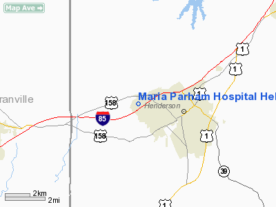
Maria Parham Hospital Heliport |
Location & QuickFacts
| FAA Information Effective: | 2008-09-25 |
| Airport Identifier: | 0NC9 |
| Airport Status: | Operational |
| Longitude/Latitude: | 078-26-58.9930W/36-19-50.5240N
-78.449720/36.330701 (Estimated) |
| Elevation: | 465 ft / 141.73 m (Estimated) |
| Land: | 0 acres |
| From nearest city: | 1 nautical miles NW of Henderson, NC |
| Location: | Vance County, NC |
| Magnetic Variation: | 07W (1985) |
Owner & Manager
| Ownership: | Privately owned |
| Owner: | Maria Parham Hospital, Inc. |
| Address: | Po Box 59
Henderson, NC 27546 |
| Phone number: | 252-380-4143 |
| Manager: | Michael L Shields, Pres |
| Address: | 566 Ruin Creek Road
Henderson, NC 27536-5932 |
| Phone number: | 252-436-1100 |
Airport Operations and Facilities
| Airport Use: | Private
MEDICAL USE. |
| Segmented Circle: | No |
| Control Tower: | No |
| Lighting Schedule: | PHONE REQ
FOR PERIMETER LGTS CALL 919-438-1551. |
| Sectional chart: | Charlotte |
| Region: | ASO - Southern |
| Boundary ARTCC: | ZDC - Washington |
| Tie-in FSS: | RDU - Raleigh |
| FSS Toll Free: | 1-800-WX-BRIEF |
Runway Information
Helipad H1
| Dimension: | 60 x 60 ft / 18.3 x 18.3 m |
| Surface: | CONC, |
| |
Runway H1 |
Runway |
| Traffic Pattern: | Left | Left |
|
Radio Navigation Aids
| ID |
Type |
Name |
Ch |
Freq |
Var |
Dist |
| HXO | NDB | Huntsboro | | 271.00 | 07W | 8.4 nm |
| AEA | NDB | Jones | | 373.00 | 09W | 25.7 nm |
| LE | NDB | Leevy | | 350.00 | 07W | 27.6 nm |
| MBV | NDB | Mecklenburg/dcmsnd | | 356.00 | 08W | 28.9 nm |
| HUR | NDB | Person | | 220.00 | 08W | 30.4 nm |
| RZZ | NDB | Rapids | | 407.00 | 08W | 36.5 nm |
| RW | NDB | Jambe | | 235.00 | 09W | 41.2 nm |
| EUU | NDB | Jnall | | 251.00 | 07W | 43.8 nm |
| ETC | NDB | Tarboro | | 257.00 | 08W | 49.9 nm |
| DAN | VOR | Danville | | 113.10 | 06W | 45.2 nm |
| RDU | VORTAC | Raleigh/durham | 119X | 117.20 | 04W | 32.0 nm |
| SBV | VORTAC | South Boston | 041X | 110.40 | 05W | 34.2 nm |
| LVL | VORTAC | Lawrenceville | 076X | 112.90 | 08W | 39.4 nm |
| TYI | VORTAC | Tar River | 125X | 117.80 | 05W | 42.0 nm |
Remarks
- PRVDD VFR/PVT USE; AREA IS MKD AND WIND INDICATOR IS MAINTAINED.
Images and information placed above are from
http://www.airport-data.com/airport/0NC9/
We thank them for the data!
| General Info
|
| Country |
United States
|
| State |
NORTH CAROLINA
|
| FAA ID |
0NC9
|
| Latitude |
36-19-50.524N
|
| Longitude |
078-26-58.993W
|
| Elevation |
450 feet
|
| Near City |
HENDERSON
|
We don't guarantee the information is fresh and accurate. The data may
be wrong or outdated.
For more up-to-date information please refer to other sources.
|
|


